MyTopo
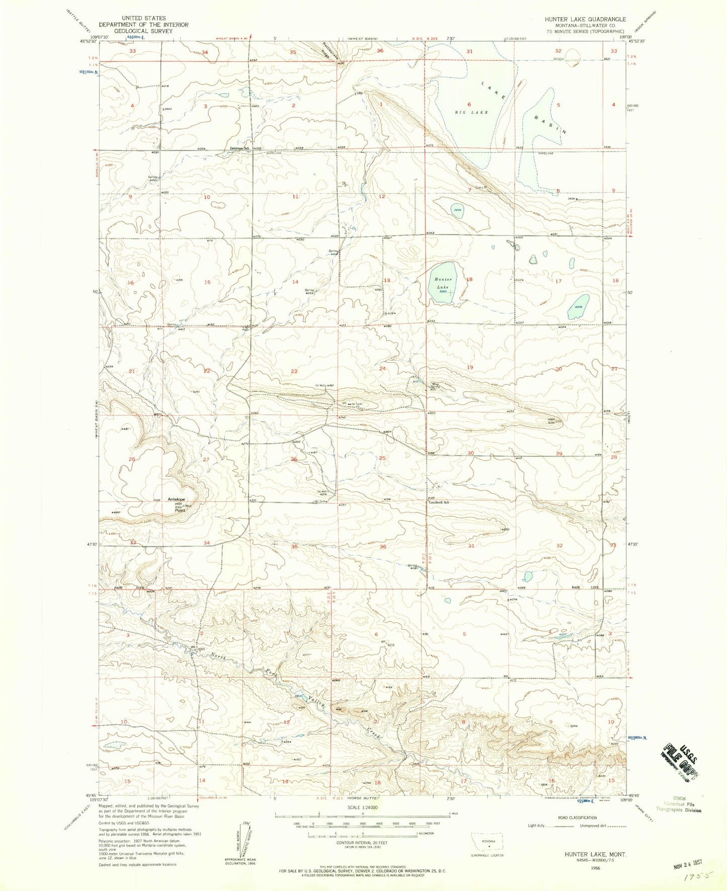
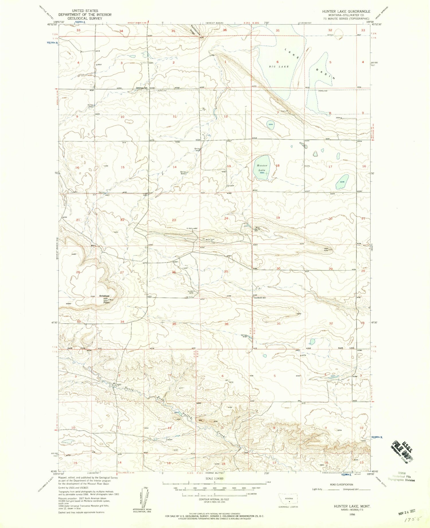
Classic USGS Hunter Lake Montana 7.5'x7.5' Topo Map
Regular price
$16.95
Regular price
Sale price
$16.95
Unit price
per
Couldn't load pickup availability
Historical USGS topographic quad map of Hunter Lake in the state of Montana. Map scale may vary for some years, but is generally around 1:24,000. Print size is approximately 24" x 27"
This quadrangle is in the following counties: Stillwater.
The map contains contour lines, roads, rivers, towns, and lakes. Printed on high-quality waterproof paper with UV fade-resistant inks, and shipped rolled.
Contains the following named places: 01N21E02BCCC01 Well, 01N21E03DABA01 Well, 01N21E14ABBC01 Well, 01N21E22AAAA01 Well, 01N22E07DADA01 Well, 01N22E29AAAC01 Well, 01S21E02CADC01 Well, Antelope Point, Hunter Lake, Leuthold School, Peterson School, Wiig Spring