MyTopo
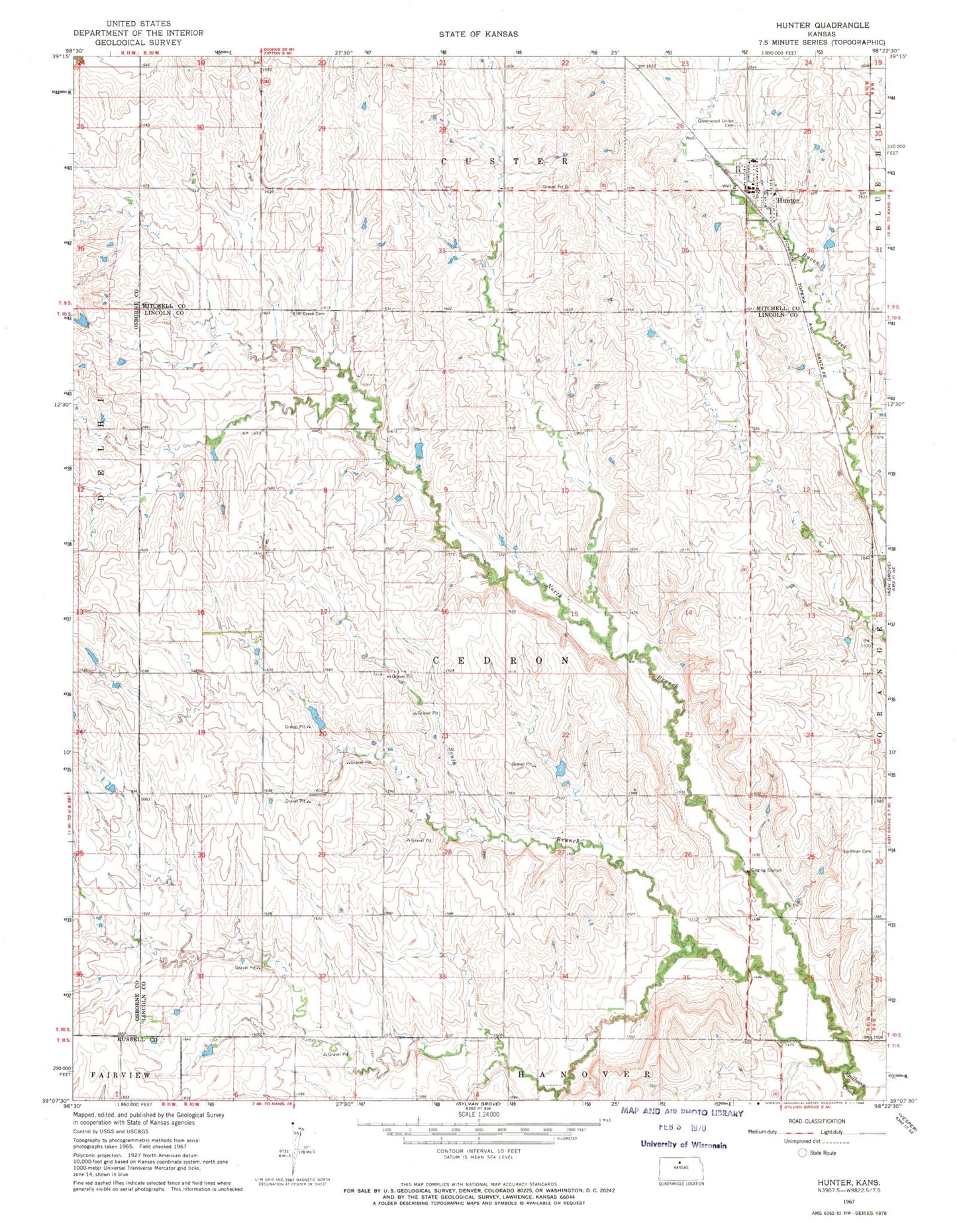
Classic USGS Hunter Kansas 7.5'x7.5' Topo Map
Couldn't load pickup availability
Historical USGS topographic quad map of Hunter in the state of Kansas. Map scale may vary for some years, but is generally around 1:24,000. Print size is approximately 24" x 27"
This quadrangle is in the following counties: Lincoln, Mitchell, Osborne, Russell.
The map contains contour lines, roads, rivers, towns, and lakes. Printed on high-quality waterproof paper with UV fade-resistant inks, and shipped rolled.
Contains the following named places: Agmark Grain Elevator Number 8, Bacon, Cedron, City of Hunter, Elm Creek Cemetery, Greenwood Union Cemetery, Hunter, Hunter Grace Chapel United Methodist Church, Hunter Post Office, Hunter Rural Fire Department, Hunter Wastewater Plant, North Branch Spillman Creek, South Branch Spillman Creek, Spillman Cemetery, Township of Cedron, Trinity Lutheran Church