MyTopo
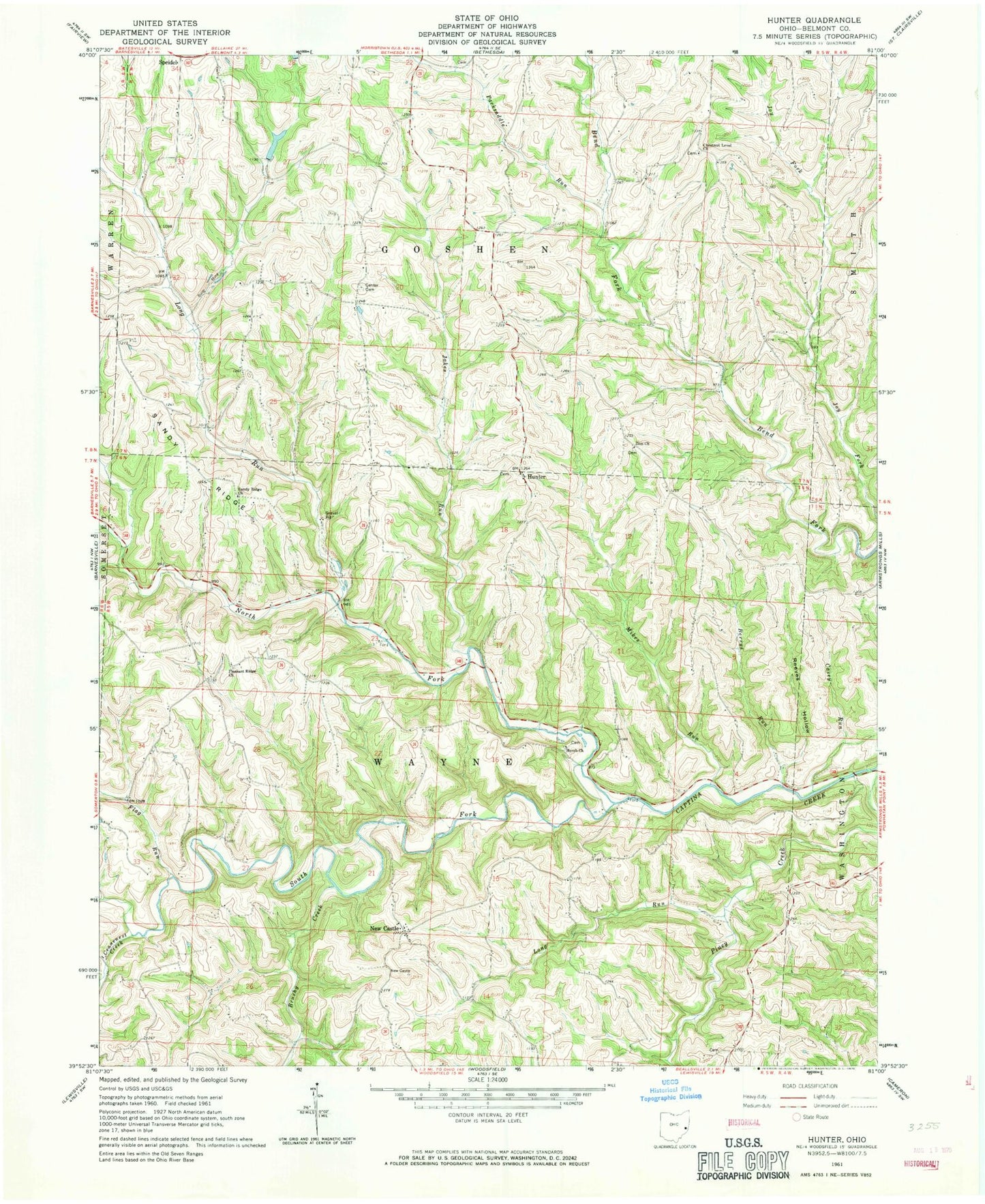
Classic USGS Hunter Ohio 7.5'x7.5' Topo Map
Couldn't load pickup availability
Historical USGS topographic quad map of Hunter in the state of Ohio. Map scale may vary for some years, but is generally around 1:24,000. Print size is approximately 24" x 27"
This quadrangle is in the following counties: Belmont.
The map contains contour lines, roads, rivers, towns, and lakes. Printed on high-quality waterproof paper with UV fade-resistant inks, and shipped rolled.
Contains the following named places: Bailey Dairy Farm, Berrys Run, Bethesda Sportsmans Club Pond, Bethesda Sportsmans Club Pond Dam, Brushy Creek, Casey Run, Center Cemetery, Century Mine, Chestnut Level Cemetery, Chestnut Level Church, Cranenest Creek, Flag Run, Horeb Church, Hunter, Hunter Cemetery, Hunter Christian Church, Hunter Post Office, Jakes Run, Long Run, Mikes Run, Mount Horeb Cemetery, Mount Zion Cemetery, New Castle, North Fork Captina Creek, Packsaddle Run, Pleasant Ridge Cemetery, Pleasant Ridge Church, Reeves Hollow, Sandy Ridge Church, South Fork Captina Creek, Tacoma Post Office, Township of Goshen, Township of Wayne, Zion Church, ZIP Code: 43719