MyTopo
Classic USGS Hunter Oklahoma 7.5'x7.5' Topo Map
Couldn't load pickup availability
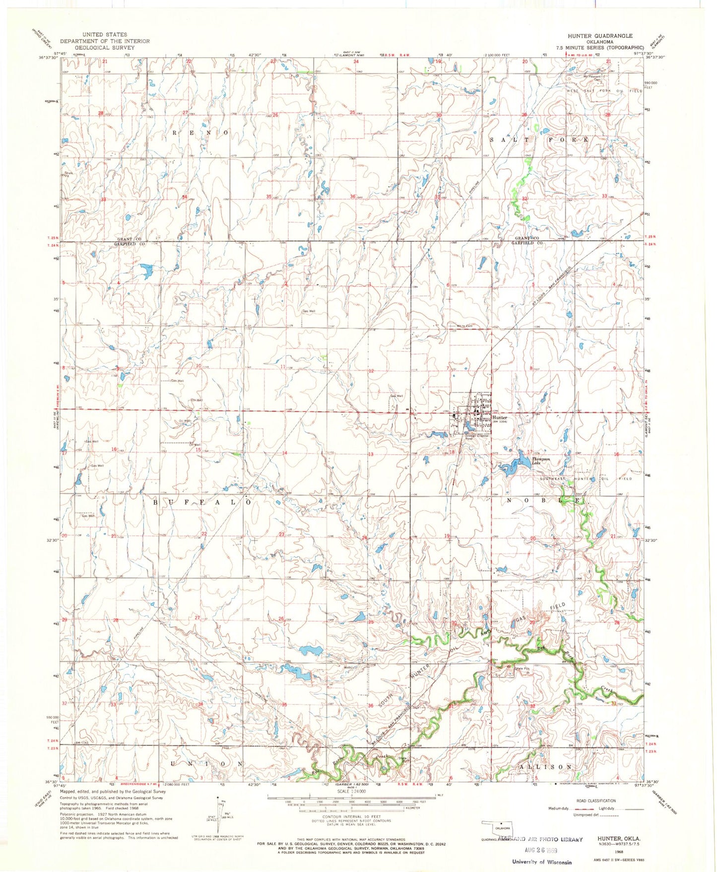
Historical USGS topographic quad map of Hunter in the state of Oklahoma. Map scale may vary for some years, but is generally around 1:24,000. Print size is approximately 24" x 27"
This quadrangle is in the following counties: Garfield, Grant.
The map contains contour lines, roads, rivers, towns, and lakes. Printed on high-quality waterproof paper with UV fade-resistant inks, and shipped rolled.
Contains the following named places: Hunter, Hunter Post Office, Hunter Volunteer Fire Department, Mount Pleasant Cemetery, South Hunter Oil and Gas Field, Southeast Hunter Oil Field, Thompson Lake, Town of Hunter, Township of Buffalo, Upper Red Rock Creek Site 24 Dam, Upper Red Rock Creek Site 24 Reservoir, Upper Red Rock Creek Site 25 Dam, Upper Red Rock Creek Site 25 Reservoir, Upper Red Rock Creek Site 34 Dam, West Salt Fork Oil Field, White Cemetery, ZIP Code: 74640