MyTopo
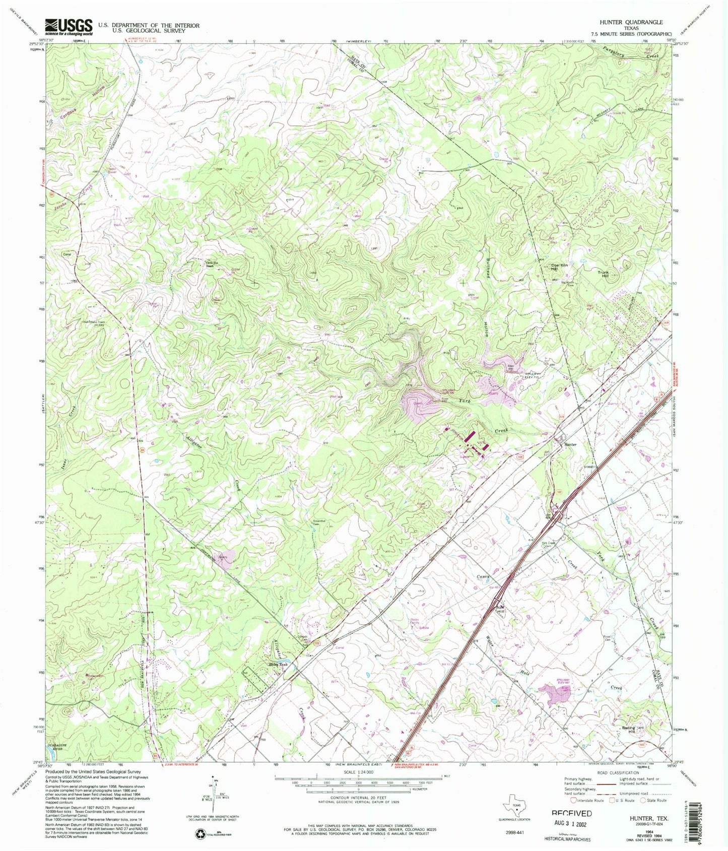
Classic USGS Hunter Texas 7.5'x7.5' Topo Map
Couldn't load pickup availability
Historical USGS topographic quad map of Hunter in the state of Texas. Typical map scale is 1:24,000, but may vary for certain years, if available. Print size: 24" x 27"
This quadrangle is in the following counties: Comal, Guadalupe, Hays.
The map contains contour lines, roads, rivers, towns, and lakes. Printed on high-quality waterproof paper with UV fade-resistant inks, and shipped rolled.
Contains the following named places: Bading Hill, Bullhead Hollow, Caney Creek, Circle Dot Ranch, Coal Kiln Hill, Conrads Cemetery, Haley Tank, Hunter, Kellermann Cemetery, Nail Hill, Rosenthal Cemetery, Trunk Hill, Wegner Ranch, York Creek Cemetery, Soil Conservation Service Site 2 Dam, Soil Conservation Service Site 2 Reservoir, Soil Conservation Service Site 1 Dam, Soil Conservation Service Site 1 Reservoir, Soil Conservation Service Site 3 Dam, Soil Conservation Service Site 3 Reservoir, Royal Forest, Flying R Ranch Airport