
MyTopo
Classic USGS Hunters Hot Springs Montana 7.5'x7.5' Topo Map
Couldn't load pickup availability
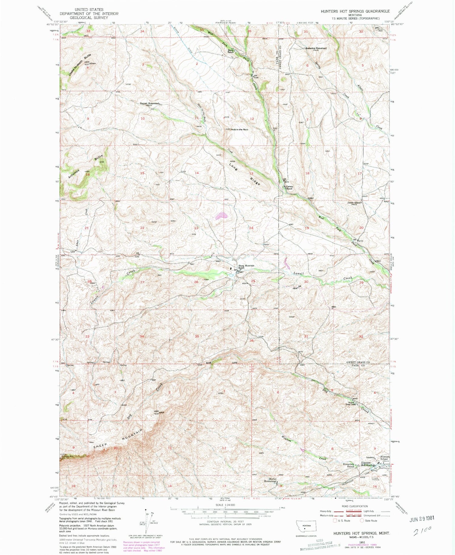
Historical USGS topographic quad map of Hunters Hot Springs in the state of Montana. Map scale may vary for some years, but is generally around 1:24,000. Print size is approximately 24" x 27"
This quadrangle is in the following counties: Park, Sweet Grass.
The map contains contour lines, roads, rivers, towns, and lakes. Printed on high-quality waterproof paper with UV fade-resistant inks, and shipped rolled.
Contains the following named places: 01N11E01D___01 Spring, 01N11E21D___01 Spring, 01S11E01A___01 Well, 01S12E09CADD01 Spring, 01S12E09CCAD01 Spring, Antelope Butte, Bishir Ranch, Carney Ranch, Choke-To-Death Butte, Green School, Hole-In-The Rock, Hole-In-The-Rock Creek, Hunters Hot Springs, Hunters Hot Springs Post Office, Hunters School, Krezelock Ranch, Long Ridge, Martel Homestead, Murphy Sheep Sheds, Prevost Homestead, Roebecker Homestead, Sheep Mountain, Sheep Mountain Ranch, Spring Creek


