MyTopo
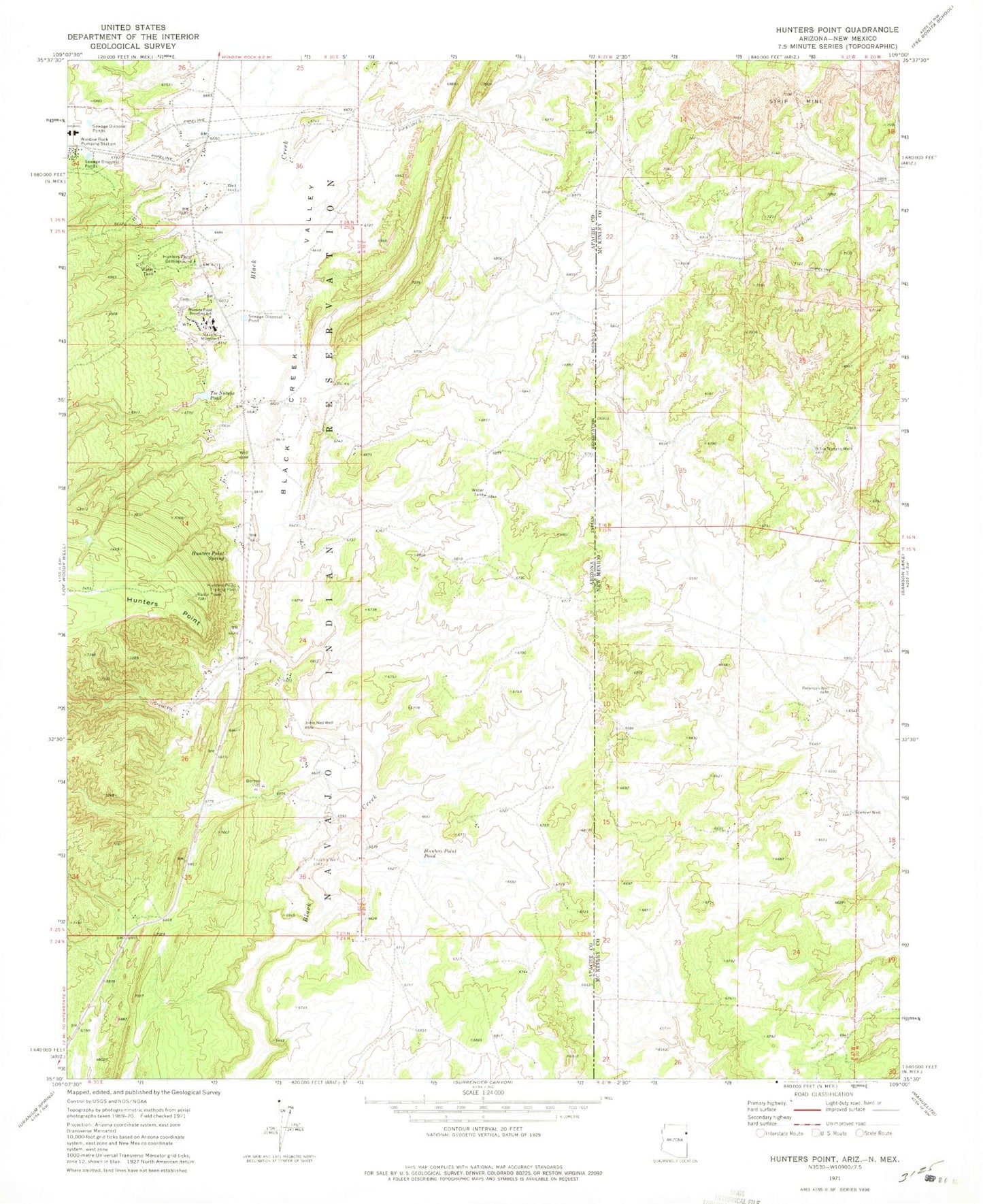
Classic USGS Hunters Point Arizona 7.5'x7.5' Topo Map
Couldn't load pickup availability
Historical USGS topographic quad map of Hunters Point in the states of Arizona, New Mexico. Map scale may vary for some years, but is generally around 1:24,000. Print size is approximately 24" x 27"
This quadrangle is in the following counties: Apache, McKinley.
The map contains contour lines, roads, rivers, towns, and lakes. Printed on high-quality waterproof paper with UV fade-resistant inks, and shipped rolled.
Contains the following named places: Billie Notahs Well, Black Creek Valley, Hunters Point, Hunters Point Boarding School, Hunters Point Campground, Hunters Point Pond, Hunters Point Spring, Hunters Point Trading Post, John Nez Well, KWRK-FM (Window Rock), Navajo Mission, Peterson Well, Spencer Well, Tabaha Well, Tse Bonito Wash, Tse Notahs Pond, W R 5 Water Well, W R 7 Water Well, W R S Water Well, Window Rock Pumping Station