MyTopo
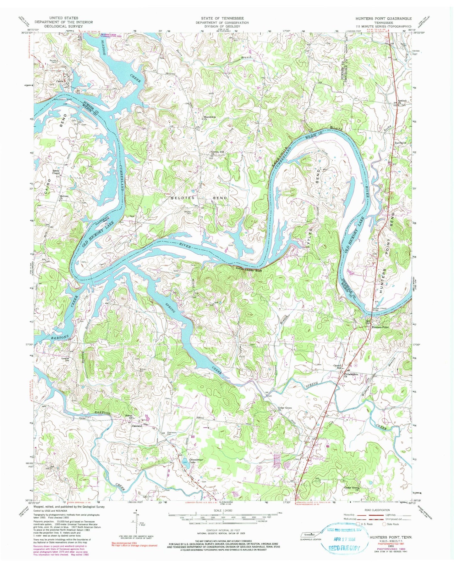
Classic USGS Hunters Point Tennessee 7.5'x7.5' Topo Map
Couldn't load pickup availability
Historical USGS topographic quad map of Hunters Point in the state of Tennessee. Map scale may vary for some years, but is generally around 1:24,000. Print size is approximately 24" x 27"
This quadrangle is in the following counties: Sumner, Trousdale, Wilson.
The map contains contour lines, roads, rivers, towns, and lakes. Printed on high-quality waterproof paper with UV fade-resistant inks, and shipped rolled.
Contains the following named places: Antioch, Antioch Church, Armstrong Island, Barnes Cemetery, Barthelia, Barthelia School, Bartons Creek, Belates Cemetery, Belotes Bar, Belotes Bend, Belotes Ferry, Belotes Ford, Berea Church, Bledsoe Creek, Brunley Branch, Cairo, Cairo Access Area, Cairo Bend, Cairo Bend Ferry, Cairo School, Canoe Branch Ferry, Carroll School, Cedar Grove Church, Commissioner District 6, Conatser Cemetery, Corum Hill Church, Cunningham Island, Cunninghams Ford, Ebaneezer, Ebaneezer Campground, Ebenezer Cemetery, Ford Island, Graves Branch, Greenbriar Lake, Horn Springs Branch, Hunters Point, Hunters Point Access Area, Hunters Point Bend, Hunters Point Ferry, Indian Ladder Bluff, Island Ford, Kings Eddy Bar, Lytles Bend, Macedonia, Macedonia Church, Melrose, Melrose Church, Melrose School, Misty Cove Marina, Nathan J Harsh Bridge, Northeast Wilson Division, Oakland, Oakland School, Odum, Old Hickory Lake, Palmer Branch, Philadelphia Church, Rankin Cemetery, Rocky Creek, Sandy Chapel, Saunders Branch, Sevenmile Bluff, Spring Creek, Walker Branch, Watson Cemetery, Wilborn Branch, Wilson Boat Dock, Wilson County Landfill, ZIP Codes: 37031, 37087


