MyTopo
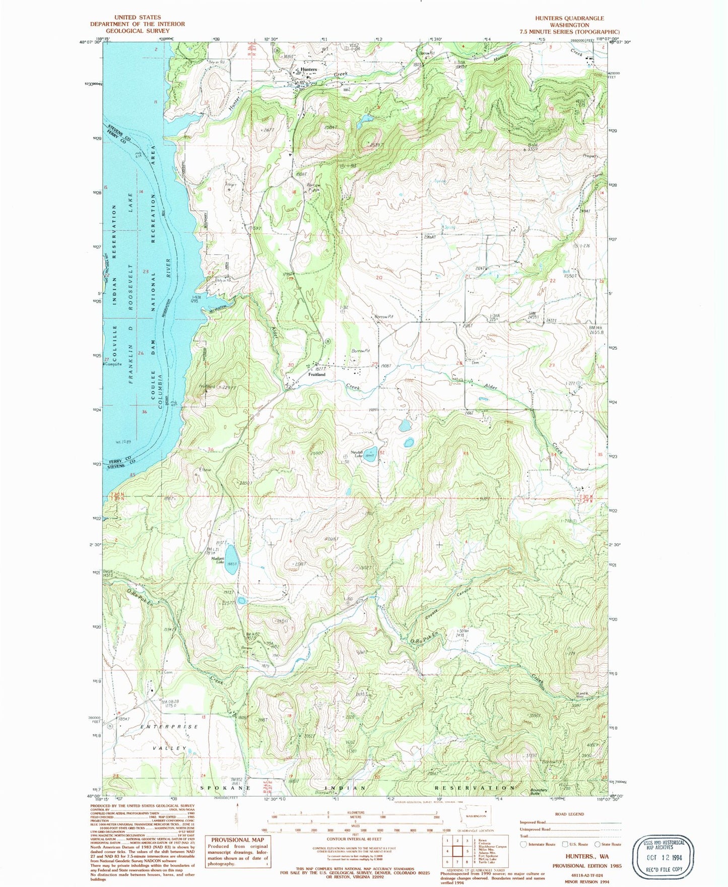
Classic USGS Hunters Washington 7.5'x7.5' Topo Map
Couldn't load pickup availability
Historical USGS topographic quad map of Hunters in the state of Washington. Map scale may vary for some years, but is generally around 1:24,000. Print size is approximately 24" x 27"
This quadrangle is in the following counties: Ferry, Stevens.
The map contains contour lines, roads, rivers, towns, and lakes. Printed on high-quality waterproof paper with UV fade-resistant inks, and shipped rolled.
Contains the following named places: Advent Church, Alder Creek, Columbia Heights Assembly Church, Columbia High and Elementary School, Coyote Canyon, Enterprise, Enterprise Cemetery, Enterprise Church, Fruitland, H and B Mine, Hunter Creek, Hunter Dam, Hunters, Hunters Landing, Hunters Pond, Hunters Pond Dam, Hunters Post Office, Hunters Public Library, Mudgett Lake, Newbill Lake, Snook Lake, Snook Lake Dam, Stevens County Fire District 2 Station 210, Stevens County Fire District 2 Station 230, ZIP Code: 99129