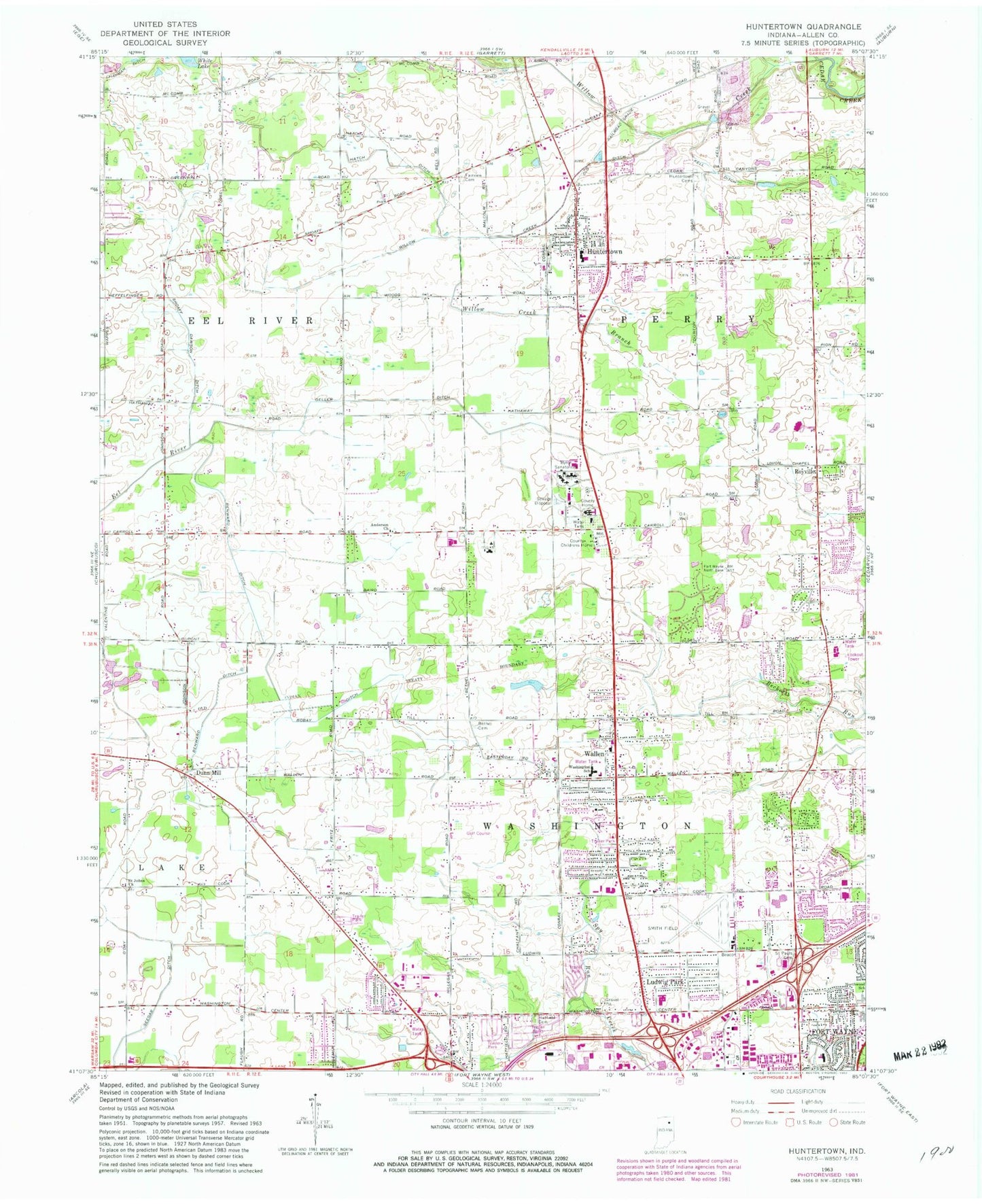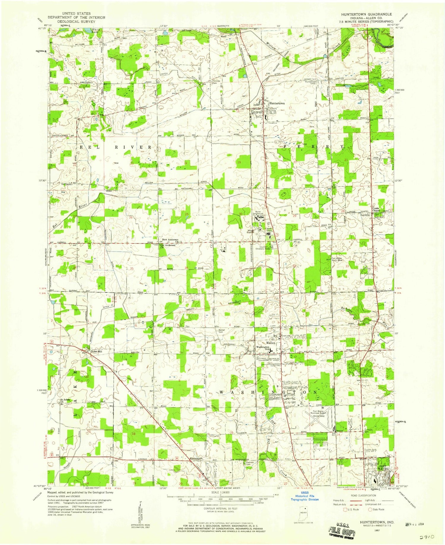
MyTopo
Classic USGS Huntertown Indiana 7.5'x7.5' Topo Map
Couldn't load pickup availability
Historical USGS topographic quad map of Huntertown in the state of Indiana. Map scale may vary for some years, but is generally around 1:24,000. Print size is approximately 24" x 27"
This quadrangle is in the following counties: Allen.
The map contains contour lines, roads, rivers, towns, and lakes. Printed on high-quality waterproof paper with UV fade-resistant inks, and shipped rolled.
Contains the following named places: Academie, Allen, Allen County Public Library Dupont Branch, Anderson Church, Benward Ditch, Bethel Cemetery, Bishop Dwenger High School, Bobay Ditch, Byron Sanatorium, Canyon Sand and Gravel Pit, Daus Addition Lake, Daus Addition Lake Dam, Dunn Mill, Fairview Cemetery, Fort Wayne, Fort Wayne Fire Department Station 15, Fort Wayne Fire Department Station 16, Geller Ditch, Hatch Ditch, Hatfield Cemetery, Huntertown, Huntertown Cemetery, Huntertown Elementary School, Huntertown Post Office, Huntertown Volunteer Fire Department, Kell Ditch, Ludwig Park, Northbrook Post Office, Royville, Saint Johns Church, Saint Pauls Evangelical Lutheran Cemetery, Shoaff Dawson Ditch, Smith Field, Town of Huntertown, Township of Perry, Township of Washington, Wallen, Washington School, Washington Township Volunteer Fire Department, Willow Creek, Willow Creek Branch, Willow Creek Ditch, ZIP Codes: 46748, 46825