MyTopo
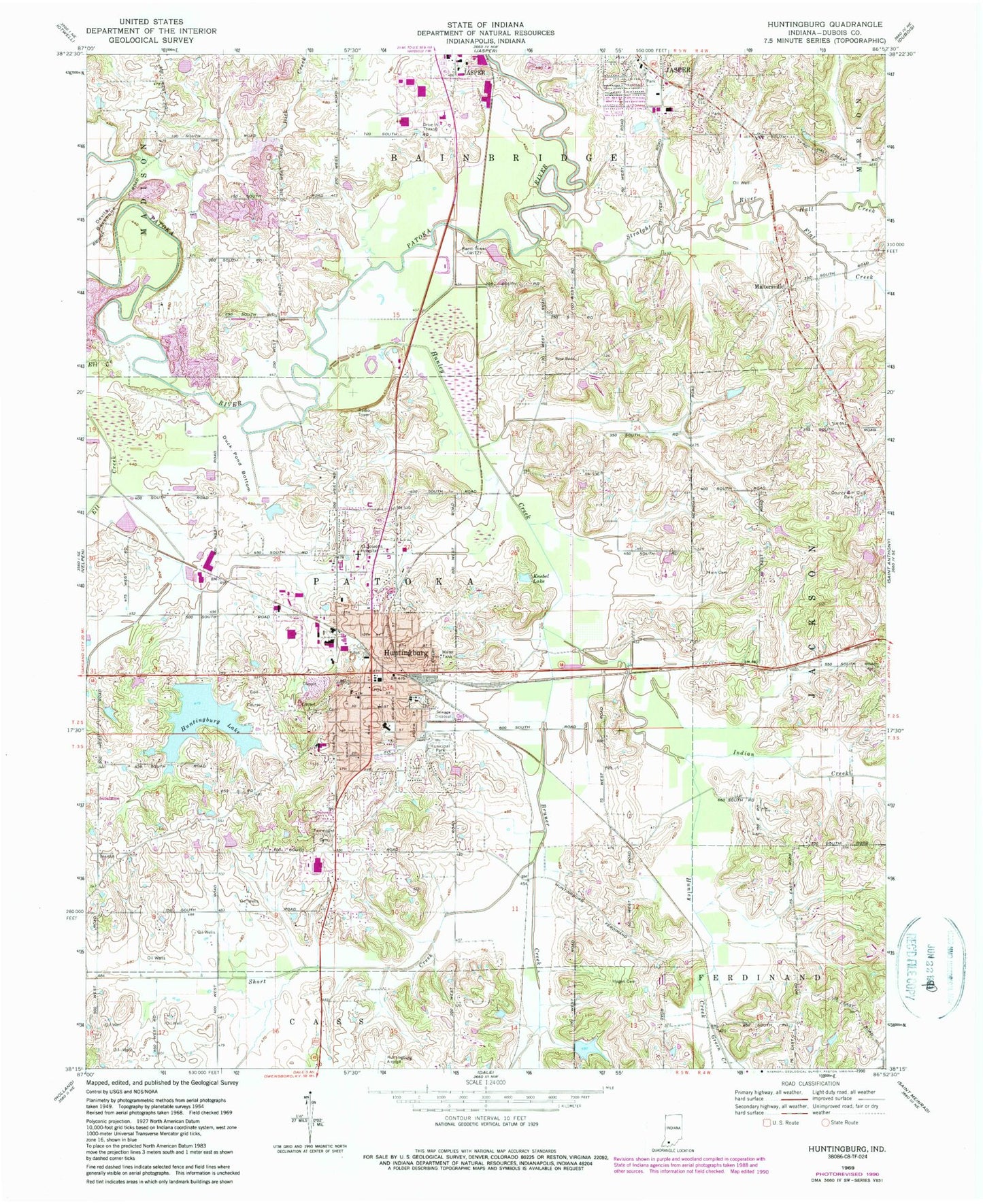
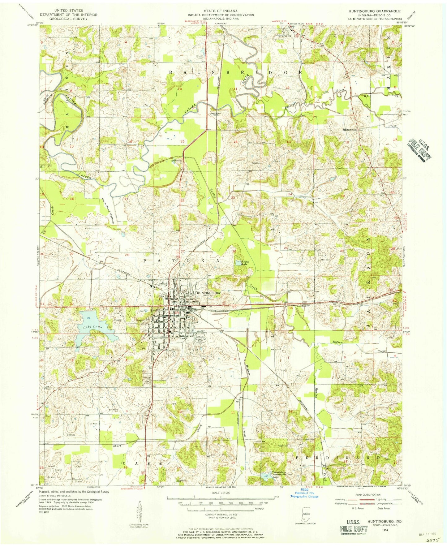
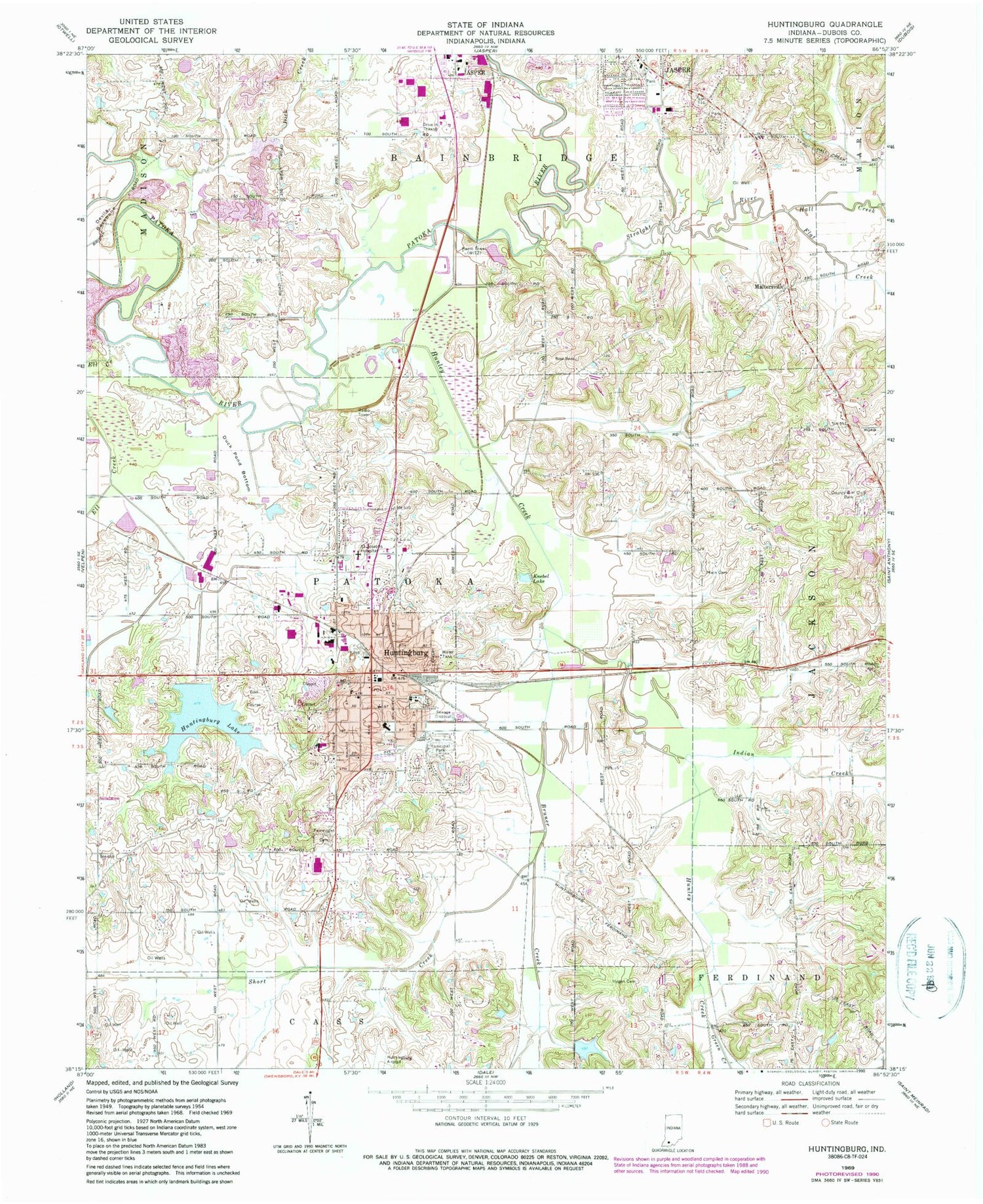
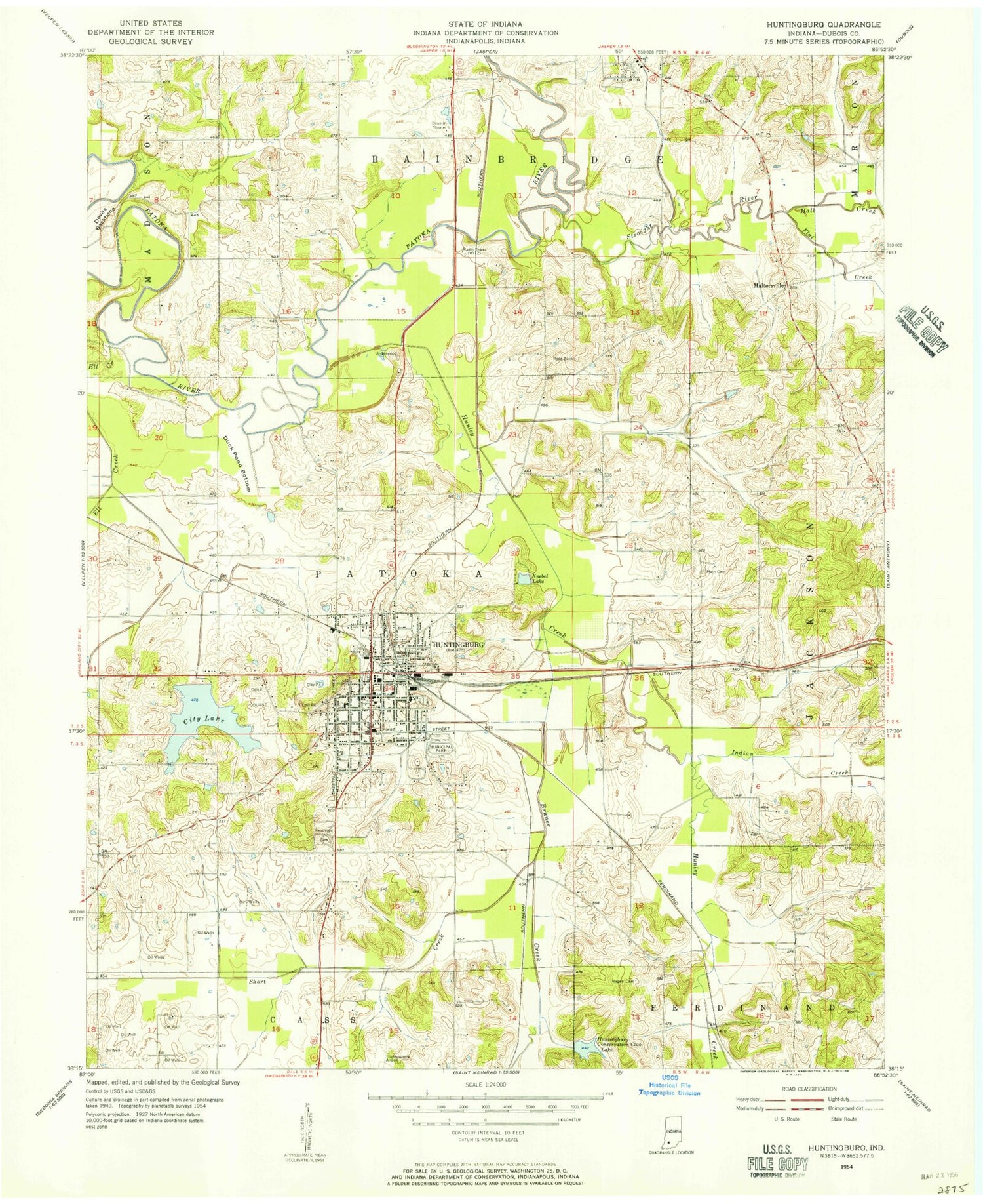
Classic USGS Huntingburg Indiana 7.5'x7.5' Topo Map
Couldn't load pickup availability
Historical USGS topographic quad map of Huntingburg in the state of Indiana. Map scale may vary for some years, but is generally around 1:24,000. Print size is approximately 24" x 27"
This quadrangle is in the following counties: Dubois.
The map contains contour lines, roads, rivers, towns, and lakes. Printed on high-quality waterproof paper with UV fade-resistant inks, and shipped rolled.
Contains the following named places: Bruner Creek, City of Huntingburg, Crestview Elementary School, Devils Backbone, Dick Creek, Dubois County, Duck Pond Bottom, Ell Creek, Fairmount Cemetery, Flat Creek, Green Creek, Hagen Cemetery, Hall Creek, Hunley Creek, Huntingburg, Huntingburg City Lake Dam, Huntingburg Conservation Club Dam, Huntingburg Conservation Club Lake, Huntingburg Fire Department, Huntingburg Fire Department Station 2, Huntingburg Lake, Huntingburg Middle School, Huntingburg Pit, Huntingburg Police Department, Huntingburg Post Office, Indian Creek, Jahn Creek, Jasper Fire Department Station 2, Knebel Lake, Main Cemetery, Maltersville, Maple Park Elementary School, Saint Josephs Hospital, Short Creek, Southridge High School, Straight River, Township of Patoka, WBDC-FM (Huntingburg), WITZ-AM (Jasper), WITZ-FM (Jasper), ZIP Code: 47542