MyTopo
Classic USGS Huntington Lake California 7.5'x7.5' Topo Map
Couldn't load pickup availability
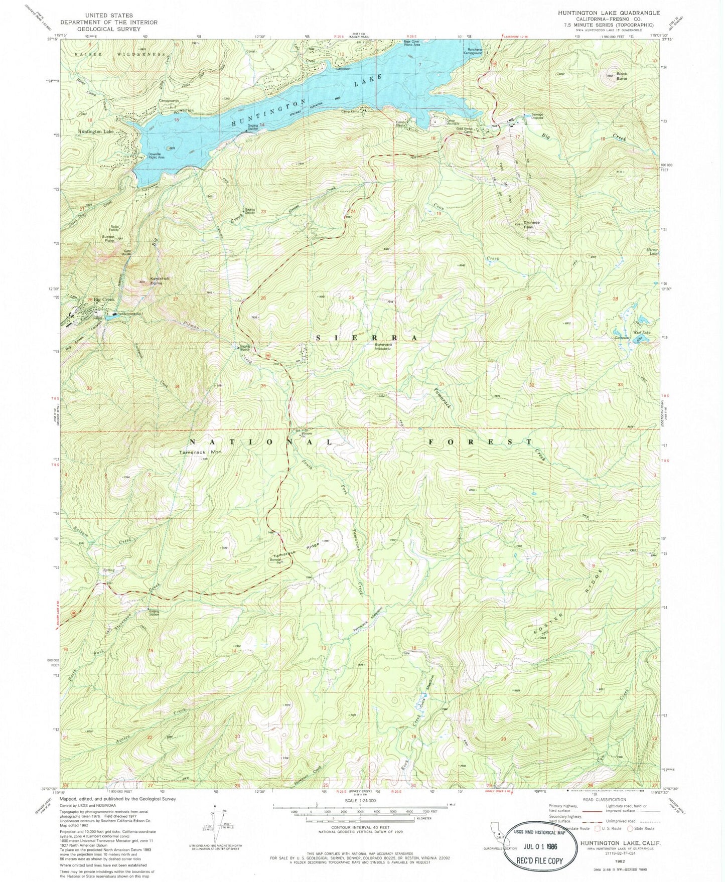
Historical USGS topographic quad map of Huntington Lake in the state of California. Typical map scale is 1:24,000, but may vary for certain years, if available. Print size: 24" x 27"
This quadrangle is in the following counties: Fresno.
The map contains contour lines, roads, rivers, towns, and lakes. Printed on high-quality waterproof paper with UV fade-resistant inks, and shipped rolled.
Contains the following named places: Shaver Trail, Bear Butte, Billy Creek, Boneyard Meadow, Camp Oljato, Chinese Peak, Coon Creek, Cutts Meadow, Grouse Creek, Home Camp Creek, Huntington Lake Game Refuge, Kerckhoff Dome, Mono Trail, Pitman Creek, Huntington Lake, Line Creek, Red Mountain Trail, Snowslide Creek, South Fork Tamarack Creek, Sunset Point, Tamarack Creek, Tamarack Meadow, West Lake, Huckleberry Creek, Tamarack Winter Sports Area, Huntington Lake Lumber Company, Huntington Lake Resort, Dowville Picnic Area, Billy Creek Campgrounds, Will-O-The Wisp Resort, Cedar Crest Resort, Chinese Peak Ski Area, Cedar Crest, Lakeview Cottages Resort, Huntington Lake, Big Creek, Tamarack Mountain, Big Creek Number 4 104-004 Dam, Huntington Lake 1 104-010 Dam, Bear Cove Picnic Area, Camp Kern, Camp Mirimichi, Gold Arrow Camp, Rancheria Campground, Tamarack Ridge, Big Creek Elementary School, Huntington Lake Post Office (historical), Cedar Crest Post Office (historical), Big Creek Volunteer Fire Department, Big Creek Census Designated Place, Big Creek Post Office