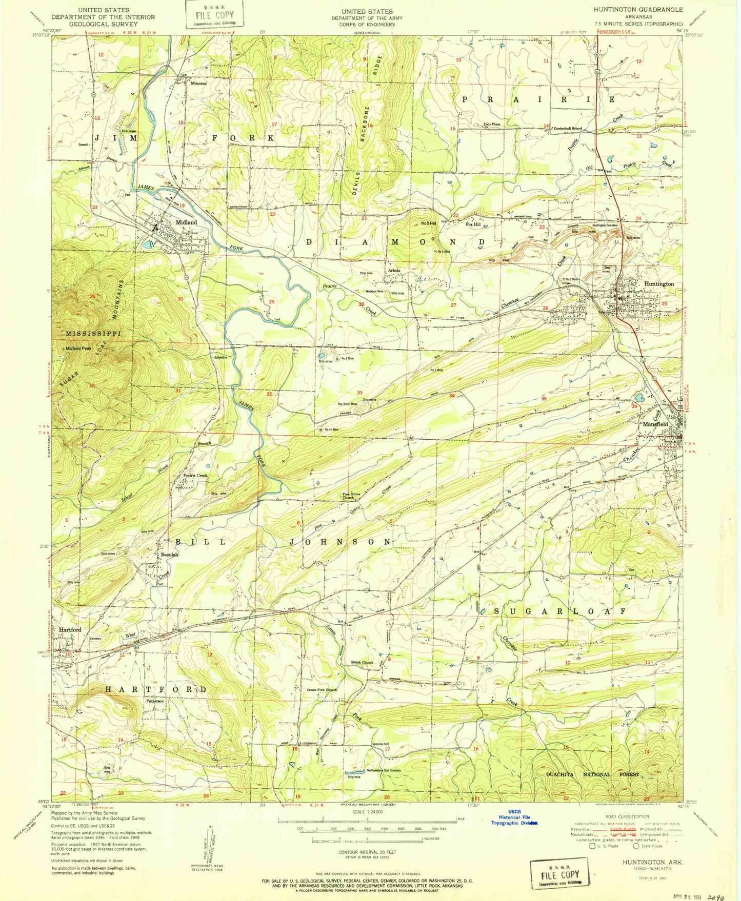
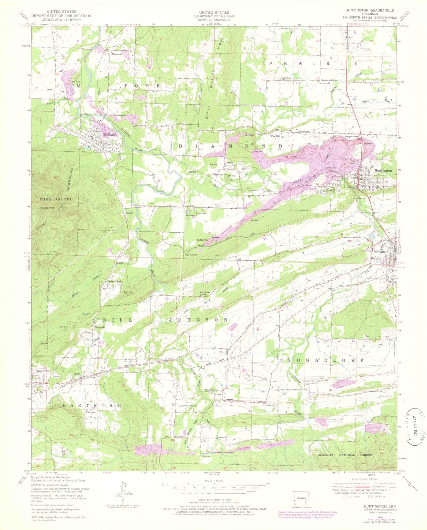
MyTopo
Classic USGS Huntington Arkansas 7.5'x7.5' Topo Map
Couldn't load pickup availability
Historical USGS topographic quad map of Huntington in the state of Arkansas. Map scale may vary for some years, but is generally around 1:24,000. Print size is approximately 24" x 27"
This quadrangle is in the following counties: Scott, Sebastian.
The map contains contour lines, roads, rivers, towns, and lakes. Printed on high-quality waterproof paper with UV fade-resistant inks, and shipped rolled.
Contains the following named places: Arkola, Buggy Hill Cemetery, Burna, Central Coal and Coke Company, Cherokee African American Cemetery, Cherokee Creek, City of Huntington, Coop Creek, Dake Cemetery, Dill Place, Faith Chapel Church, Fox Hill, Frog Town, Gooberhull School, Hartford Memorial Cemetery, Hartford Memorial Park, Huntington, Huntington Cemetery, Huntington Police Department, Huntington Post Office, Huntington Volunteer Fire Department, James Fork Cemetery, James Fork Church, Johnny Cake Lake Number One Dam, Johnny Cake Lake Number Two Dam, Johnny Cake Park, Johnson Branch, Lake Number One, Lake Number Two, Mansfield, Mansfield Fire Station, Mansfield Police Department, Midland, Midland Fire Station, Midland Post Office, Montreal, Mount Olive Cemetery, Northwestern Company, Number 14 Mine, Number 2 Mine, Number 3 Mine, Number 5 Hill, Number 5 Mine, Number 6 Mine, Old Prairie Creek, Park Lake, Park Lake Dam, Pine Grove Church, Pine Grove Creek, Prairie Creek, Roy Smith Mine, School House Branch, Sebastian County Park, Shiloh Church, Town of Midland, Township 3, Township of Bill Johnson, Township of Diamond, Township of Jim Fork, Township of Sugarloaf, West Creek, West Harmony Creek, Woodson Mine, ZIP Codes: 72940, 72945