MyTopo
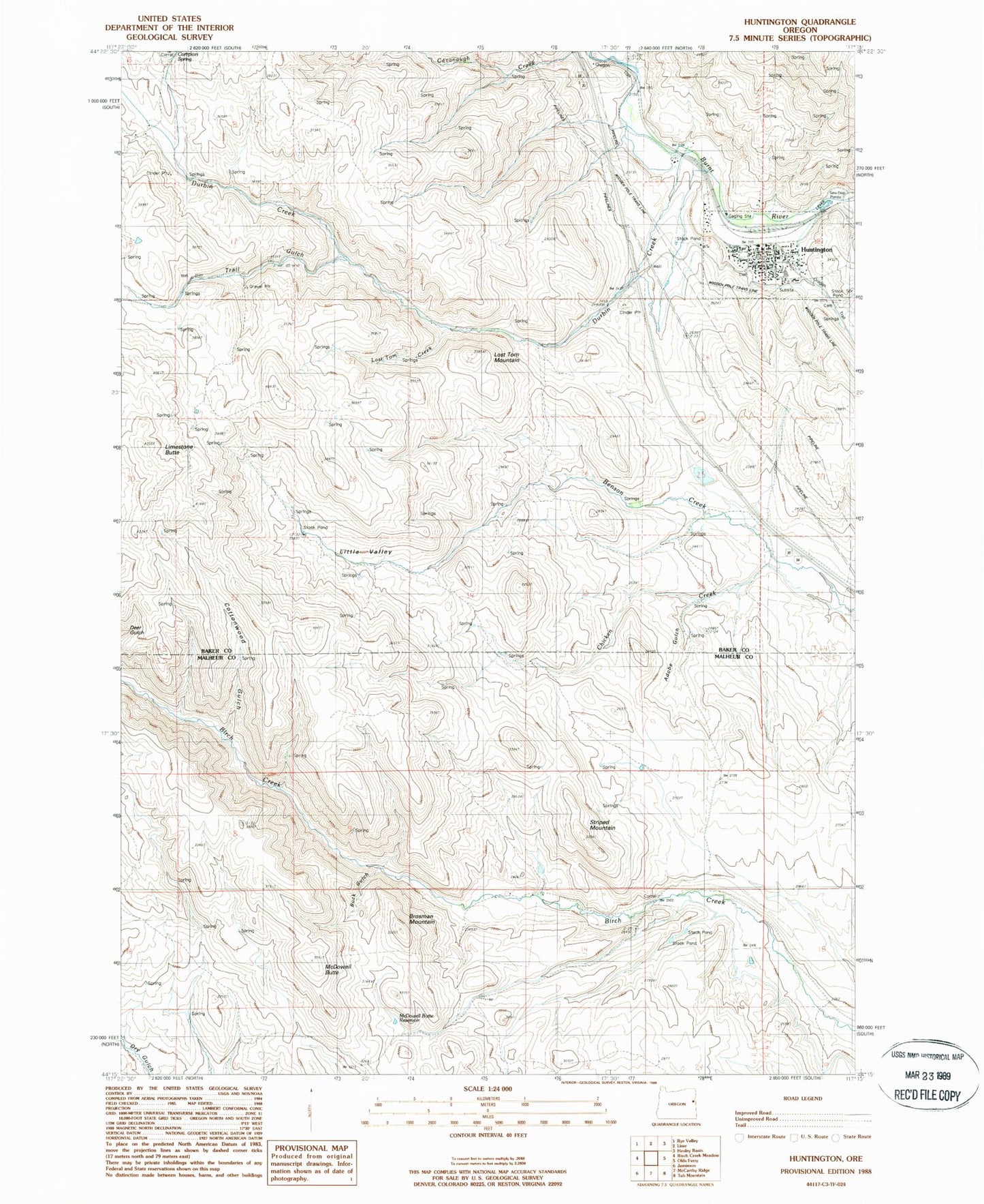
Classic USGS Huntington Oregon 7.5'x7.5' Topo Map
Couldn't load pickup availability
Historical USGS topographic quad map of Huntington in the state of Oregon. Map scale may vary for some years, but is generally around 1:24,000. Print size is approximately 24" x 27"
This quadrangle is in the following counties: Baker, Malheur.
The map contains contour lines, roads, rivers, towns, and lakes. Printed on high-quality waterproof paper with UV fade-resistant inks, and shipped rolled.
Contains the following named places: Adobe Gulch, Andersen Creek, Baker County Library Huntington Branch Library, Benson Dam, Benson Reservoir, Brosman Mountain, Buck Gulch, Cavanaugh Creek, City of Huntington, Compton Spring, Cottonwood Gulch, Dry Creek, Durbin Creek, Huntington, Huntington City Hall, Huntington Historical Museum, Huntington Independent Order of Odd Fellows Cemetery, Huntington Old Cemetery, Huntington Post Office, Huntington Public Works Department Office, Huntington School, Huntington Volunteer Fire Department, Huntington Wastewater Treatment Ponds, Limestone Butte, Little Valley, Lost Tom Creek, Lost Tom Mountain, McDowell Butte, McDowell Butte Reservoir, Smith Gulch, Striped Mountain, Trail Gulch, Vane Ranch Dam, Vane Ranch Reservoir, Willow Springs Creek