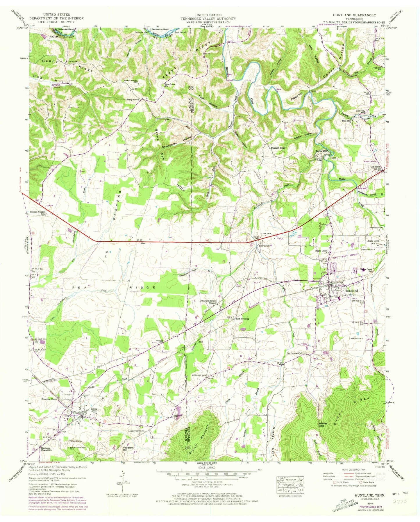
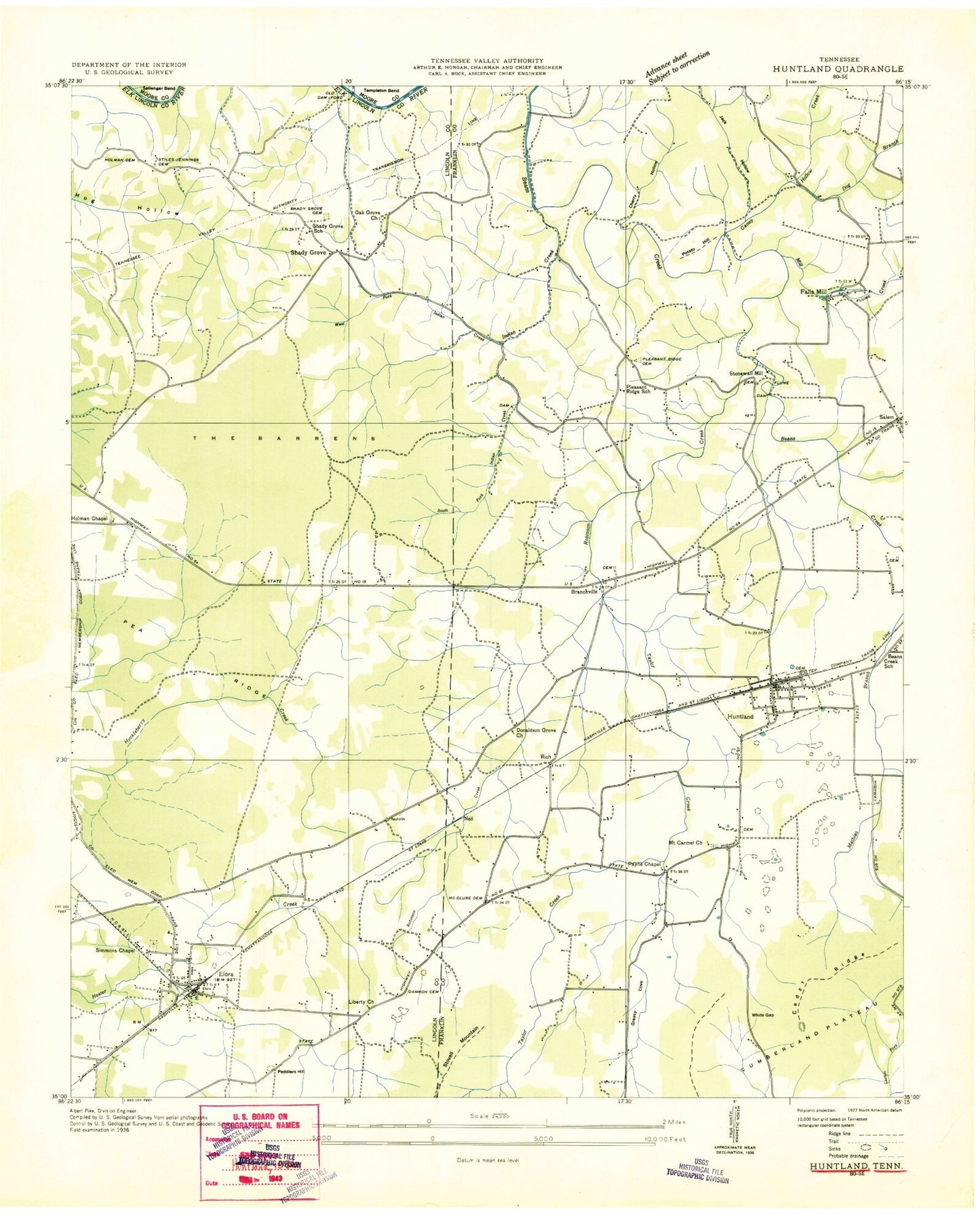
MyTopo
Classic USGS Huntland Tennessee 7.5'x7.5' Topo Map
Couldn't load pickup availability
Historical USGS topographic quad map of Huntland in the state of Tennessee. Map scale may vary for some years, but is generally around 1:24,000. Print size is approximately 24" x 27"
This quadrangle is in the following counties: Franklin, Lincoln, Moore.
The map contains contour lines, roads, rivers, towns, and lakes. Printed on high-quality waterproof paper with UV fade-resistant inks, and shipped rolled.
Contains the following named places: Aqua Valley Farms, Arnold Cemetery, Arnold Hollow, Beans Creek Church, Beans Creek School, Bradley Farms, Branchville, Brazelton Farms, Brown Cemetery, Brown Mill, Caney Hollow, Caney Hollow Creek, Cave Spring, Cherry Hollow, Commissioner District 3, Damron Cemetery, Dog Branch, Donaldson Grove Church, Elora, Elora Cemetery, Elora Post Office, Elora School, Elora Volunteer Fire Rescue, Eskridge Cemetery, Factory Branch, Falls Mill, Goat Island, Gonder Cemetery, Greasy Cove, Happy Ridge, Harris Poultry Farm, Holman Cemetery, Holman Chapel, Holman Chapel School, Hunt - Larkin Cemetery, Huntland, Huntland City Hall, Huntland High School, Huntland Police Department, Huntland Post Office, Huntland Volunteer Fire Department, Indian Creek, Jack Hollow, Jenny Branch, Keith Hollow, Larkin Cemetery, Lee Cemetery, Liberty Church, Lipscomb Cemetery, McClure Cemetery, Moore Memorial Cemetery, Moseley-Simmons Cemetery, Mount Carmel, Mount Carmel Cemetery, Mount Carmel Church, Neil, Oak Grove Baptist Church, Old Beans Creek Cemetery, Old Dam Ford, Old Salem, Omohundro Hollow, Patrick Cemetery, Payne Chapel, Peddlers Hill, Peddlers Hill Dairy, Persimmon Pond Branch, Pleasant Ridge, Pleasant Ridge Baptist Church, Pleasant Ridge Cemetery, Pleasant Ridge School, Potato Hill, Rattlesnake Spring Branch, Rich Crossing, Roberts Cemetery, Robertson Cemetery, Robinson Creek, Rocky Springs Cemetery, Russell Cemetery, Shady Grove, Shady Grove Cemetery, Shady Grove School, Simmons Chapel, Simmons Chapel School, Skeet Ridge, South Fork Indian Creek, Station Hollow, Stiles Cemetery, Stone Dye Hills, Stovall Mountain, Sulphur Hollow, Syler Cemetery, Taylor Creek, Taylor Farm, Templeton Bend, The Barrens, Town of Huntland, West Fork Indian Creek, Whites Gap, ZIP Code: 37328