
MyTopo
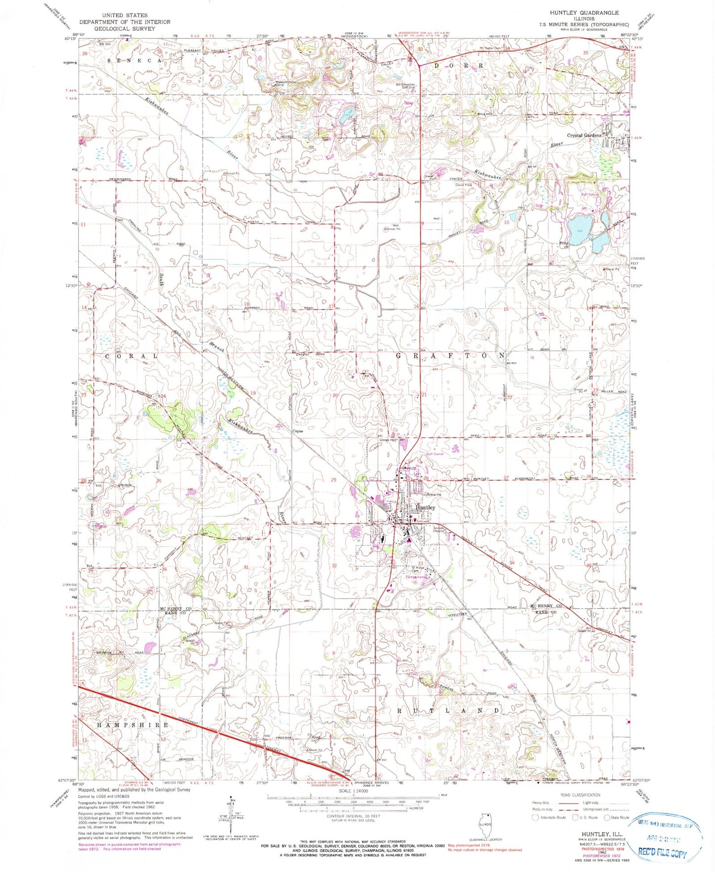
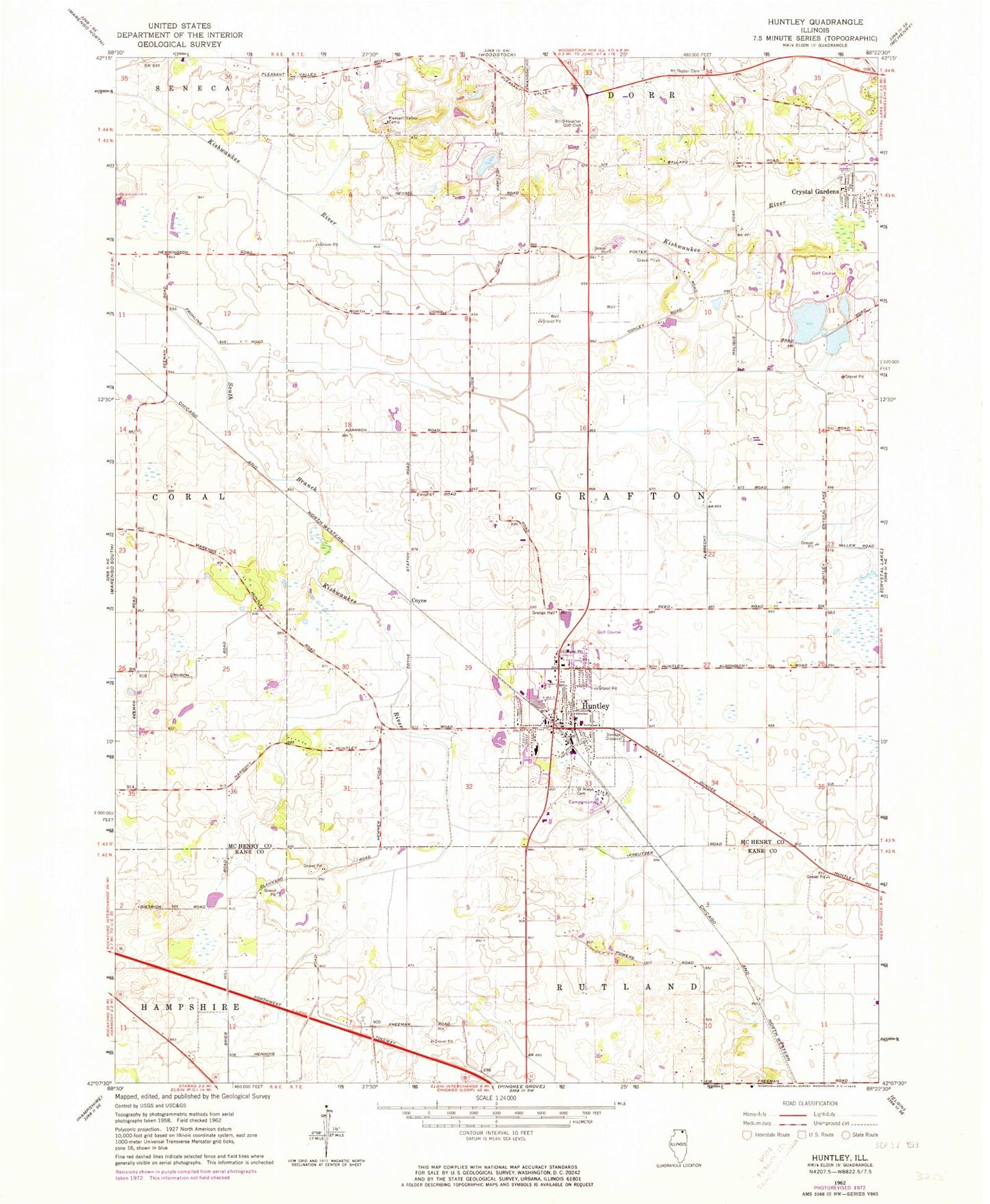
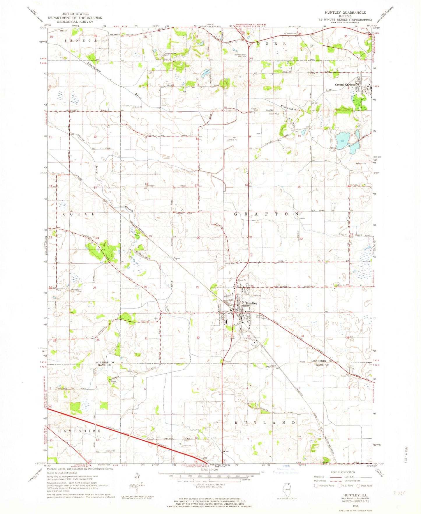
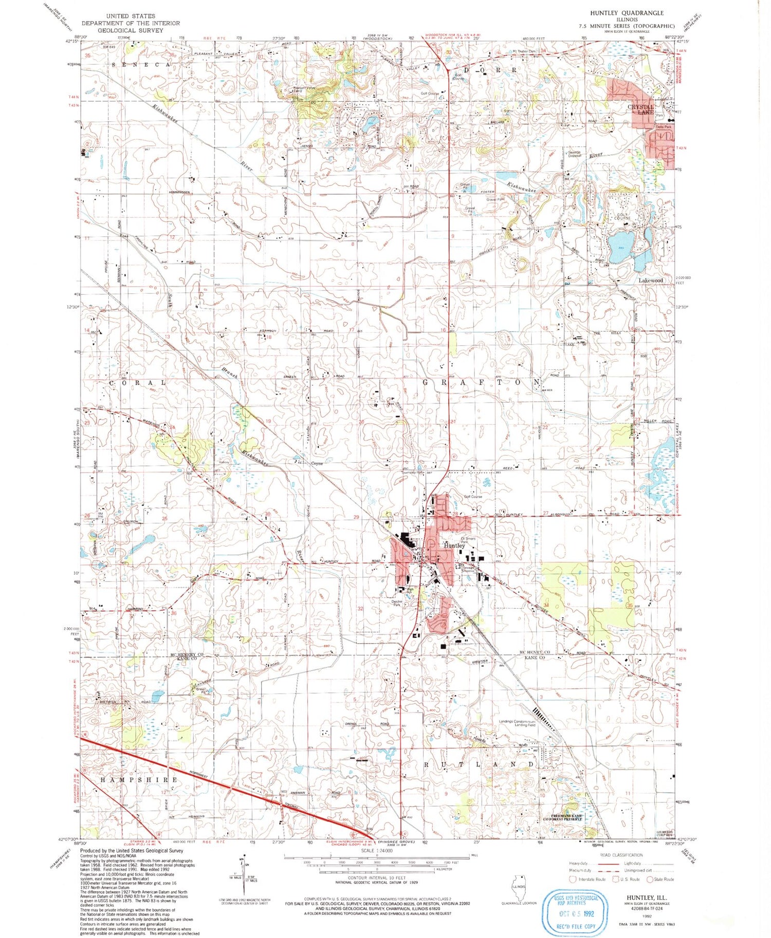
Classic USGS Huntley Illinois 7.5'x7.5' Topo Map
Couldn't load pickup availability
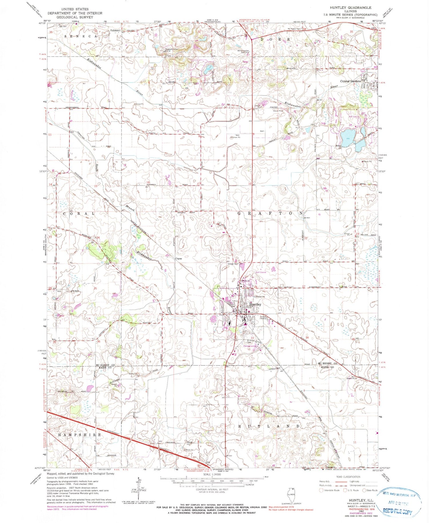
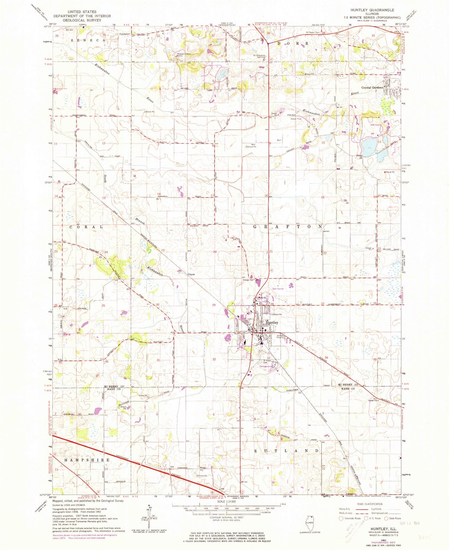
Historical USGS topographic quad map of Huntley in the state of Illinois. Map scale may vary for some years, but is generally around 1:24,000. Print size is approximately 24" x 27"
This quadrangle is in the following counties: Kane, McHenry.
The map contains contour lines, roads, rivers, towns, and lakes. Printed on high-quality waterproof paper with UV fade-resistant inks, and shipped rolled.
Contains the following named places: Butler School, Butternut Preserve, Coyne, Crystal Gardens, Crystal Woods Golf Club, Deicke Park, Della Park, Eakin Creek South, Eakin Creek West, Fox Valley Christian Reformed Church, Freeman Kame Nature Preserve, Freemans Kane County Forest Preserve, Grafton Township Hall, Hickory Grove School, Huntley, Huntley Elementary School, Huntley Fire Protection District Station 1, Huntley Fire Protection District Station 2, Huntley Fire Protection District Station 3, Huntley High School, Huntley Police Department, Huntley Post Office, Kishwaukee Fen Nature Preserve, Lakewood Golf Club, Landings Condominium Airport, Mount Thabor Cemetery, Ol Timers Park, O'Rourke School, Phyllis Field, Pinecrest Country Club, Pleasant Valley Camp, Saint Mary Catholic Cemetery, Saint Marys Roman Catholic Church, School Number 19, School Number 20, School Number 21, School Number 81, School Number 82, School Number 83, School Number 84, School Number 86, South Lake, South Lake Dam, The Landings, Township of Grafton, Turnberry Country Club, Turnberry Wetlands, Village of Huntley, Village of Lakewood, West Elementary School, Woodstock Fire Department Lakewood Station, ZIP Code: 60142