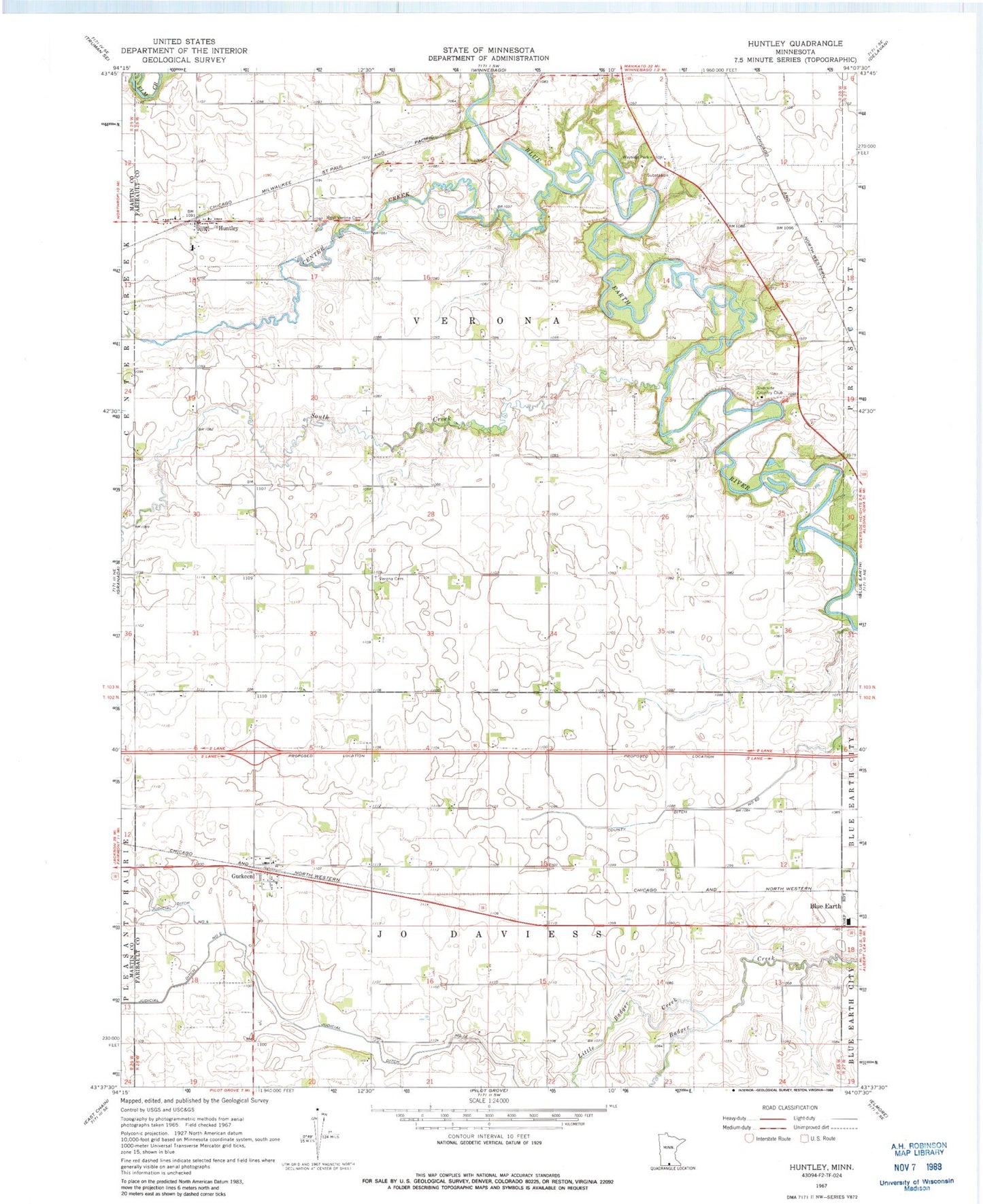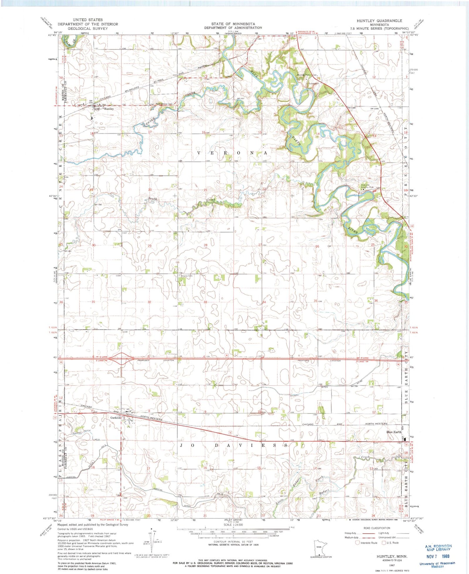
MyTopo
Classic USGS Huntley Minnesota 7.5'x7.5' Topo Map
Couldn't load pickup availability
Historical USGS topographic quad map of Huntley in the state of Minnesota. Map scale may vary for some years, but is generally around 1:24,000. Print size is approximately 24" x 27"
This quadrangle is in the following counties: Faribault, Martin.
The map contains contour lines, roads, rivers, towns, and lakes. Printed on high-quality waterproof paper with UV fade-resistant inks, and shipped rolled.
Contains the following named places: Center Creek, Community Covenant Church, County Ditch Number Sixty, Guckeen, Guckeen Post Office, Huntley, Huntley Post Office - CPO, Judicial Ditch Number Four, Judicial Ditch Number Twelve, Little Badger Creek, Our Lady of Mercy Church, Riverside Country Club, South Creek, Township of Jo Daviess, Township of Verona, Verona Cemetery, West Verona Cemetery, Winnebago Wayside Park, ZIP Code: 56047