MyTopo
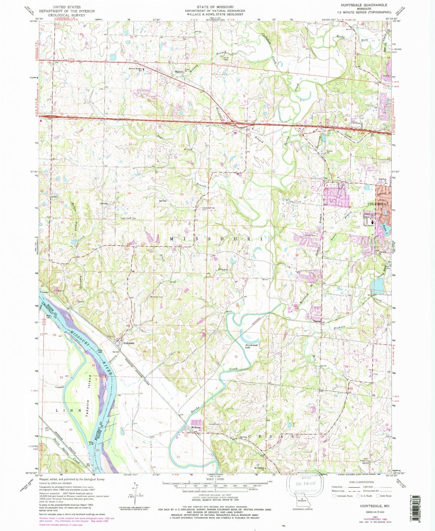
Classic USGS Huntsdale Missouri 7.5'x7.5' Topo Map
Couldn't load pickup availability
Historical USGS topographic quad map of Huntsdale in the state of Missouri. Map scale may vary for some years, but is generally around 1:24,000. Print size is approximately 24" x 27"
This quadrangle is in the following counties: Boone, Cooper, Moniteau.
The map contains contour lines, roads, rivers, towns, and lakes. Printed on high-quality waterproof paper with UV fade-resistant inks, and shipped rolled.
Contains the following named places: Bear Creek, Black Branch, Boone County Fire Protection District Station 14, Boone County Fire Protection District Station 9, Broadway Church, Brushwood, Brushwood Lake, Callahan Creek, Cedar Lake, Cedar Lake Section 23 Dam, Columbia Fire Department Station 6, Conley Cemetery, County House Branch, Daniel, Fairview Cemetery, Fairview Church, Fairview Elementary School, Fairview Lake, Fairview Lake Dam, Goodin Branch, Goodin Cemetery, Grocery Branch, Harmony Creek, Henderson Branch, Hickory Grove School, Hinkson Creek, Hulen Lake, Hulen Lake East Dam, Hulen Lake West Dam, Hunt Lake, Huntsdale, Huntsdale School, Kennard Station, Mary Paxton Keeley Elementary School, McBaine, McBaine Bend, McBaine School, Merideth Branch, Midway, Midway Branch, Midway Heights Elementary School, Mill Creek, Morton Branch, Mount Celestial Church, Mount Nebo Cemetery, Petite Saline Creek, Rapp Lake Dam, Rocky Fork Creek, Sapp Lake Dam, Scotts Branch, Searcys Bend, Smarr Lake Dam, Smithton Middle School, Star School, Strawn School, Sugar Branch, Sugar Branch Airport, Sugar Creek Cemetery, Tadpole Island, Terrapin Creek, Town of Huntsdale, Town of McBaine, Township of Katy, Turner, Turner Station, Union Church, Valley Spring School, Valley Springs Cemetery, Vawter School, Via School, Whist Landing, ZIP Code: 65203