MyTopo
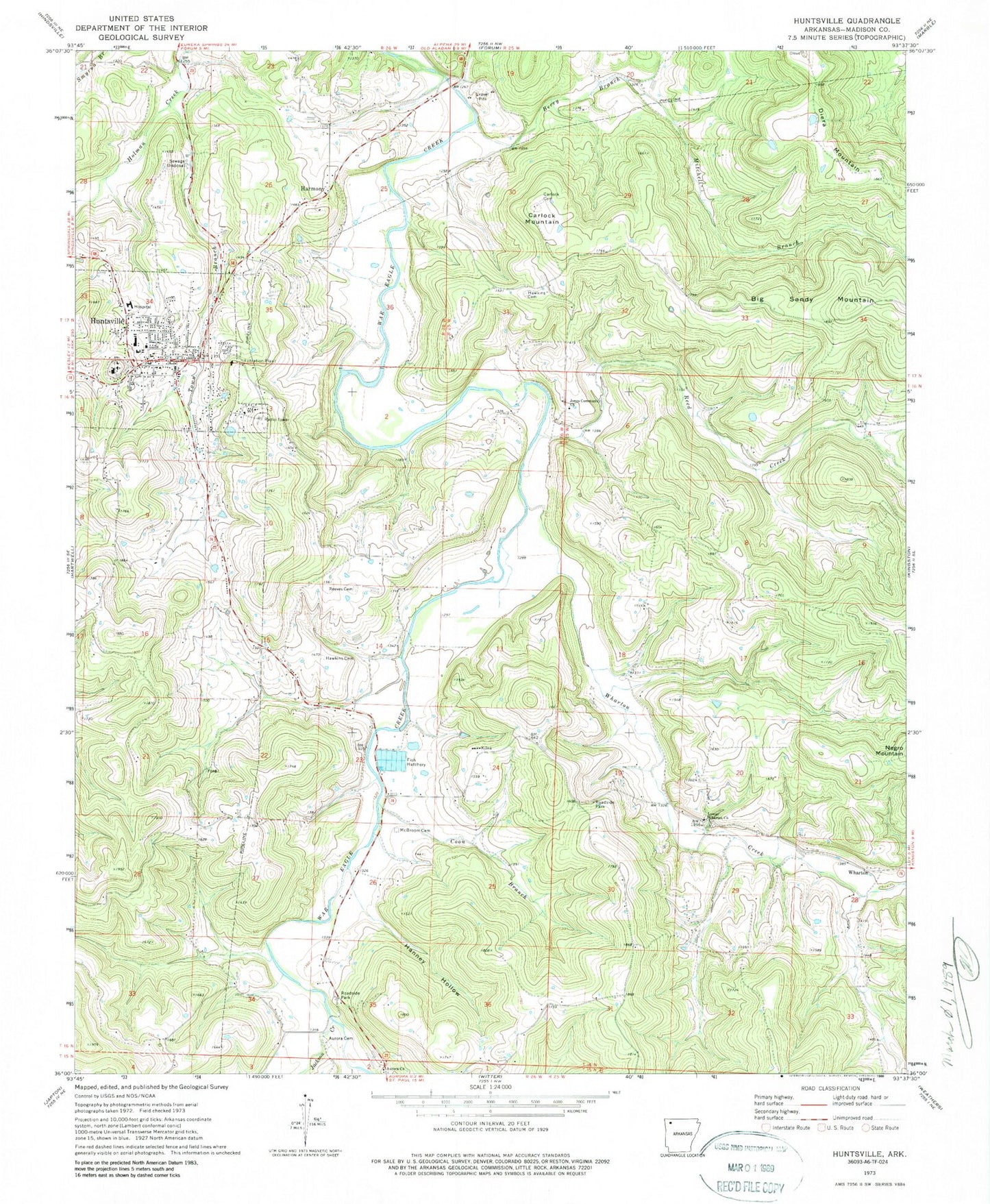
Classic USGS Huntsville Arkansas 7.5'x7.5' Topo Map
Couldn't load pickup availability
Historical USGS topographic quad map of Huntsville in the state of Arkansas. Map scale may vary for some years, but is generally around 1:24,000. Print size is approximately 24" x 27"
This quadrangle is in the following counties: Madison.
The map contains contour lines, roads, rivers, towns, and lakes. Printed on high-quality waterproof paper with UV fade-resistant inks, and shipped rolled.
Contains the following named places: Aurora Cemetery, Aurora Church, Berry Branch, Boston Mountain Rural Health, Carlock Cemetery, Carlock Mountain, City of Huntsville, City of Huntsville Lake, City of Huntsville Lake Dam, Coon Branch, Diera Mountain, Dotson Cemetery, Elm Spring, Hanney Hollow, Harmony, Hawkins Cemetery, Huntsville, Huntsville Fire Department, Huntsville High School, Huntsville Intermediate School, Huntsville Memorial Hospital, Huntsville Memorial Hospital Heliport, Huntsville Middle School, Huntsville Police Department, Huntsville Post Office, Jackson Creek, Jones Community Church, KFAY-FM (Huntsville), Lower Wharton Church, Lower Wharton Creek Cemetery, Madison County, Madison County Emergency Medical Service, Madison County Sheriff's Office, Mc Broom Cemetery, McConnells Chapel Cemetery, Mitchell Branch, Reed Creek, Reeves Cemetery, Town Branch, Township of Huntsville Ward 1, Township of Huntsville Ward 2, Township of Huntsville Ward 3, Township of Huntsville Ward 4, Township of War Eagle, Watson Primary School, Wharton, Wharton Creek, ZIP Code: 72740