MyTopo
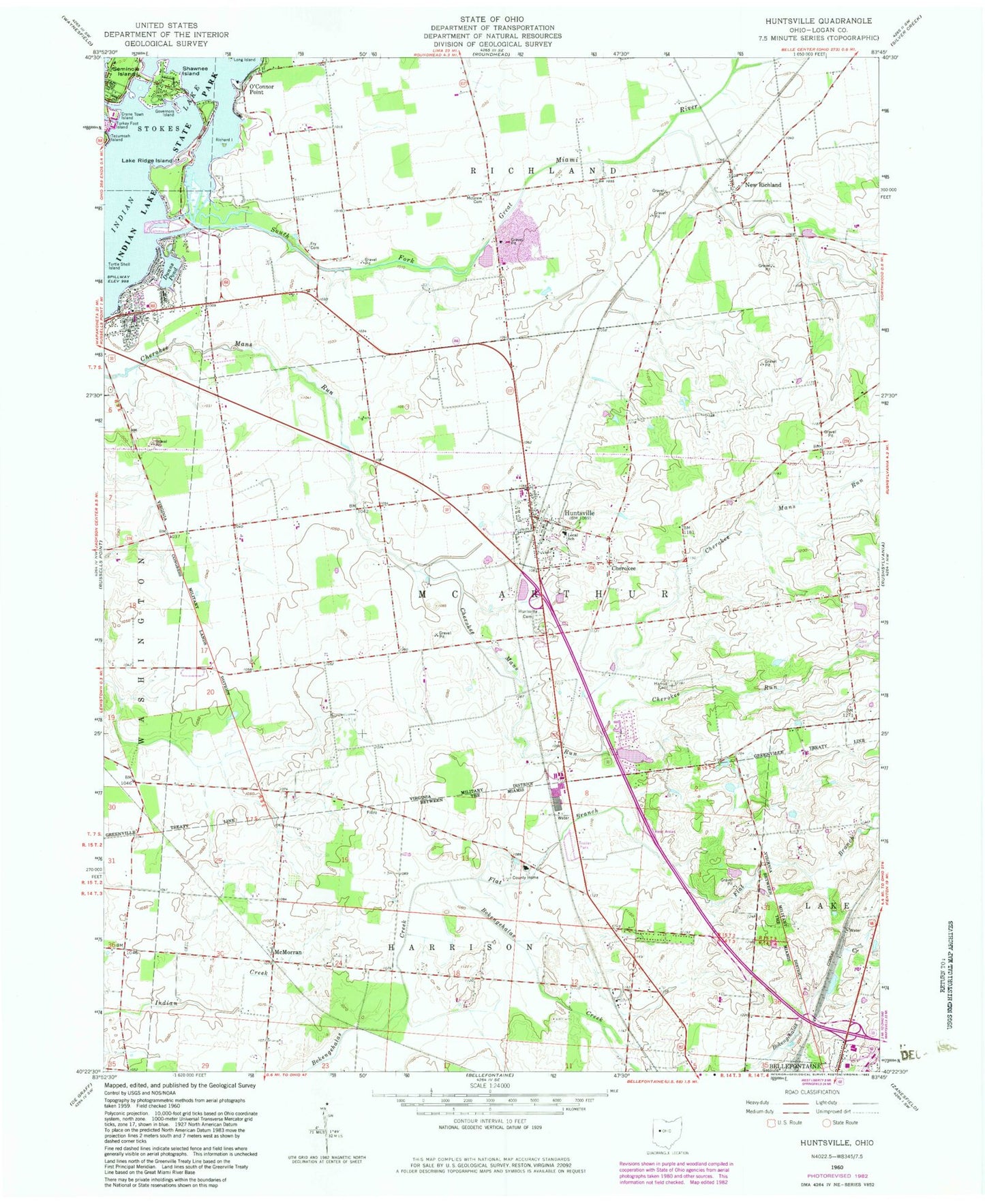
Classic USGS Huntsville Ohio 7.5'x7.5' Topo Map
Couldn't load pickup availability
Historical USGS topographic quad map of Huntsville in the state of Ohio. Typical map scale is 1:24,000, but may vary for certain years, if available. Print size: 24" x 27"
This quadrangle is in the following counties: Logan.
The map contains contour lines, roads, rivers, towns, and lakes. Printed on high-quality waterproof paper with UV fade-resistant inks, and shipped rolled.
Contains the following named places: Cherokee, Cherokee Run, Crane Town Island, Flat Branch, Fry Cemetery, Governors Island, Harrod Cemetery, Huntsville, Huntsville Cemetery, Local School, McGraw Cemetery, Richard Island, Shawnee Island, Turkey Foot Island, Turtle Shell Island, Lake Ridge Island, McMorran, Bickham Bridge, Calvary Christian School, Cherokee Hills Golf Course, Huntsville Elementary School, Logan County Home, Rabbitsville School (historical), School Number 1 (historical), School Number 2 (historical), School Number 1 (historical), School Number 4 (historical), School Number 6 (historical), School Number 7 (historical), School Number 9 (historical), School Number 9 (historical), Indian Lake State Park, Huntsville United Methodist Church, New Richland Baptist Church, New Richland, O'Connor Point, South Fork Great Miami River, Logan County, Bell Pond Dam, Bell Pond, Mary Rutan Heliport, Township of Lake, Township of McArthur, Township of Richland, County Home Cemetery, Johnston Cemetery, Huntsville Post Office, New Richland Post Office (historical), Village of Huntsville, Huntsville Fire Department, Robinaugh Emergency Medical Services, Hurley Farm, Wagner Farm, Rushwood Farms