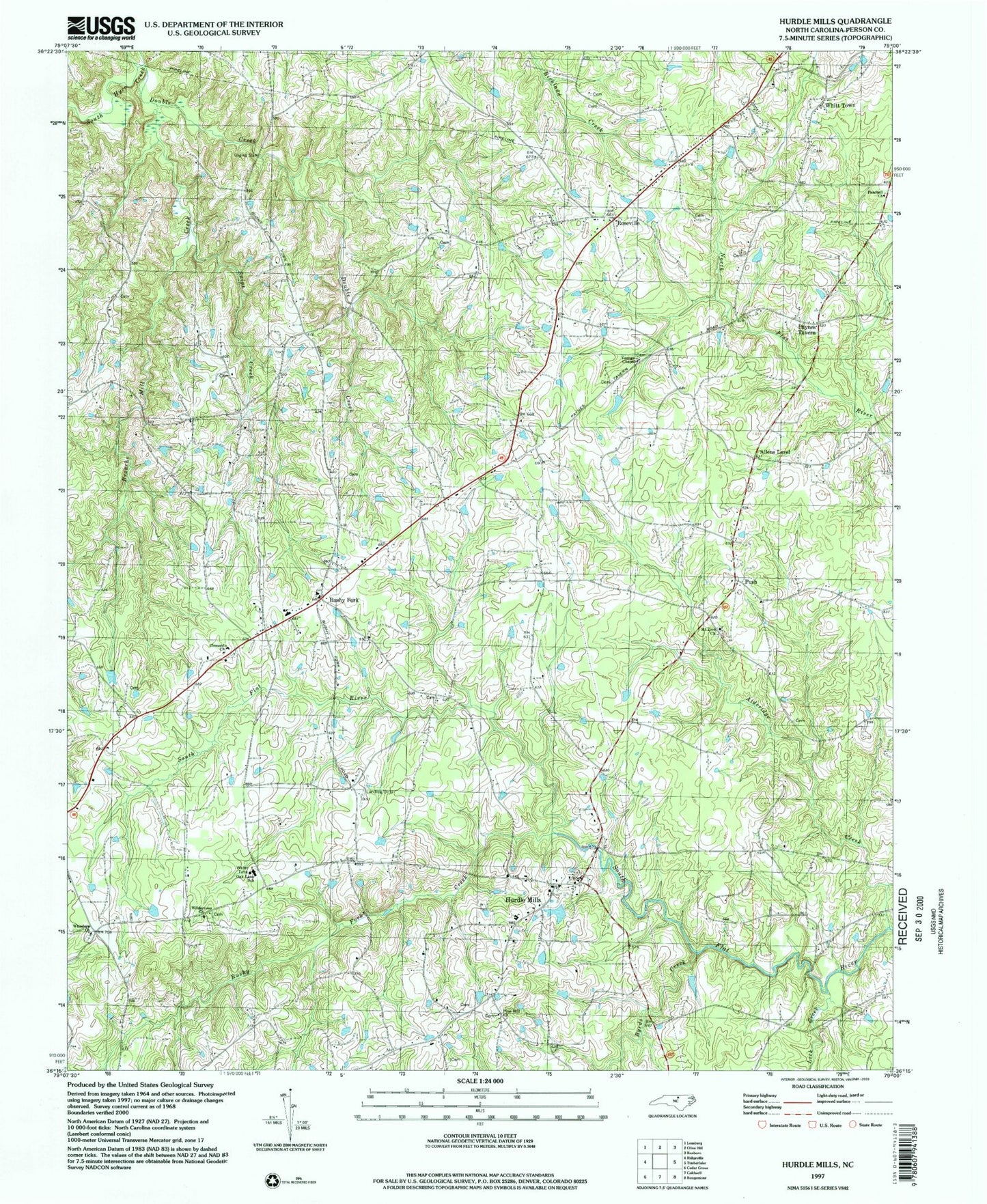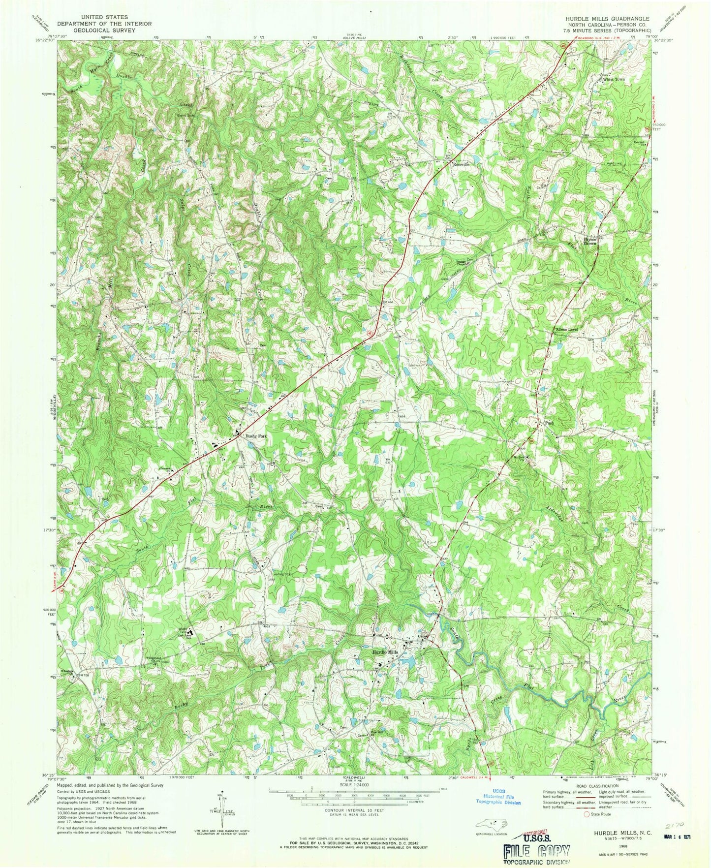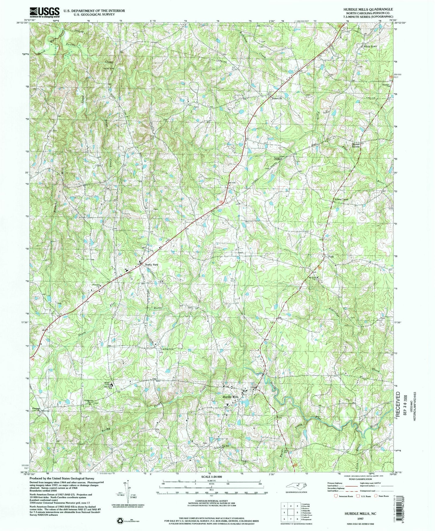

MyTopo
Classic USGS Hurdle Mills North Carolina 7.5'x7.5' Topo Map
Couldn't load pickup availability
Historical USGS topographic quad map of Hurdle Mills in the state of North Carolina. Map scale may vary for some years, but is generally around 1:24,000. Print size is approximately 24" x 27"
This quadrangle is in the following counties: Person.
The map contains contour lines, roads, rivers, towns, and lakes. Printed on high-quality waterproof paper with UV fade-resistant inks, and shipped rolled.
Contains the following named places: Alderidge Creek, Allens Level, Broachs Mill Creek, Bushy Fork, Bushy Fork Creek, Bushy Fork School, Byrds Creek, Clement Cemetery, Clement Missionary Baptist Church, Double Creek, Hurdle Mills, Hurdle Mills Post Office, Hurdle Mills School, Hurdle Mills Volunteer Fire Department Station 2, Lick Creek, Mount Zion United Methodist Cemetery, Mount Zion United Methodist Church, Oak Lane School, Paschall Church, Paynes Tavern, Perry Field, Pine Hill Church, Push, Roseville, Snipe Creek, Thaxton Pond, Thaxton Pond Dam, Township of Bushy Fork, Warrens Grove School, Wheelers Church, Wheelers Primitive Baptist Church Cemetery, Whitfield Farms Airport, Whitfield Pond, Whitfield Pond Dam, Whitfields Store, Whitt Town, Wilderness Church, Youngs Chapel, ZIP Code: 27541