MyTopo
Classic USGS Hurley East New Mexico 7.5'x7.5' Topo Map
Regular price
$16.95
Regular price
Sale price
$16.95
Unit price
per
Couldn't load pickup availability
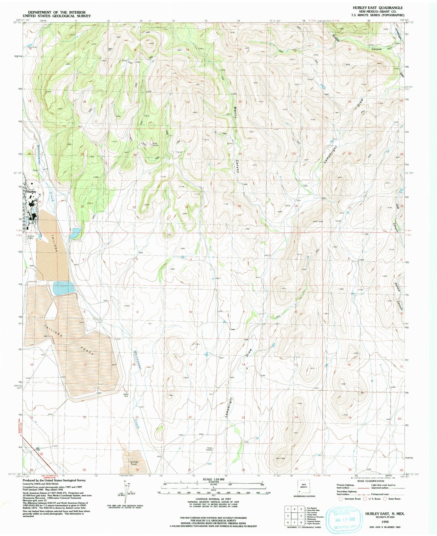
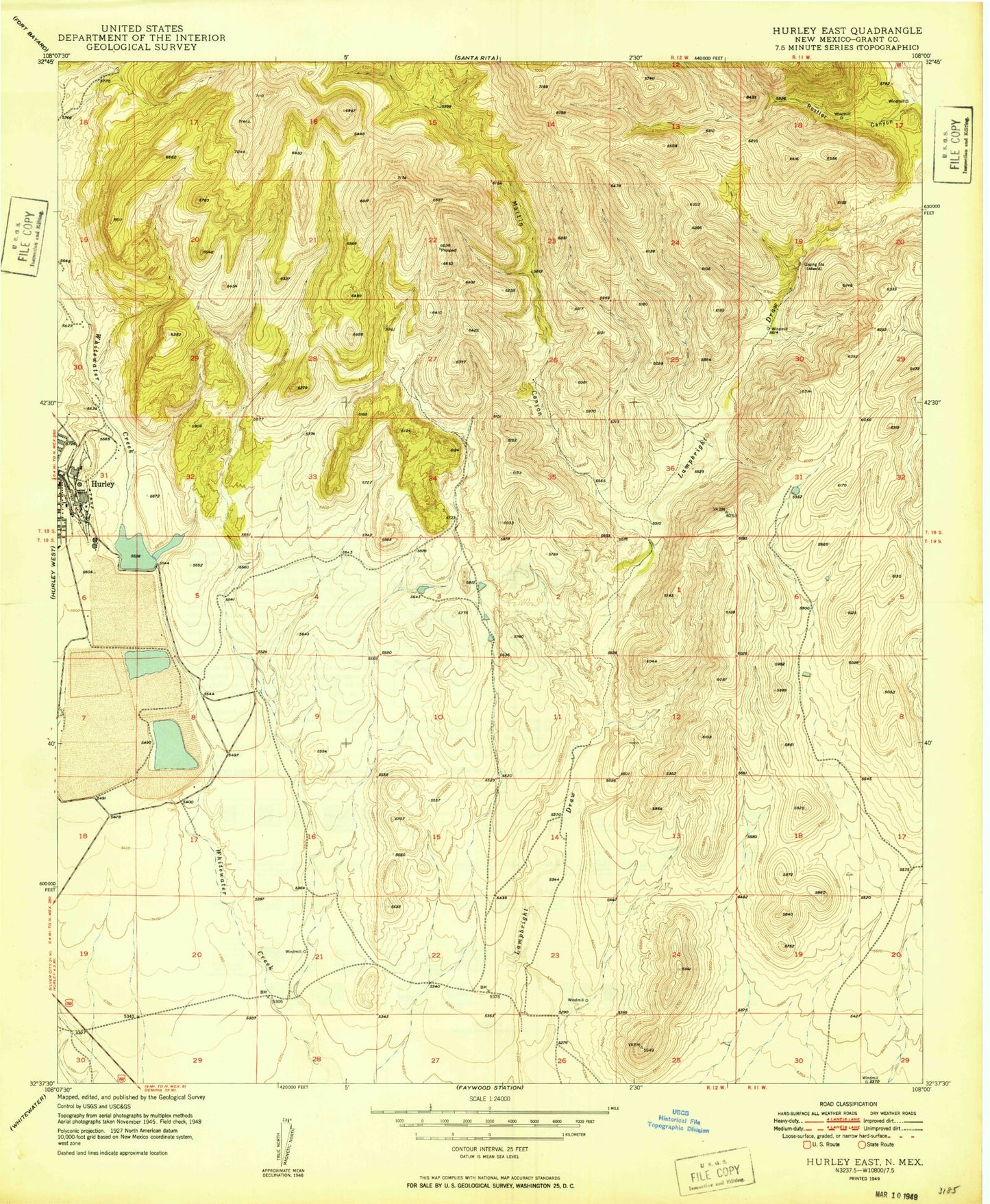
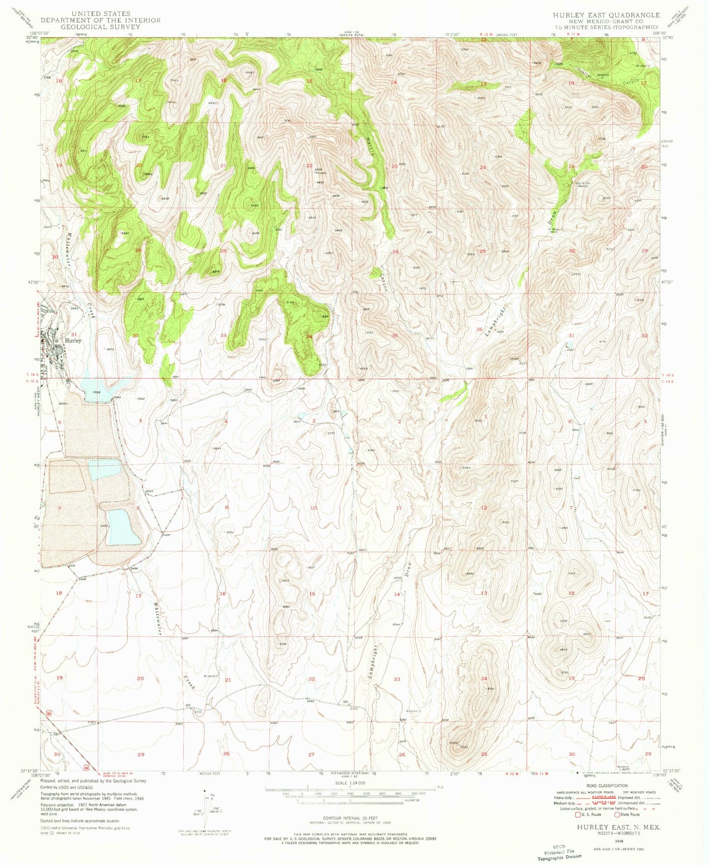
Historical USGS topographic quad map of Hurley East in the state of New Mexico. Map scale may vary for some years, but is generally around 1:24,000. Print size is approximately 24" x 27"
This quadrangle is in the following counties: Grant.
The map contains contour lines, roads, rivers, towns, and lakes. Printed on high-quality waterproof paper with UV fade-resistant inks, and shipped rolled.
Contains the following named places: 00324 Water Well, 00349 Water Well, 00686 Water Well, 00743 Water Well, 00752 Water Well, 00753 Water Well, G 322 Water Well, Kennicott Reservoir Lake Number 1 Dam, Martin Canyon, Rincon Well, Rustler Canyon, Whitewater Reservoir