MyTopo
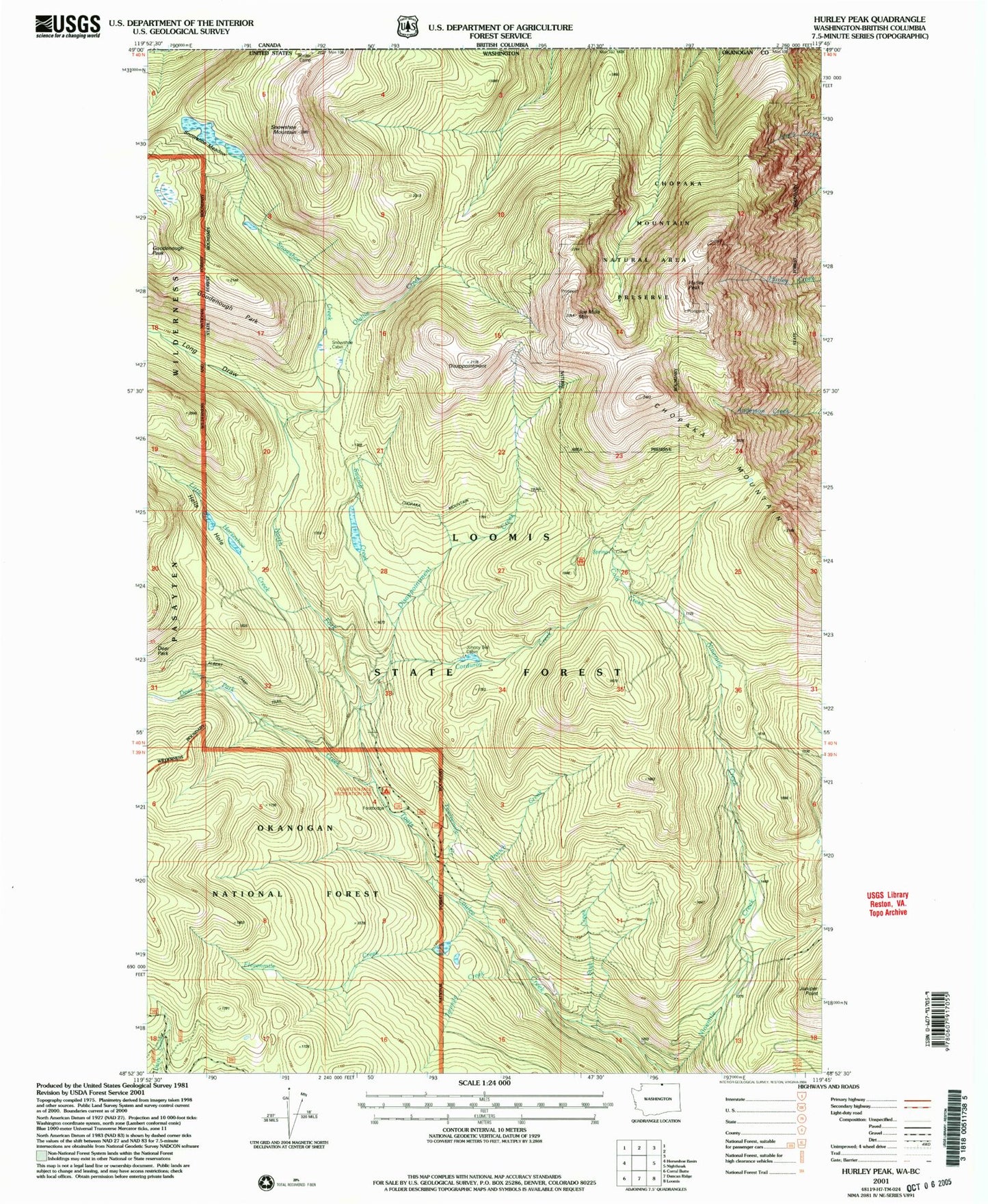
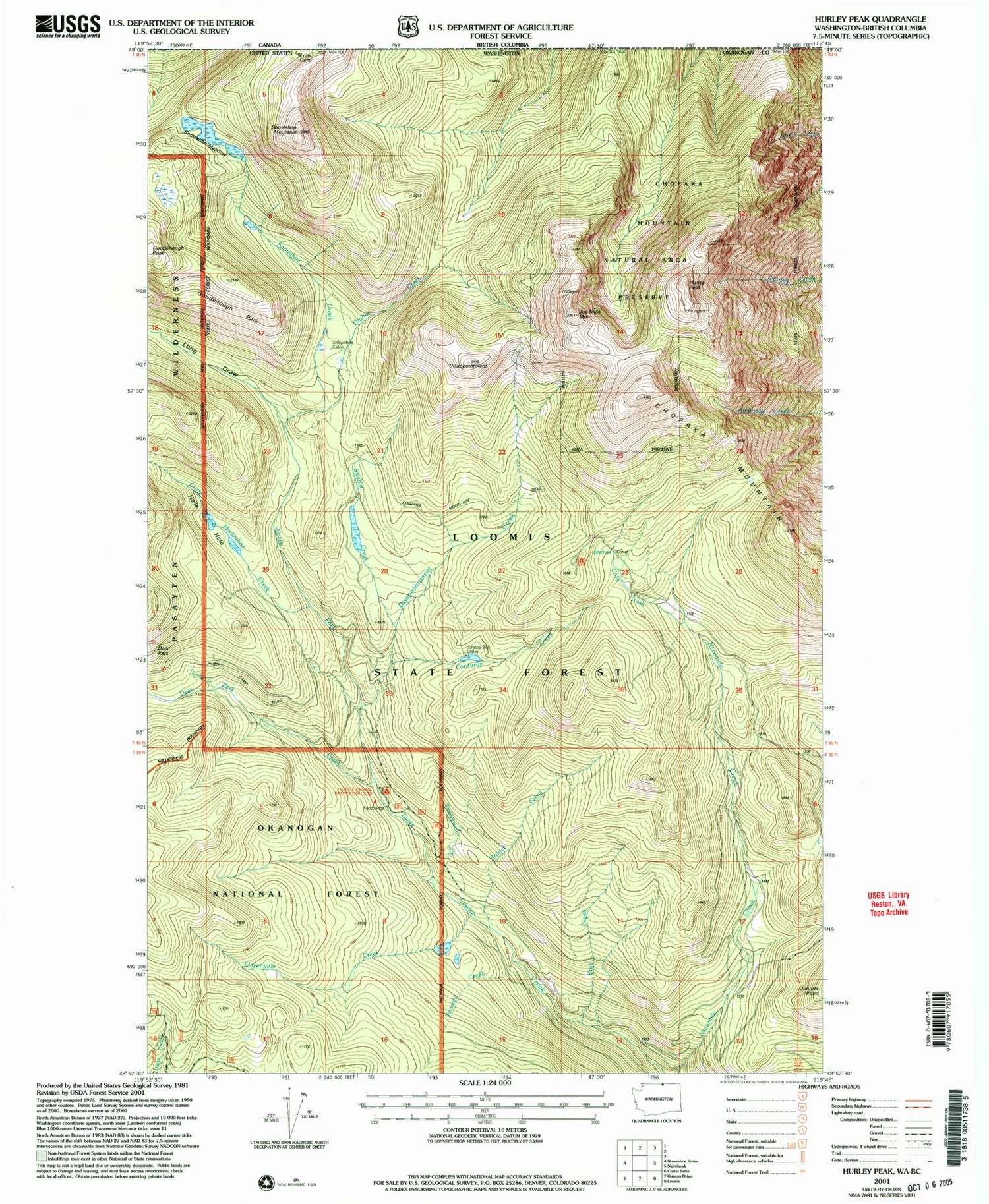
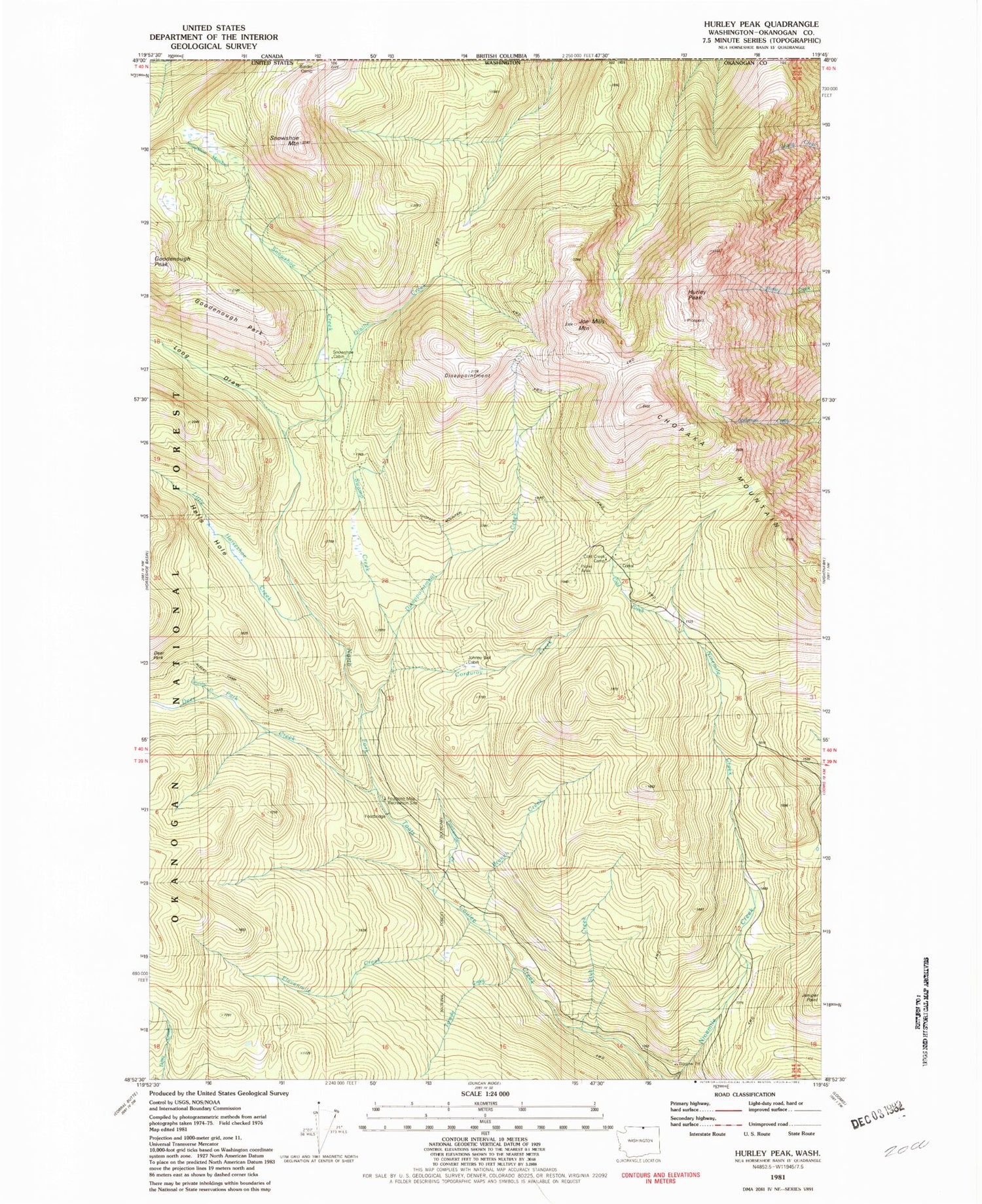
Classic USGS Hurley Peak Washington 7.5'x7.5' Topo Map
Couldn't load pickup availability
Historical USGS topographic quad map of Hurley Peak in the state of Washington. Map scale may vary for some years, but is generally around 1:24,000. Print size is approximately 24" x 27"
This quadrangle is in the following counties: Okanogan.
The map contains contour lines, roads, rivers, towns, and lakes. Printed on high-quality waterproof paper with UV fade-resistant inks, and shipped rolled.
Contains the following named places: Border Camp, Branch Creek, Chopaka Mountain, Chopaka Mountain Trail, Cold Creek, Cold Creek Camp, Corduroy Creek, Deer Park Creek, Disappointment, Disappointment Creek, Elevenmile Creek, Fourteen Mile Recreation Site, Fourteen Mile Trailhead, Goodenough Park, Hells Hole, Hurley Peak, Joe Mills Mountain, Johnny Bell Cabin, Juniper Point, Little Horseshoe Creek, Long Draw, North Fork Toats Creek Trail, Olallie Creek, Snehumption Creek, Snowshoe Creek, Snowshoe Meadow, Snowshoe Mountain, Stub Creek, Sunday Creek, Swamp Creek, Tenmile Creek, Twelvemile Creek