MyTopo
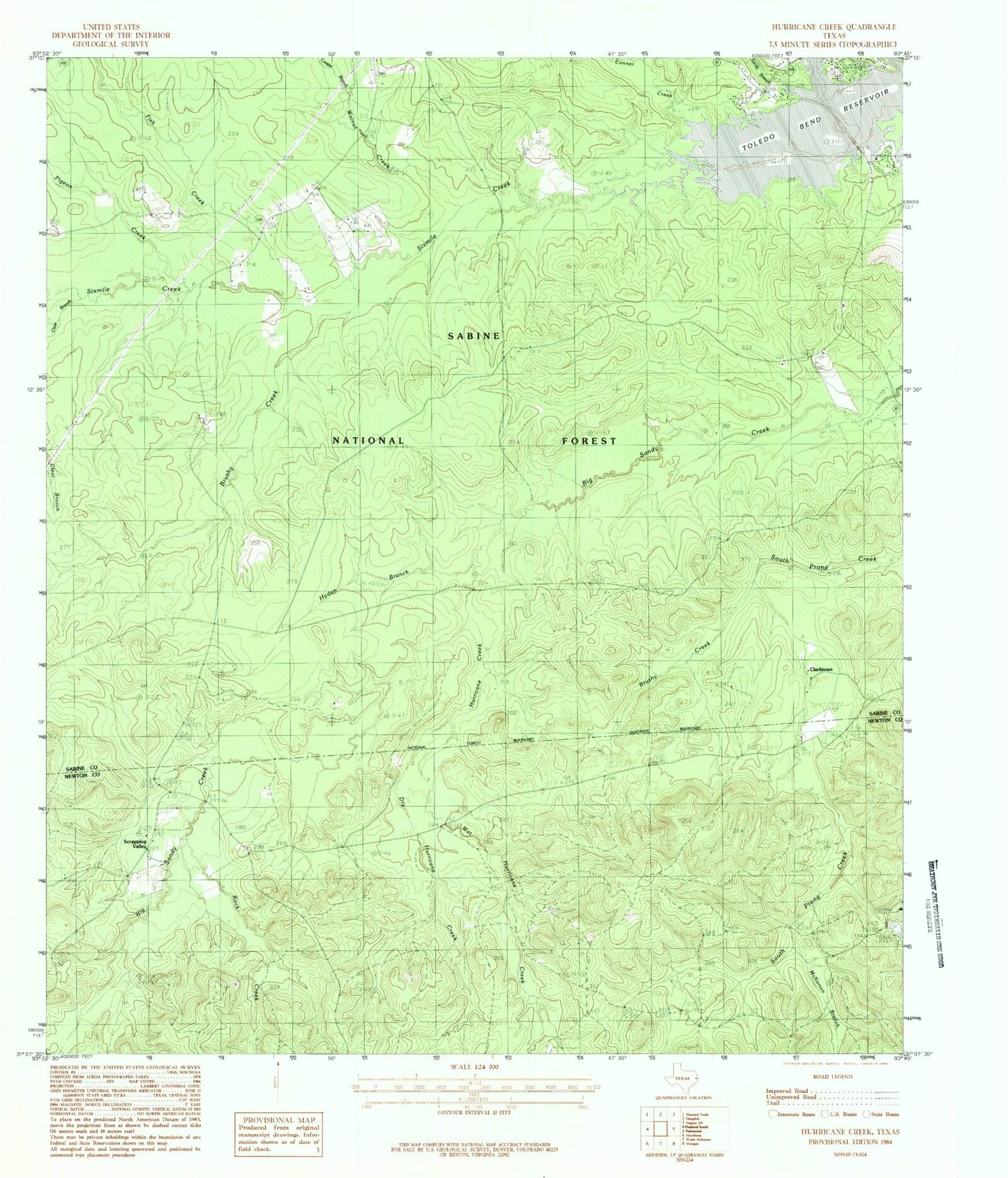
Classic USGS Hurricane Creek Texas 7.5'x7.5' Topo Map
Couldn't load pickup availability
Historical USGS topographic quad map of Hurricane Creek in the state of Texas. Map scale may vary for some years, but is generally around 1:24,000. Print size is approximately 24" x 27"
This quadrangle is in the following counties: Newton, Sabine.
The map contains contour lines, roads, rivers, towns, and lakes. Printed on high-quality waterproof paper with UV fade-resistant inks, and shipped rolled.
Contains the following named places: Anderson Bowie Cemetery, Brushy Creek, Clark - Clarkton Cemetery, Clarktown, Conner Creek, Cooper Branch, Deas-Mason-Smith Cemetery, Dry Hurricane Creek, Fish Creek, Friendship Church, Hurricane Creek, Hyden Branch, Lick Branch, Mason, McNorton Branch, Pigeon Creek, Pine Hill Cemetery, Pine Hill Church, Pleasant Hill Cemetery, Rice Creek, Rock Creek, Sandy Branch, Scrappin Valley Lake, Scrappin Valley Lake Dam, Scrapping Valley, Sixmile Creek, Walnut Creek, Wet Hurricane Creek, Wilkerson Family Cemetery