MyTopo
Classic USGS Hurricane Deck California 7.5'x7.5' Topo Map
Couldn't load pickup availability
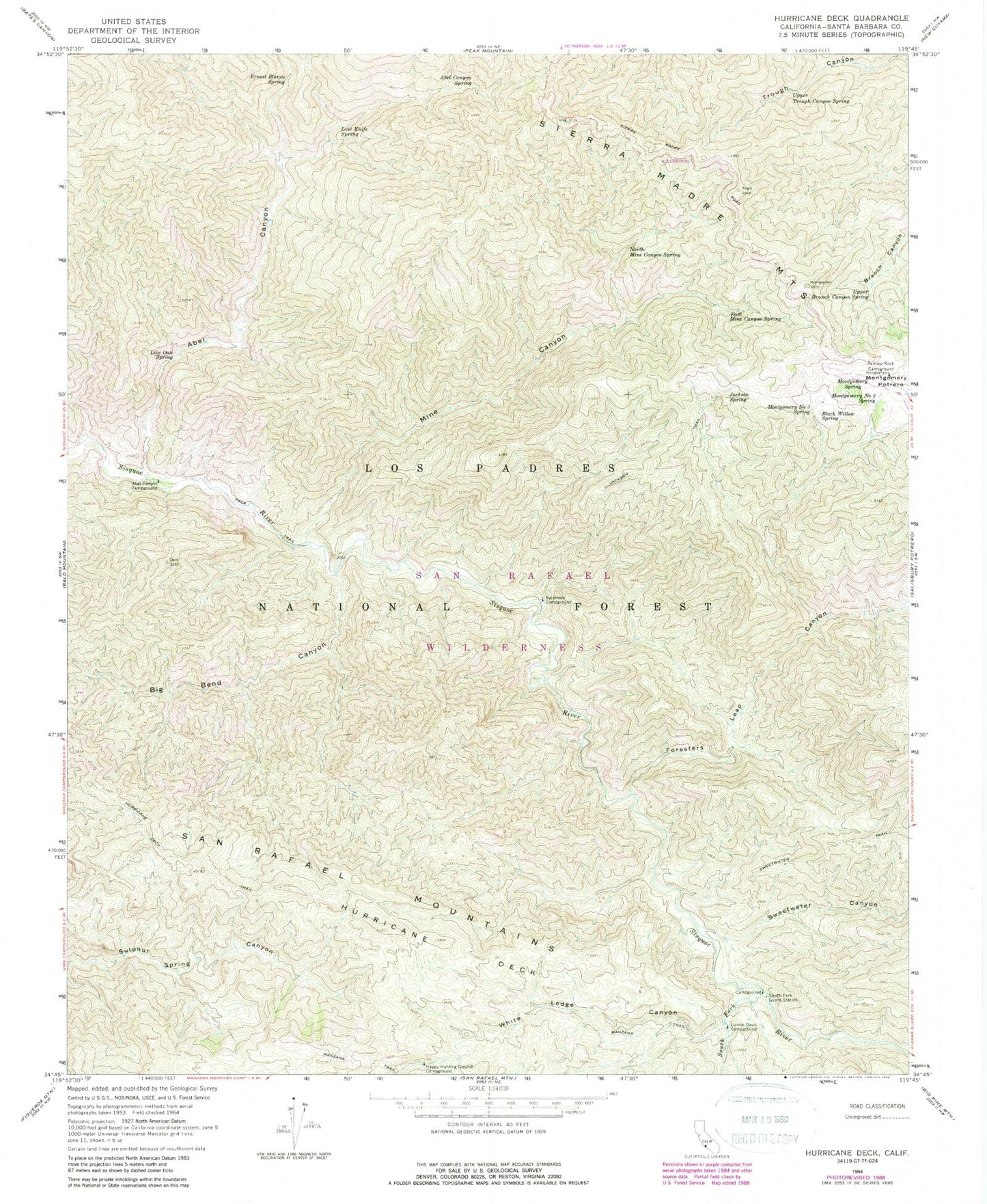
Historical USGS topographic quad map of Hurricane Deck in the state of California. Typical map scale is 1:24,000, but may vary for certain years, if available. Print size: 24" x 27"
This quadrangle is in the following counties: Santa Barbara.
The map contains contour lines, roads, rivers, towns, and lakes. Printed on high-quality waterproof paper with UV fade-resistant inks, and shipped rolled.
Contains the following named places: Abel Canyon Spring, Black Willow Spring, East Mine Canyon Spring, Ernest Blanco Spring, Hurricane Deck, Jackson Spring, Jackson Trail, Live Oak Spring, Lost Knife Spring, Manzana Trail, Mine Canyon, Montgomery Number Two Spring, Montgomery Number Three Spring, Montgomery Spring, North Mine Canyon Spring, South Fork Guard Station, South Fork Sisquoc River, Upper Branch Canyon Spring, Upper Trough Canyon Spring, White Ledge Canyon, Abel Canyon, Big Bend Canyon, Foresters Leap Canyon, Hurricane Deck Trail, Montgomery Potrero, Sweetwater Canyon, White Ledge Campground, South Fork Rustic Campsite, Cliff Campground, Abel Canyon Campground, Happy Hunting Ground Campground, Lonnie Davis Campground, Painted Rock Campground, Sycamore Campground, Cuyama Division, San Rafael Wilderness, Sisquoc Wild and Scenic River