MyTopo
Classic USGS Hurricane Hill Washington 7.5'x7.5' Topo Map
Couldn't load pickup availability
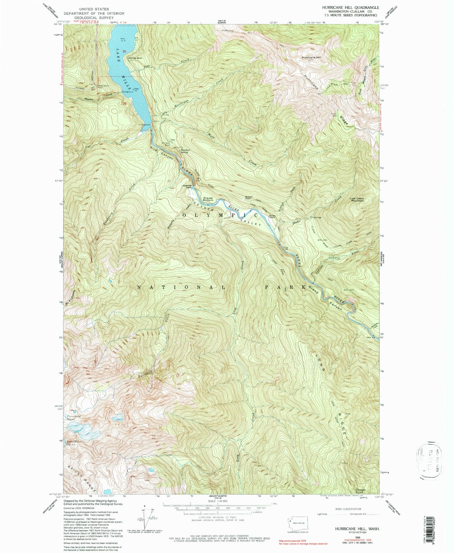
Historical USGS topographic quad map of Hurricane Hill in the state of Washington. Typical map scale is 1:24,000, but may vary for certain years, if available. Print size: 24" x 27"
This quadrangle is in the following counties: Clallam, Jefferson.
The map contains contour lines, roads, rivers, towns, and lakes. Printed on high-quality waterproof paper with UV fade-resistant inks, and shipped rolled.
Contains the following named places: Antelope Creek, Boulder Creek, Bowman Creek, Cat Creek, Fairchild Creek, Fitzhenry Creek, Geyser Valley, Goblin Gates, Grand Canyon, Haggerty Creek, Hurricane Hill, Hurricane Hill Trail, Idaho Creek, Krause Bottom, Lillian River, Lillian River Trail, Lillian Shelter, Little River Trail, Long Creek, Long Ridge, Long Ridge Trail, Lost Cabin Mountain, Michaels Ranch, Lake Mills (historical), Rica Canyon, Sege Creek, Stukey Creek, Whiskey Bend, Windy Arm, Winslow Spring, Wolf Creek, Hurricane Ridge Ski Lodge, Hurricane Creek