MyTopo
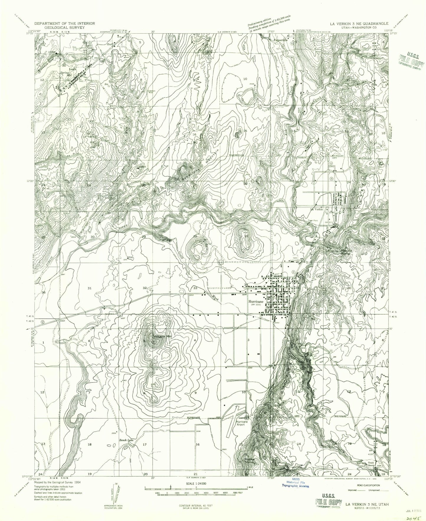
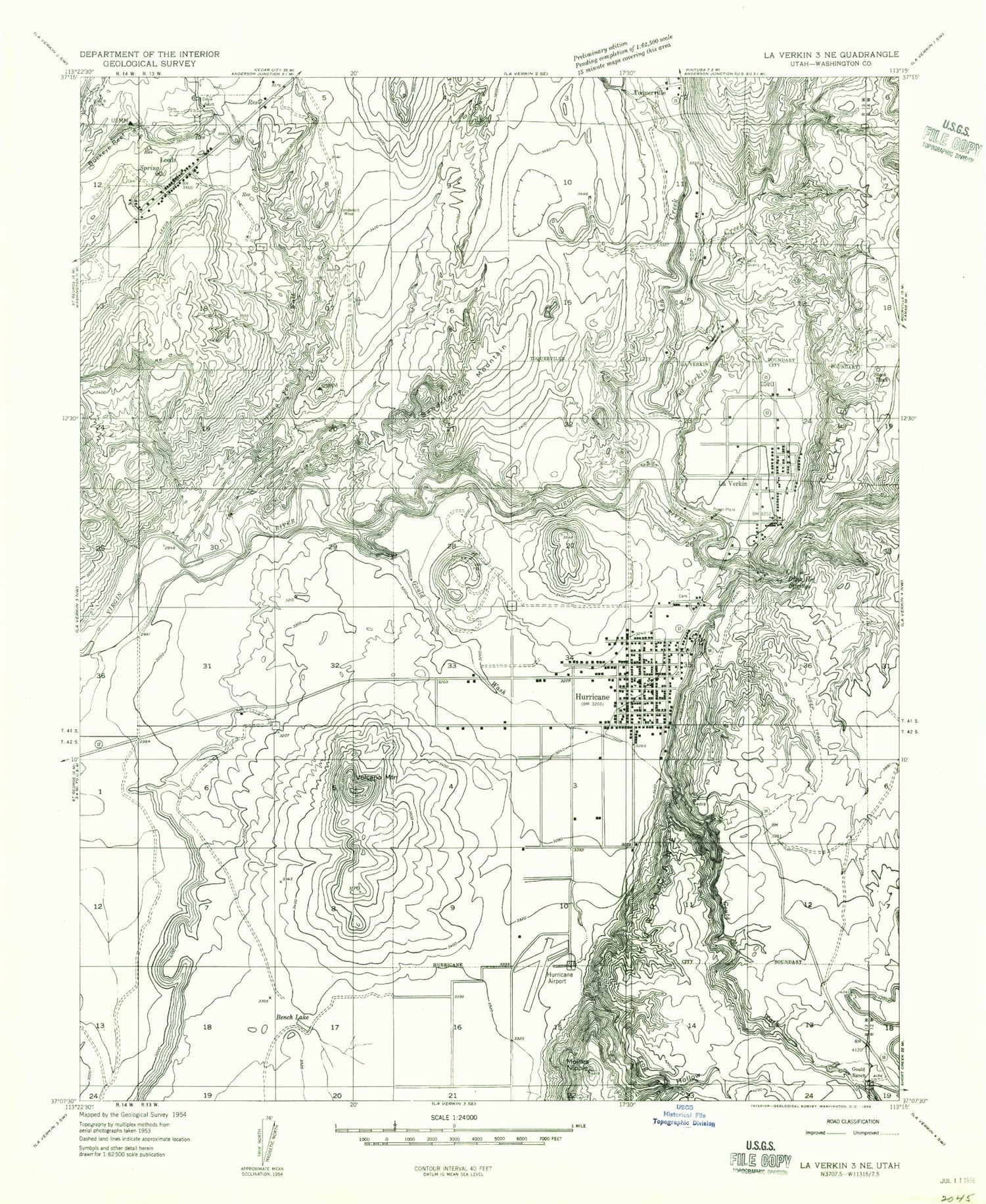
Classic USGS Hurricane Utah 7.5'x7.5' Topo Map
Couldn't load pickup availability
Historical USGS topographic quad map of Hurricane in the state of Utah. Map scale may vary for some years, but is generally around 1:24,000. Print size is approximately 24" x 27"
This quadrangle is in the following counties: Washington.
The map contains contour lines, roads, rivers, towns, and lakes. Printed on high-quality waterproof paper with UV fade-resistant inks, and shipped rolled.
Contains the following named places: Ash Creek, Bench Lake, Big Hill, Buckeye Reef, Chinatown Wash, City of Hurricane, City of La Verkin, Dixie Hot Springs, Doyle Shaft, East Reef, First Southern Baptist Church, Frog Hollow, Gateway Trailer Park, General Dick Stout Field, Gould Ranch, Gould Wash, Grapevine Wash, Hurricane, Hurricane Canal, Hurricane City Cemetery, Hurricane Elementary School, Hurricane Fields, Hurricane High School, Hurricane Hill, Hurricane Middle School, Hurricane Police Department, Hurricane Post Office, Hurricane Valley Fire and Rescue Station 41, Hurricane Valley Fire and Rescue Station 42, Jehovahs Witnesses Kingdom Hall, Kimball Motel and RV Park, La Verkin Canal, La Verkin City Cemetery, La Verkin Creek, La Verkin Fire Department, La Verkin Police Department, La Verkin Post Office, LaVerkin, LaVerkin Elementary School, Leeds, Leeds Area Special Service District Fire Department, Leeds Cemetery, Leeds Ditch, Leeds Police Department, Leeds Post Office, Little Purgatory, Mollies Nipple, Nephis Twist, Quail Lake RV Park, Roberts Roost, Sandstone Mountain, Seventh Day Adventist Church, Silver Reef Catholic Cemetery, Silver Reef Protestant Cemetery, Sullivan Knoll, Tecumseh Hill, The Church of Jesus Christ of Latter Day Saints, Toquerville Cemetery, Town of Leeds, Vanderbilt Mine, Virgin Territory Trailer Park, Wet Sandy, Workman Wash, ZIP Code: 84746