MyTopo
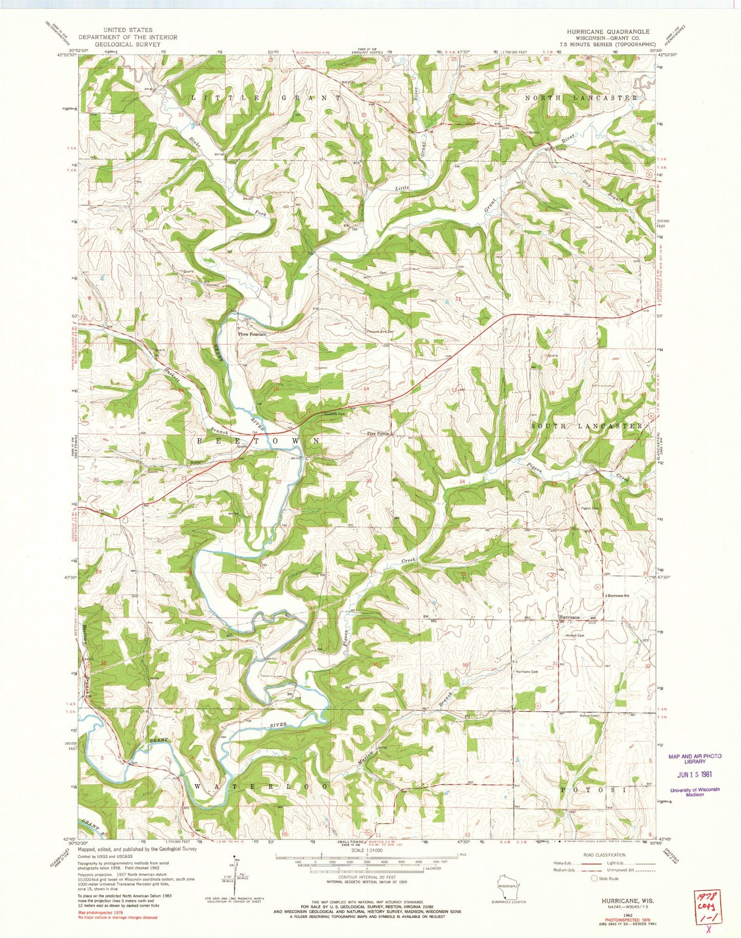
Classic USGS Hurricane Wisconsin 7.5'x7.5' Topo Map
Couldn't load pickup availability
Historical USGS topographic quad map of Hurricane in the state of Wisconsin. Map scale may vary for some years, but is generally around 1:24,000. Print size is approximately 24" x 27"
This quadrangle is in the following counties: Grant.
The map contains contour lines, roads, rivers, towns, and lakes. Printed on high-quality waterproof paper with UV fade-resistant inks, and shipped rolled.
Contains the following named places: Bahl Farms, Beetown Branch, Blackburn Bridge, Blake Fork, Day Branch, Five Points, Flora Fountain, Grant Hills Farm, Hackett Branch, Hidden Acres Farms, Hurricane, Hurricane Cemetery, Hurricane School, Kinney Cemetery, Little Grant River, Martin Branch, Morrell Cemetery, Pidgeon Bridge, Pigeon Creek, Pleasant Ridge Cemetery, Porters Bridge, Raiseback Bridge, Town of Beetown, Wilcox Bridge