MyTopo
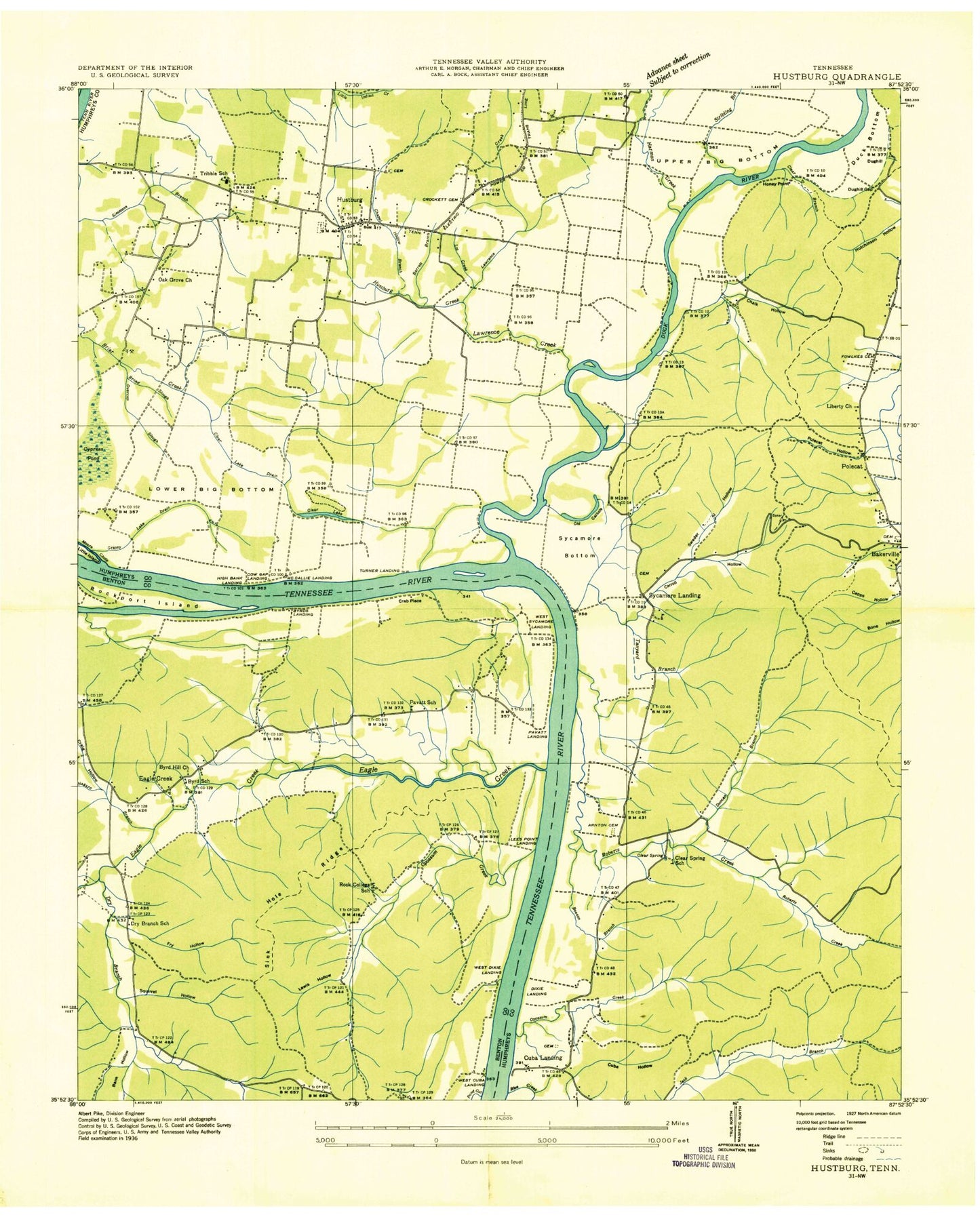
Classic USGS Hustburg Tennessee 7.5'x7.5' Topo Map
Couldn't load pickup availability
Historical USGS topographic quad map of Hustburg in the state of Tennessee. Map scale may vary for some years, but is generally around 1:24,000. Print size is approximately 24" x 27"
This quadrangle is in the following counties: Benton, Humphreys.
The map contains contour lines, roads, rivers, towns, and lakes. Printed on high-quality waterproof paper with UV fade-resistant inks, and shipped rolled.
Contains the following named places: Arrington Cemetery, Bakerville School, Beason Branch, Blue Creek, Briar Creek, Broad Slough, Buchanans Landing, Burnett Branch, Byrd Cemetery, Byrd School, Byrds Landing, Carroll Hollow, Chalk Hollow, Chappell Cemetery, Chappell Hollow Branch, Clear Branch, Clear Lake, Clear Lake Drain, Clear Spring, Clear Spring School, Cow Gap Landing, Crab Place, Craig Hollow, Crockett Cemetery, Cuba Hollow, Cuba Landing, Cude Cemetery, Cypress Pond, DePriest Cemetery, Dixie Landing, Dreden Cemetery, Dry Branch, Dry Branch Cemetery, Dry Branch Church, Dry Branch School, Duck Bottom, Duck River, Duck River Dewatering Area, Duck River Unit Tennessee National Wildlife Refuge, Dughill, Dughill Gap, Duncan Branch, Eagle Creek, Eagle Creek Baptist Church, Eagle Creek Cemetery, Ebenezer Church, Estes Cemetery, Foote Mineral Company Dam Number One, Foote Mineral Company Tailings Pond, Fowlkes Cemetery, Fry Hollow, Grassy Lake Drain, Haggard Branch, Hamm Cemetery, Harmon Creek, High Bank Landing, Honey Point, Hustburg, Hustburg Creek, Jones Cemetery, Larkins Cemetery, Lawrence Creek, Lees Point Landing, Lewis Hollow, Liberty Church, Link Cemetery, Lower Big Bottom, Matlock Cemetery, McCallie Landing, Morris Cemetery, Neblett Cemetery, Oak Grove Church, Old Cathole, Opossum Creek, Overcup Slough, Pavatt Cemetery, Pavatt Landing, Pavatt School, Polecat, Polecat Hollow, Pond Creek, Roberts Creek, Rock College School, Rockport Island, Simmons Branch, Simmons Branch Industrial Site, Sinkhole Ridge, Squirrel Hollow, Stribling Branch, Swader Hollow, Sycamore Bottom, Sycamore Landing, Tanyard Branch, Tennessee National Wildlife Refuge, Tribble High School, Turner Landing, Upper Big Bottom, Vanhook Cemetery, Varbrough Cemetery, Walker Cemetery, West Cuba Landing, West Dixie Landing, West Sycamore Landing, Willbanks Cemetery, Willbanks Hollow, ZIP Code: 37134