MyTopo
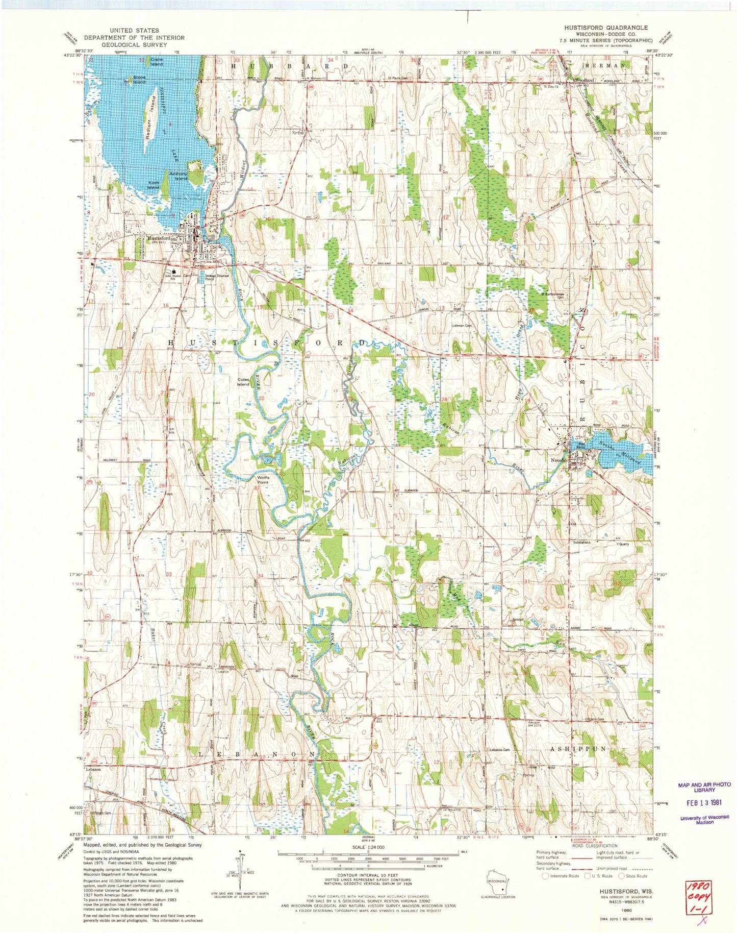
Classic USGS Hustisford Wisconsin 7.5'x7.5' Topo Map
Couldn't load pickup availability
Historical USGS topographic quad map of Hustisford in the state of Wisconsin. Map scale may vary for some years, but is generally around 1:24,000. Print size is approximately 24" x 27"
This quadrangle is in the following counties: Dodge.
The map contains contour lines, roads, rivers, towns, and lakes. Printed on high-quality waterproof paper with UV fade-resistant inks, and shipped rolled.
Contains the following named places: Anthony Island, Bethany Lutheran Church, Bethany Lutheran School, Coles Island, Crane Island, First Presbyterian Church, Hepp Creek, Honor Elementary School, Hustisford, Hustisford 2WP888 Dam, Hustisford Community Library, Hustisford Fire Department, Hustisford Junior / Senior High School, Hustisford Police Department, Hustisford Post Office, John Hustis Elementary School, Koch Island, Lake Country Victory High School, Lebanon Cemetery, Lehman Cemetery, Mud Run, Neosho, Neosho / Rubicon / Ashippun Police Department, Neosho Fire Department, Neosho Millpond, Neosho Post Office, Radloff Island, Riegleman Field, Rubicon River, Saint Bartholomew Cemetery, Saint John Church, Saint Johns Cemetery, Saint Michaels Church, Saint Peters Cemetery, Sinissippi Lake, Sinissippi Lake 509, Stone Island, Town of Hustisford, Village of Hustisford, Village of Neosho, Wildcat Creek, Wolfs Point, Woodland, Woodland Road School, Woodland Volunteer Fire Department, ZIP Codes: 53034, 53059