MyTopo
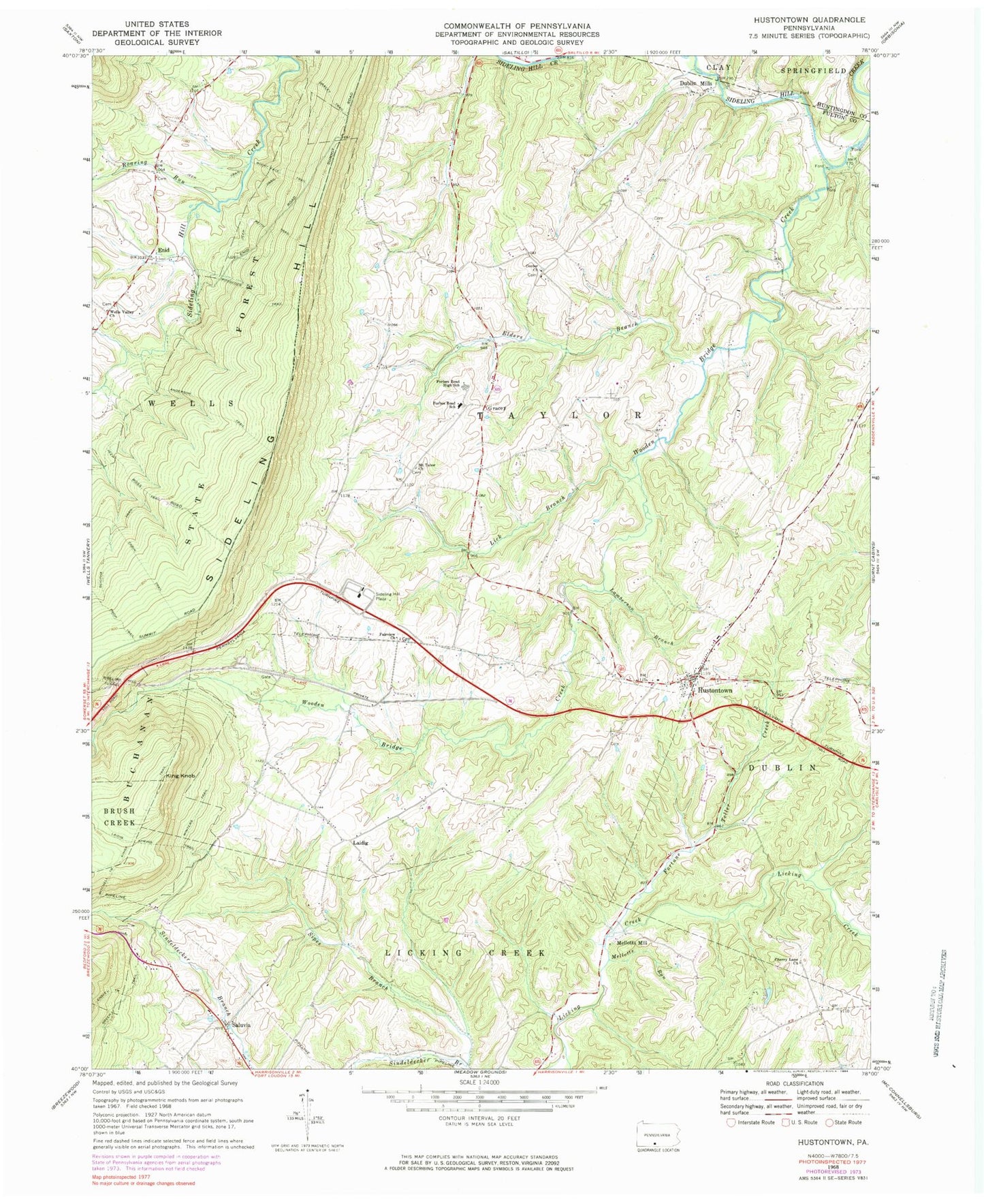
Classic USGS Hustontown Pennsylvania 7.5'x7.5' Topo Map
Couldn't load pickup availability
Historical USGS topographic quad map of Hustontown in the state of Pennsylvania. Map scale may vary for some years, but is generally around 1:24,000. Print size is approximately 24" x 27"
This quadrangle is in the following counties: Fulton, Huntingdon.
The map contains contour lines, roads, rivers, towns, and lakes. Printed on high-quality waterproof paper with UV fade-resistant inks, and shipped rolled.
Contains the following named places: Anderson Trail, Appalachian Mountains, Cabin Trail, Center Church, Center United Methodist Cemetery, Cherry Lane Church, Davis Lane Cemetery, Dublin Mills, Dublin Mills Community Church Cemetery, Elders Branch, Enid, Enid School, Ensley Trail, Fairview Cemetery, Fairview Church, Flying R Airport, Forbes Road Elementary School, Forbes Road Junior-Senior High School, Fortune Teller Creek, Gracey, Gracey School, Green Trail, Hiram, Hustontown, Hustontown Area Volunteer Fire Company - Station 57, Hustontown Methodist Cemetery, Hustontown Post Office, Keith Trail, King Knob, Kings Trail, Laidig, Lamberson Branch, Lick Branch, Mellotts Mill, Mellotts Run, Mitchell Trail, Mount Tabor Cemetery, Mount Tabor Church, Roaring Run, Rocky Face Trail, Saluvia, School Number 3, Sciotha Trail, Sideling Hill Plaza, Sipes Branch, Township of Taylor, Vallance School, Waterfall School, Wells Valley Chapel Cemetery, Wells Valley Church, Winegardner Cemetery, Winegardner School, Wintergreen School, Winters Trail, Woodcock Trail, Wooden Bridge Creek, ZIP Code: 17229