MyTopo
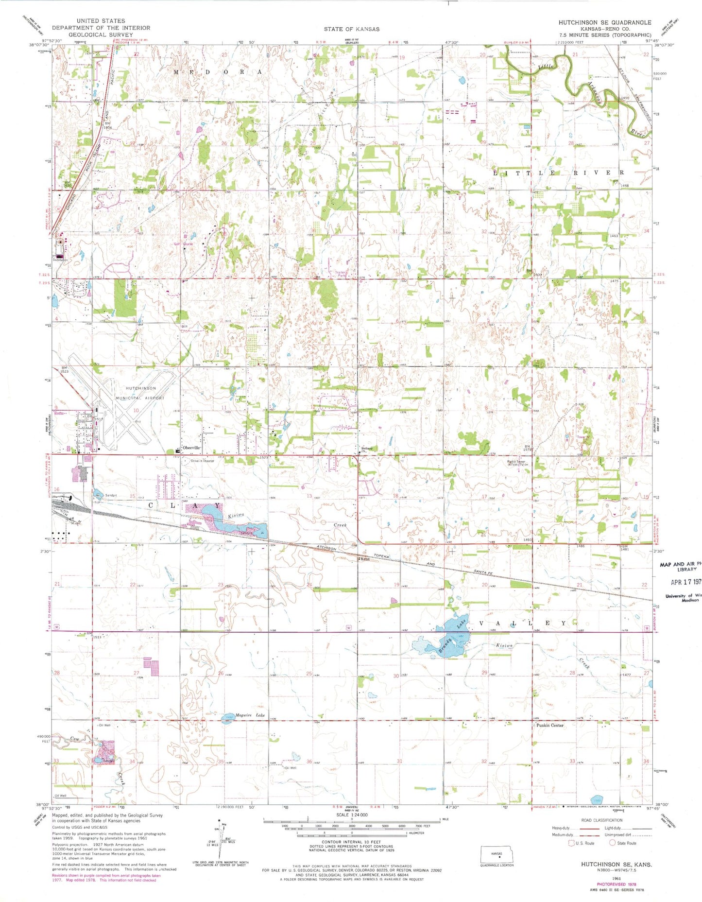
Classic USGS Hutchinson SE Kansas 7.5'x7.5' Topo Map
Couldn't load pickup availability
Historical USGS topographic quad map of Hutchinson SE in the state of Kansas. Map scale may vary for some years, but is generally around 1:24,000. Print size is approximately 24" x 27"
This quadrangle is in the following counties: Reno.
The map contains contour lines, roads, rivers, towns, and lakes. Printed on high-quality waterproof paper with UV fade-resistant inks, and shipped rolled.
Contains the following named places: Bethany Church of the Nazarene, Cottonwood Hills Golf Club, Heart Ministries, Hutchinson Fire Department Station 7, Hutchinson Regional Airport, Kansas Underground Salt Museum, Kent, Kent Post Office, KPTS-TV (Hutchinson), KSCW - TV (Burrton), KSKU-FM (Hutchinson), KTVH-TV (Hutchinson), KWCH - TV (Burrton), Magwire Lake, New Hope Baptist Church, Obee Elementary School, Obeeville, Prairie Dunes Country Club, Prairie Hills Middle School, Punkin Center, Showalter Mobile Home Park, Township of Clay, Township of Valley, Victory Village Christian Academy