MyTopo
Classic USGS Huttig Arkansas 7.5'x7.5' Topo Map
Couldn't load pickup availability
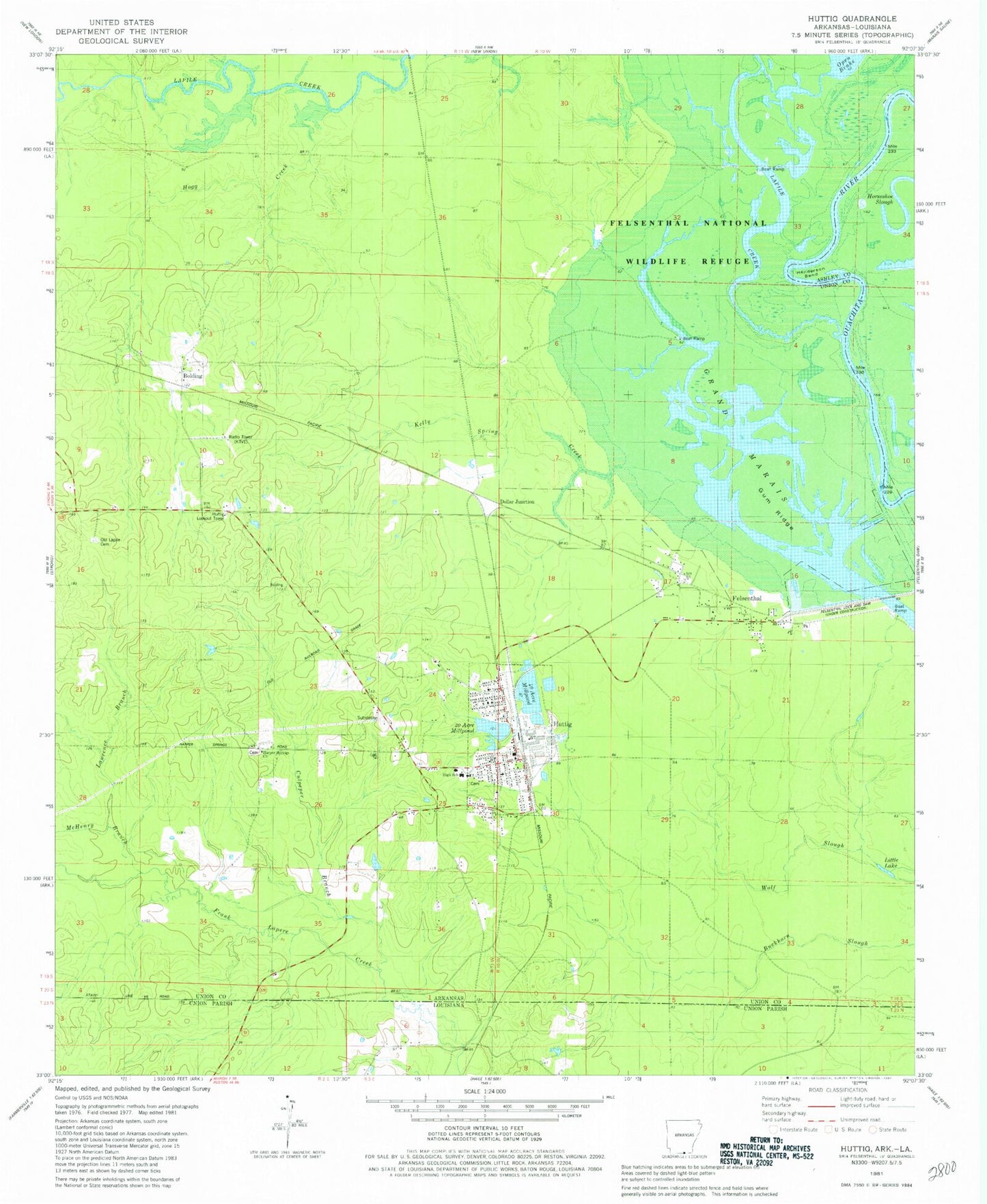
Historical USGS topographic quad map of Huttig in the state of Arkansas. Map scale may vary for some years, but is generally around 1:24,000. Print size is approximately 24" x 27"
This quadrangle is in the following counties: Ashley, Union.
The map contains contour lines, roads, rivers, towns, and lakes. Printed on high-quality waterproof paper with UV fade-resistant inks, and shipped rolled.
Contains the following named places: Arkansas Noname 55 Dam, Arkansas Noname 55 Reservoir, Arkansas Noname 56 Dam, Arkansas Noname 56 Reservoir, Bolding, Bolding Methodist Church, City of Huttig, Culpeper Branch, Dollar Junction, Felsenthal, Felsenthal Baptist Church, First Baptist Church, Forty Acre Millpond, Grand Marais, Grand Marais Recreation Site, Gum Ridge, Harper Springs Cemetery, Harper Springs Church, Henderson Bend, Hogg Creek, Huttig, Huttig Ambulance Department, Huttig Cemetery, Huttig Elementary School, Huttig Fire Department, Huttig High School, Huttig Lookout Tower, Huttig Police Department, Huttig Post Office, Kelly Spring Creek, KTVE-TV (El Dorado), Lawrence Branch, Little Lake, Mchenry Branch, McHenry Branch, Old Lapile, Old Lapile Cemetery, Simms Cemetery, Smith Chapel, South Lapile Creek, Town of Felsenthal, Twenty Acre Millpond, Wolf Slough, ZIP Code: 71747