MyTopo
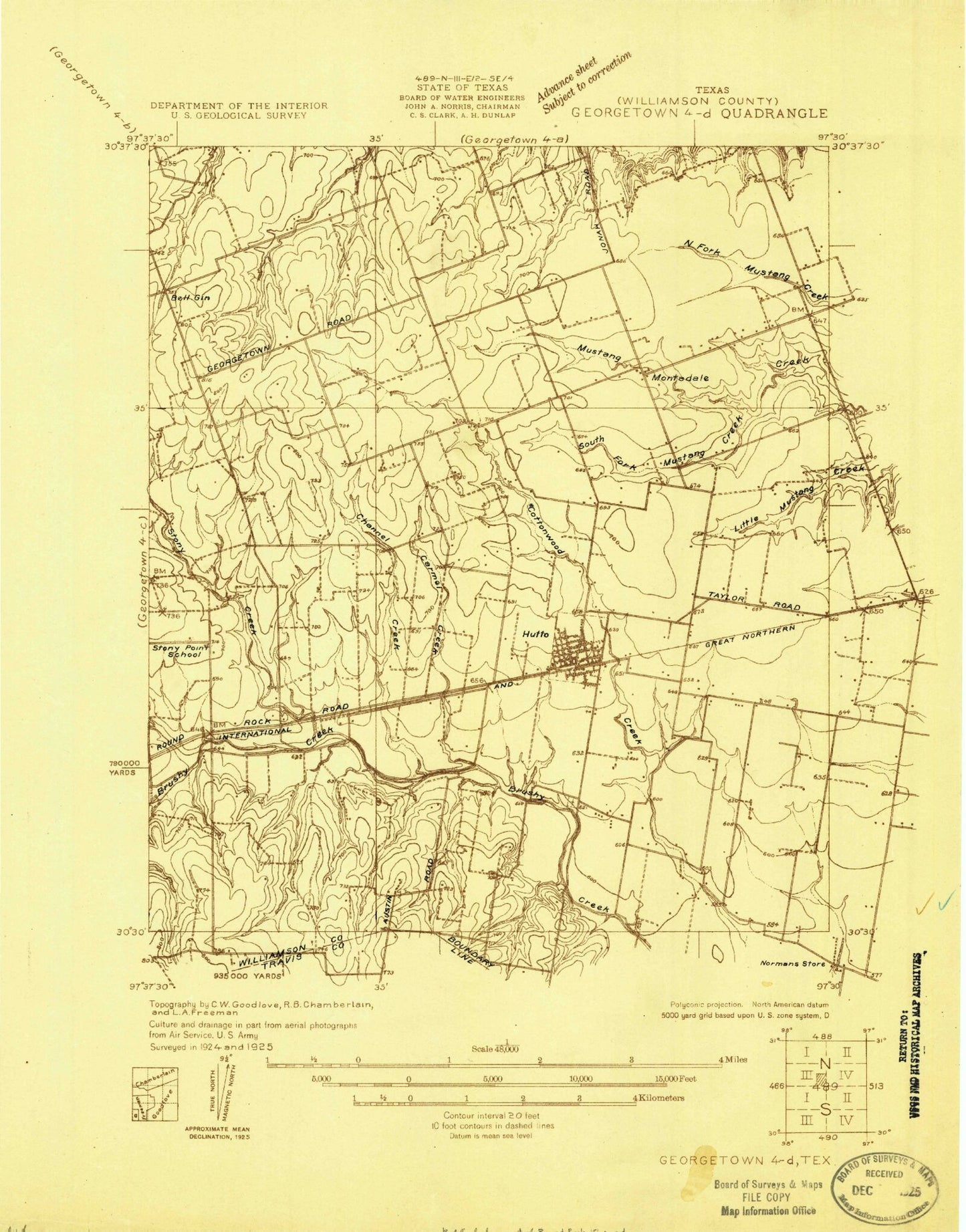
Classic USGS Hutto Texas 7.5'x7.5' Topo Map
Couldn't load pickup availability
Historical USGS topographic quad map of Hutto in the state of Texas. Map scale may vary for some years, but is generally around 1:24,000. Print size is approximately 24" x 27"
This quadrangle is in the following counties: Travis, Williamson.
The map contains contour lines, roads, rivers, towns, and lakes. Printed on high-quality waterproof paper with UV fade-resistant inks, and shipped rolled.
Contains the following named places: Bell Gin, Chandler Branch, City of Hutto, Cross Country Estates Marshall Field, Forest Creek Elementary School, Hummingbird Heliport, Hutto, Hutto City Hall, Hutto Fire Rescue Williamson County Emergency Services District 3, Hutto Police Department, Hutto Post Office, KRGT-FM (Hutto), McNutt Creek, Montadale School, Old Settlers Park at Palm Valley, Soil Conservation Service Site 15 Dam, Soil Conservation Service Site 15 Reservoir, Soil Conservation Service Site 18 Dam, Soil Conservation Service Site 18 Reservoir, Soil Conservation Service Site 19 Dam, Soil Conservation Service Site 19 Reservoir, Soil Conservation Service Site 20 Dam, Soil Conservation Service Site 20 Reservoir, Soil Conservation Service Site 21 Dam, Soil Conservation Service Site 21 Reservoir, South Fork Mustang Creek, Texas No Name Number 48 Dam, ZIP Code: 78634