MyTopo
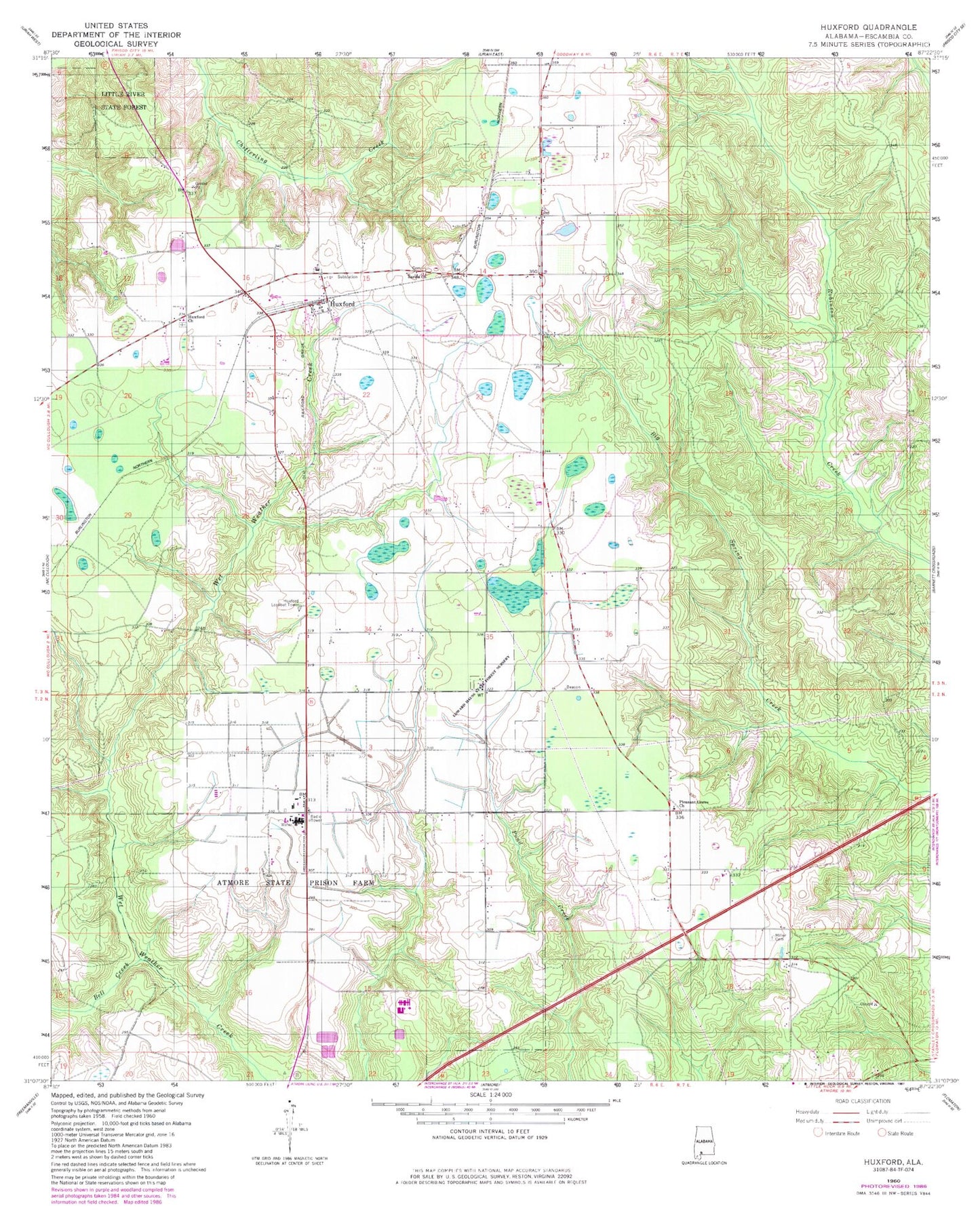
Classic USGS Huxford Alabama 7.5'x7.5' Topo Map
Couldn't load pickup availability
Historical USGS topographic quad map of Huxford in the state of Alabama. Map scale may vary for some years, but is generally around 1:24,000. Print size is approximately 24" x 27"
This quadrangle is in the following counties: Escambia.
The map contains contour lines, roads, rivers, towns, and lakes. Printed on high-quality waterproof paper with UV fade-resistant inks, and shipped rolled.
Contains the following named places: Atmore Inert Landfill, Atmore State Prison Farm, Bell Creek, City of Atmore, Concord School, Edward Hauss State Forest Nursery, Fountain Correctional Facility Sewage Lagoon, G K Fountain Correctional Facility, Huxford, Huxford Baptist Church, Huxford Church, Huxford Church Cemetery, Huxford High School, Huxford Lookout Tower, Huxford Oil Field, Huxford Post Office, Huxford Volunteer Fire Department, Local School, McCullough-Huxford Division, Miller Cemetery, Okwakee Lake, Pleasant Grove Baptist Church, Pleasant Grove Church Cemetery, Sardis Church, William C Holman Correctional Facility, ZIP Codes: 36502, 36543