MyTopo
Classic USGS Huxley Iowa 7.5'x7.5' Topo Map
Couldn't load pickup availability
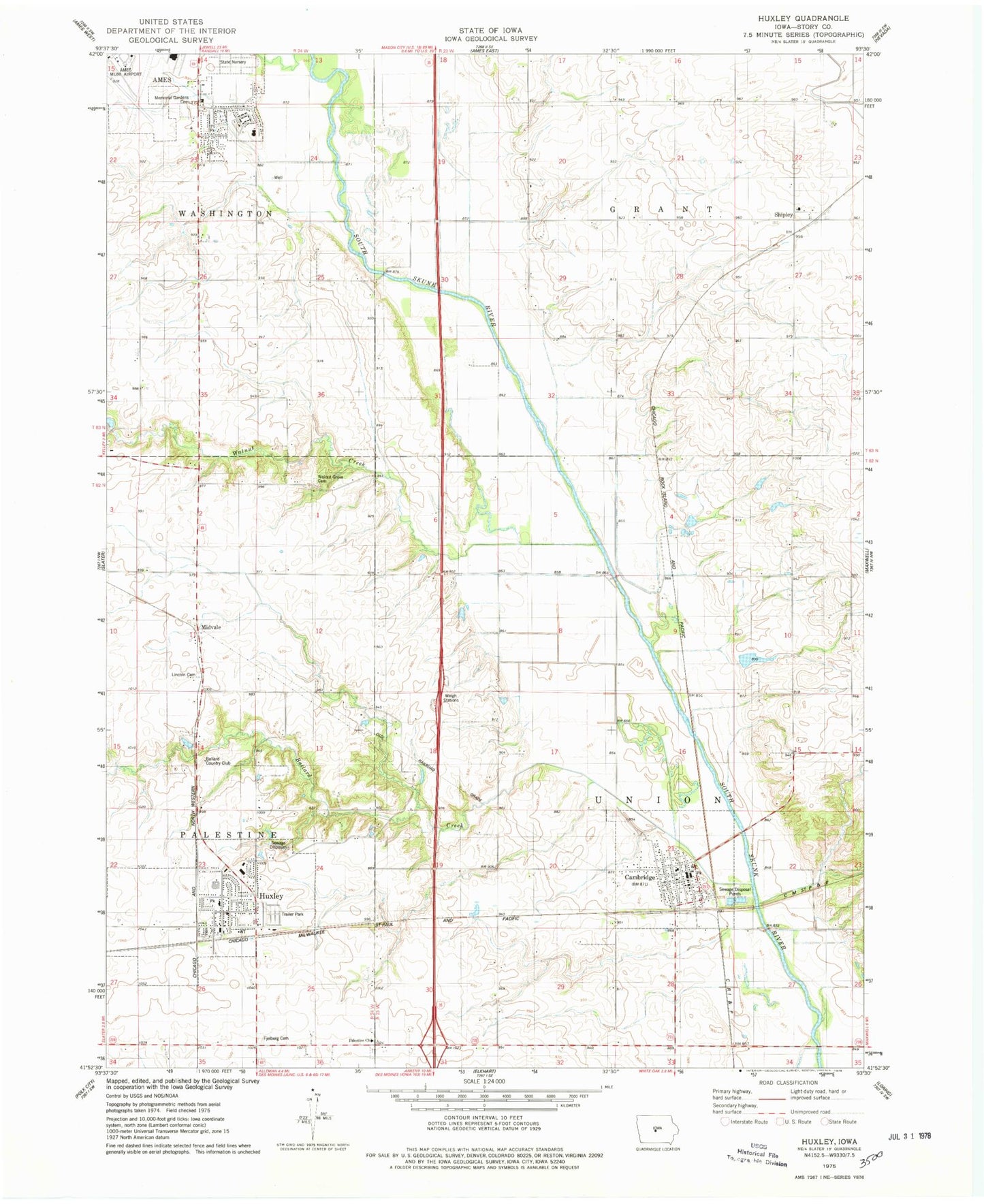
Historical USGS topographic quad map of Huxley in the state of Iowa. Map scale may vary for some years, but is generally around 1:24,000. Print size is approximately 24" x 27"
This quadrangle is in the following counties: Story.
The map contains contour lines, roads, rivers, towns, and lakes. Printed on high-quality waterproof paper with UV fade-resistant inks, and shipped rolled.
Contains the following named places: Ames Municipal Airport, Ballard Cemetery, Ballard Community High School, Ballard Country Club, Ballard Creek, Ballard East Elementary School, Ballard Middle School, Berhow Park, Bethany Lutheran Church, Cambridge, Cambridge Cemetery, Cambridge City Hall, Cambridge Fire and Rescue, Cambridge Post Office, Centennial Park, City of Cambridge, City of Huxley, Colbyville Post Office, Country Gables Park, Faith Baptist Church, Fjeldberg Cemetery, Fjeldberg Lutheran Church, Grace Evangelical Free Church, Harvest Assembly of God Church, Heartland Cooperative Company Elevator, Huxley, Huxley City Hall, Huxley Family Physicians Center, Huxley Fire and Rescue, Huxley Library, Huxley Police Department, Huxley Post Office, Huxley Wastewater Treatment Plant, Iowa State Nursery, Kate Mitchell Elementary School, Lincoln Cemetery, Memorial Park, Midvale, Nazareth Lutheran Church, Nordkalsem Park, Oakwood Station, Palestine Cemetery, Palestine Church, Palestine Post Office, Point Palestine Post Office, Railroad Park, Shipley, Shipley Post Office, Skunk River Bridge, Stephens State Forest - Woodburn Unit, Story Memorial Gardens Cemetery, Teagarden Park, Township of Grant, Township of Union, Trinity United Methodist Church, United Methodist Church, Walnut Creek, Walnut Grove Cemetery, ZIP Codes: 50046, 50124


