MyTopo
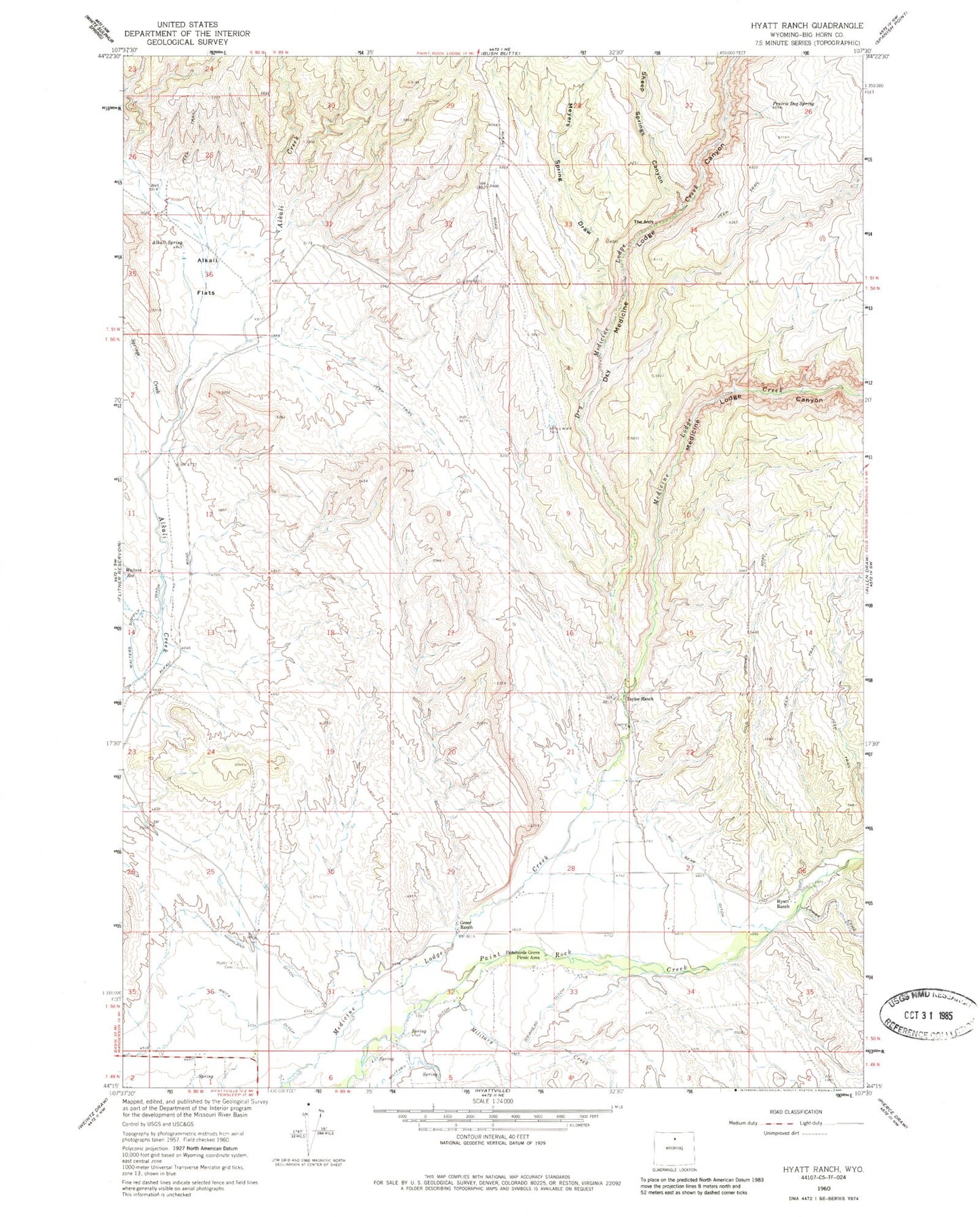
Classic USGS Hyatt Ranch Wyoming 7.5'x7.5' Topo Map
Couldn't load pickup availability
Historical USGS topographic quad map of Hyatt Ranch in the state of Wyoming. Map scale may vary for some years, but is generally around 1:24,000. Print size is approximately 24" x 27"
This quadrangle is in the following counties: Big Horn.
The map contains contour lines, roads, rivers, towns, and lakes. Printed on high-quality waterproof paper with UV fade-resistant inks, and shipped rolled.
Contains the following named places: Alkali Flats, Alkali Spring, Big Bear Ditch, Buck Draw, Dry Medicine Lodge Canyon, Dry Medicine Lodge Creek, Enlargement of the Walters Dam, Go-Ahead Ditch, Greer Ranch, Highland Ditch, Hyatt Ranch, Hyattville Cemetery, Luman Creek, Medicine Lodge Canyon, Military Creek, Military Ditch, Myers Spring Draw, Paintrock Area Mine, Prairie Dog Spring, Pritchards Grove Picnic Area, Sheep Springs Canyon, Shirran Pit, Springs Creek, Taylor Ranch, The Arch, Walters Supply Ditch, ZIP Code: 82428