MyTopo
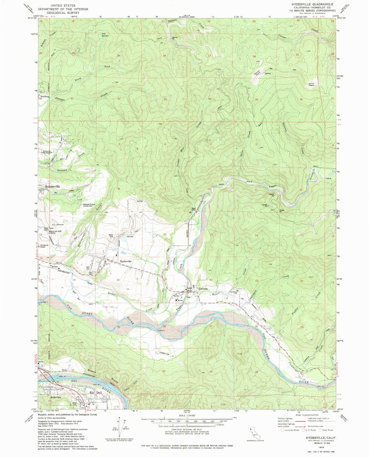
Classic USGS Hydesville California 7.5'x7.5' Topo Map
Couldn't load pickup availability
Historical USGS topographic quad map of Hydesville in the state of California. Map scale may vary for some years, but is generally around 1:24,000. Print size is approximately 24" x 27"
This quadrangle is in the following counties: Humboldt.
The map contains contour lines, roads, rivers, towns, and lakes. Printed on high-quality waterproof paper with UV fade-resistant inks, and shipped rolled.
Contains the following named places: Allen Creek, Barber Creek, Belleview, Blanton Creek, Blanton Prairie, Carlotta, Carlotta Post Office, Carlotta Volunteer Fire Department Station 1, City of Rio Dell, Cooper Mill Creek, Cuddeback Creek, Cuddeback Elementary School, Cummings Creek, Cummings Creek Camp, Eagle Prairie Elementary School, Felt Springs, Fiedler Creek, Fortuna Volunteer Fire Department Hydesville Station, Fox Creek, French Gulch, Hydesville, Hydesville Cemetery, Hydesville Census Designated Place, Hydesville Elementary School, Hydesville Independent Order of Odd Fellows Cemetery, Hydesville Post Office, KNCR-AM (Fortuna), KWHZ-FM (Ferndale), Masons and Independent Order of Odd Fellows Cemetery, Myrick Prairie, Nanning Creek, Newburg, North Fork Strongs Creek, Redwood Empire Country Club, Rio Dell Fire Protection District, Rio Dell Primary School, Scotia Bluffs, Stone, Wilson Creek, Wolverton Gulch, Yager Camp, Yager Creek, ZIP Code: 95547