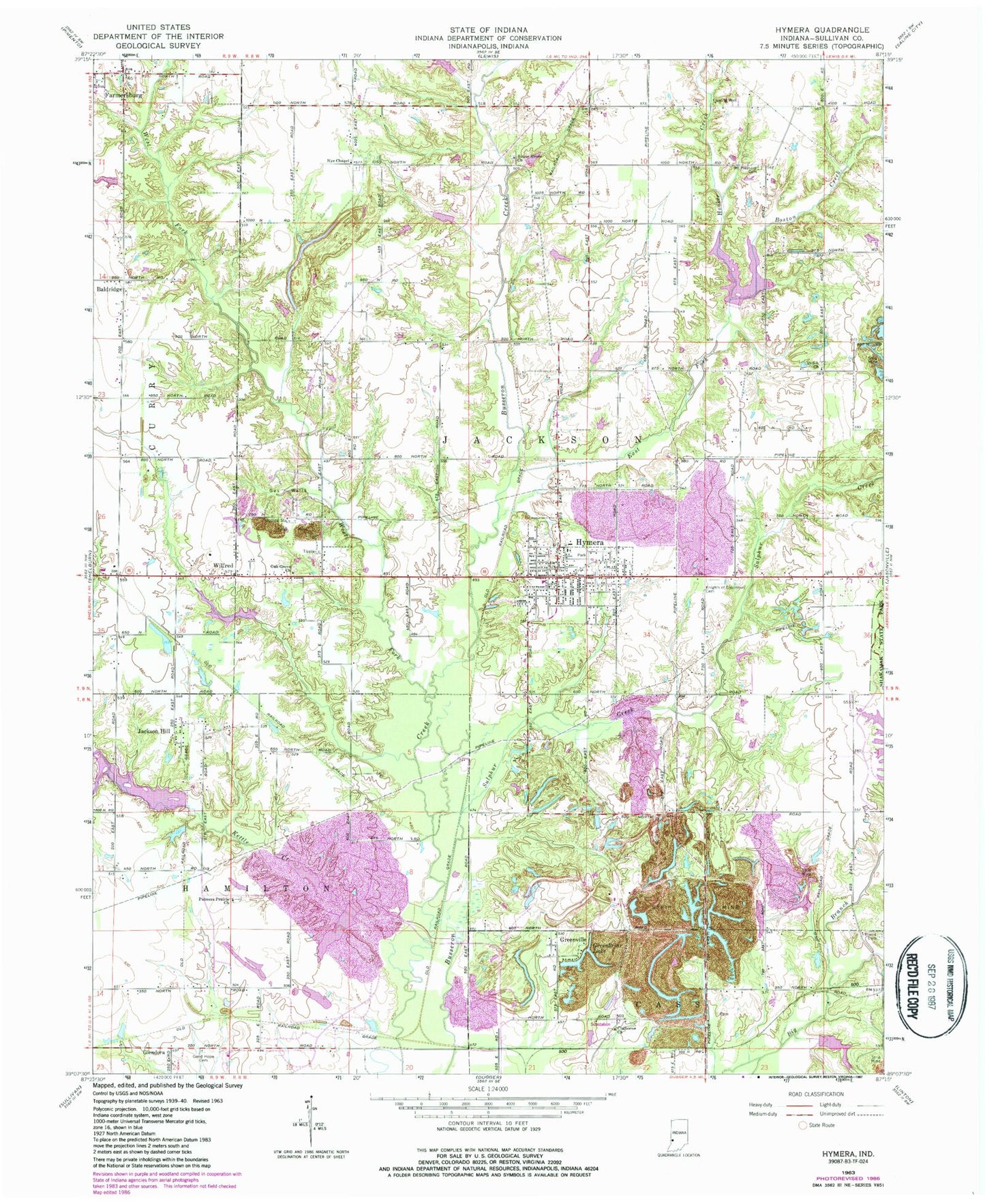
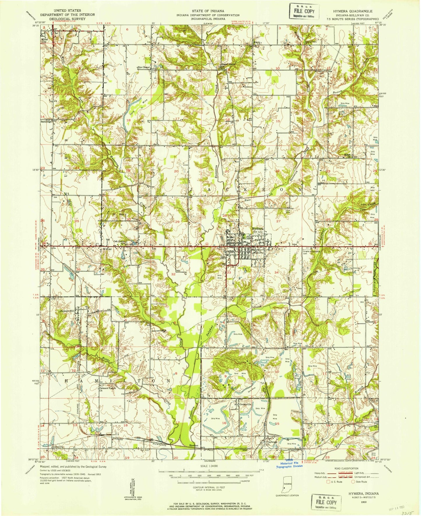
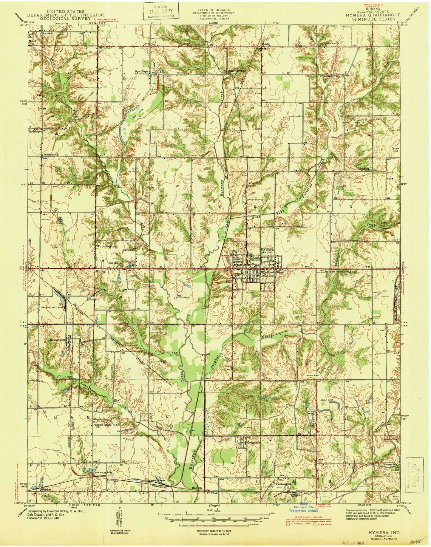
MyTopo
Classic USGS Hymera Indiana 7.5'x7.5' Topo Map
Couldn't load pickup availability
Historical USGS topographic quad map of Hymera in the state of Indiana. Map scale may vary for some years, but is generally around 1:24,000. Print size is approximately 24" x 27"
This quadrangle is in the following counties: Sullivan.
The map contains contour lines, roads, rivers, towns, and lakes. Printed on high-quality waterproof paper with UV fade-resistant inks, and shipped rolled.
Contains the following named places: Austin Air Ads Airport, Baker, Baldridge, Boston Creek, Burris Cemetery, Busseron Dam Number D-9, Busseron Dam Number F-2, Busseron Dam Number G-5, Busseron Dam Number I-2, Claiborne Church, East Fork Busseron Creek, Glendora, Good Hope Cemetery, Greenbriar Lake, Greenville, Hamilton Pond, Hawton, Hooker Creek, Hymera, Hymera Elementary School, Hymera Emergency Response Team, Hymera Post Office, Hymera Volunteer Fire Department, Jackson Hill, Knights of Pythias Cemetery, Mount Pleasant Cemetery, Nye Chapel, Oak Grove Church, Palmers Prairie Church, Shiloh Church, Sugar Grove Church, Sulphur Creek, Town of Hymera, Township of Jackson, West Fork Busseron Creek, Wilfred, ZIP Code: 47855