MyTopo
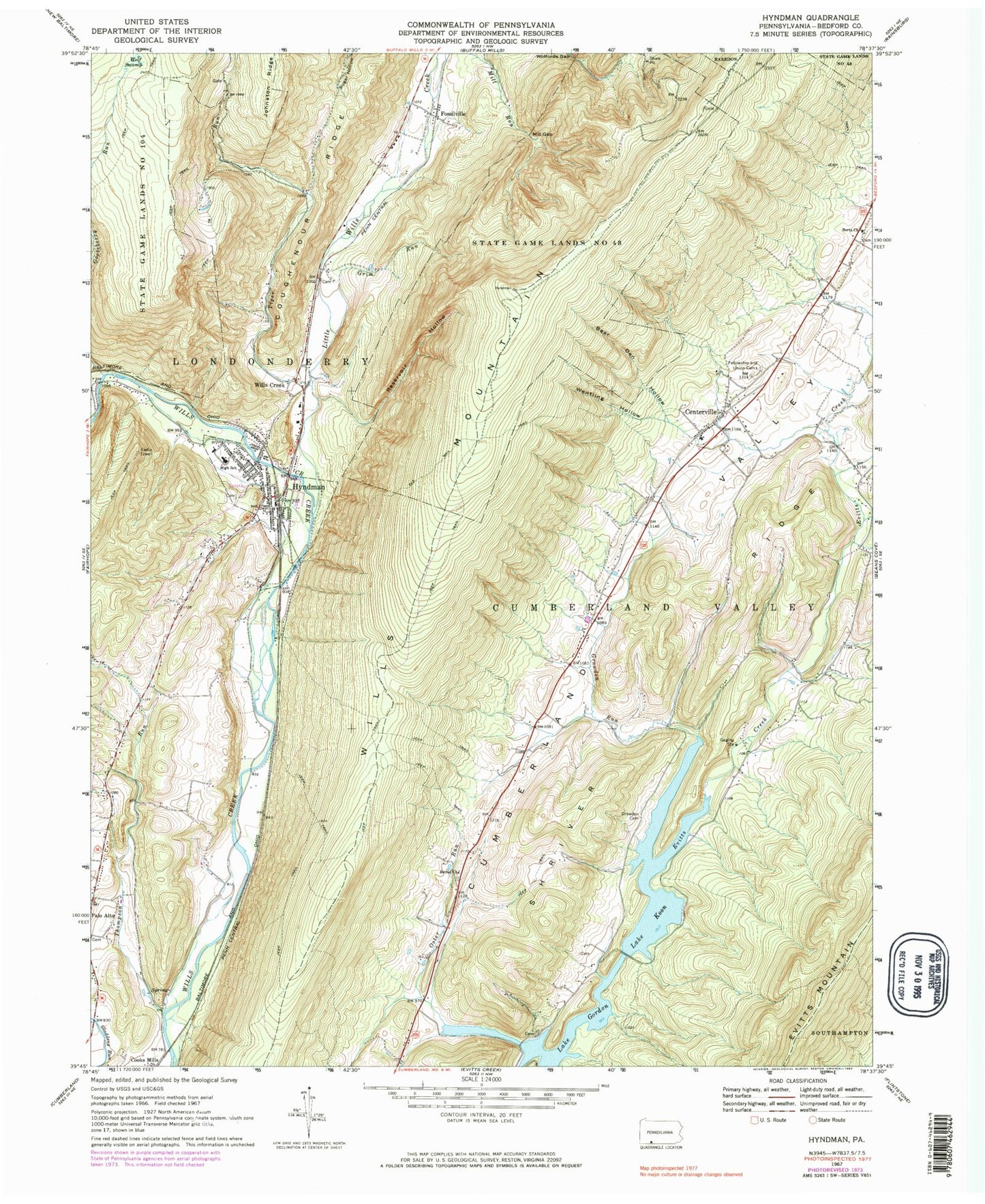
Classic USGS Hyndman Pennsylvania 7.5'x7.5' Topo Map
Couldn't load pickup availability
Historical USGS topographic quad map of Hyndman in the state of Pennsylvania. Map scale may vary for some years, but is generally around 1:24,000. Print size is approximately 24" x 27"
This quadrangle is in the following counties: Bedford.
The map contains contour lines, roads, rivers, towns, and lakes. Printed on high-quality waterproof paper with UV fade-resistant inks, and shipped rolled.
Contains the following named places: Bear Den Hollow, Bedford Valley Post Office, Bethel Church, Bethel Methodist Episcopal Church Cemetery, Borough of Hyndman, Bortz Church, Bortz Lutheran Church Cemetery, Centerville, Cooks Mill Cemetery, Coughenour Ridge, Cruse, Cumberland Valley Elementary School, Cumberland Valley Township Fire Department - Station 45, Evitts, Fort Lookout School, Fossilville, Gooseberry Run, Grim Run, Growden Cemetery, Growden Run, Hoblitzell, Hydman Post Office, Hyndman, Hyndman Area Rescue Squad - Station 14, Hyndman Cemetery, Hyndman Middle Senior High School, Hyndman Volunteer Fire Department - Station 34, Kennel School, Lake Gordon, Lake Koon, Little Wills Creek, Londonderry Intermediate Elementary School, Manassas School, Mill Gap, Mill Run, Mineral Spring School, Oakford Cemetery, Old Mail Trail, Oster Run, Palo Alto Hilltop Cemetery, Reservoir Hollow, Schaffer School, Shriver Ridge, Thomas W Koon Dam, Thompson Run, Tiger Run, Tiger Run School, Township of Cumberland Valley, Township of Londonderry, Union Cemetery, Wentling Hollow, Wills Creek, Wills Mountain, Wolf Swamp, Wolfords Gap