MyTopo
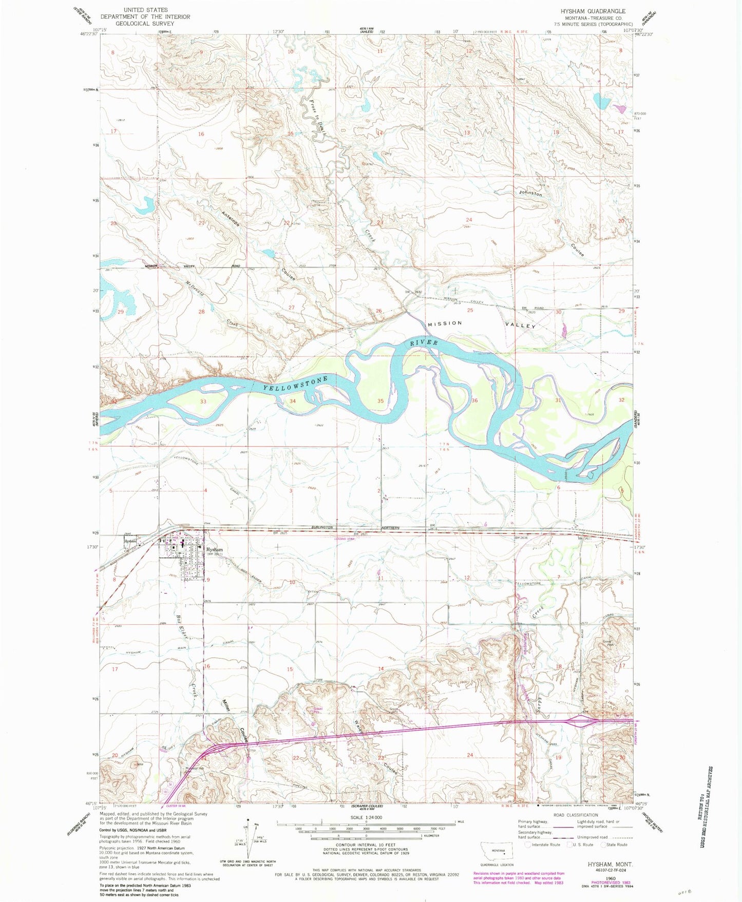
Classic USGS Hysham Montana 7.5'x7.5' Topo Map
Couldn't load pickup availability
Historical USGS topographic quad map of Hysham in the state of Montana. Map scale may vary for some years, but is generally around 1:24,000. Print size is approximately 24" x 27"
This quadrangle is in the following counties: Treasure.
The map contains contour lines, roads, rivers, towns, and lakes. Printed on high-quality waterproof paper with UV fade-resistant inks, and shipped rolled.
Contains the following named places: 06N36E01C___01 Well, 06N36E02A___01 Well, 06N36E09B___01 Well, 06N37E07C___01 Well, 07N36E15ABAA01 Well, Amelia Island Fishing Access Site, Antelope Coulee, Box Elder Creek, Box Elder Ditch, Community Presbyterian Church, Cowen Creek, Fort Sarpy, Froze to Death Creek, Froze to Death Number 7 Dam, Froze-to-Death, Froze-to-Death Land Company Number 1 Dam, Grierson Number 1 Dam, Hyde Post Office, Hysham, Hysham Airport, Hysham Baptist Church, Hysham Canal, Hysham Community Elevator, Hysham Community Health Clinic, Hysham Main Canal, Hysham Post Office, Hysham School, Hysham Volunteer Fire Department, Johnston Coulee, McDonald Creek, Memorial Vale Cemetery, Miller Coulee, Rutledge School, Saint Josephs Catholic Church, Sarpy Junction, Shoestring School, Stacy Island Fishing Access Site, Town of Hysham, Treasure County 89ers Museum, Treasure County Ambulance, Treasure County Courthouse, Treasure County Sheriff's Office, Trinity Lutheran Church, Wales Coulee, West Sanders School, Zent Hardware Company Elevator