MyTopo
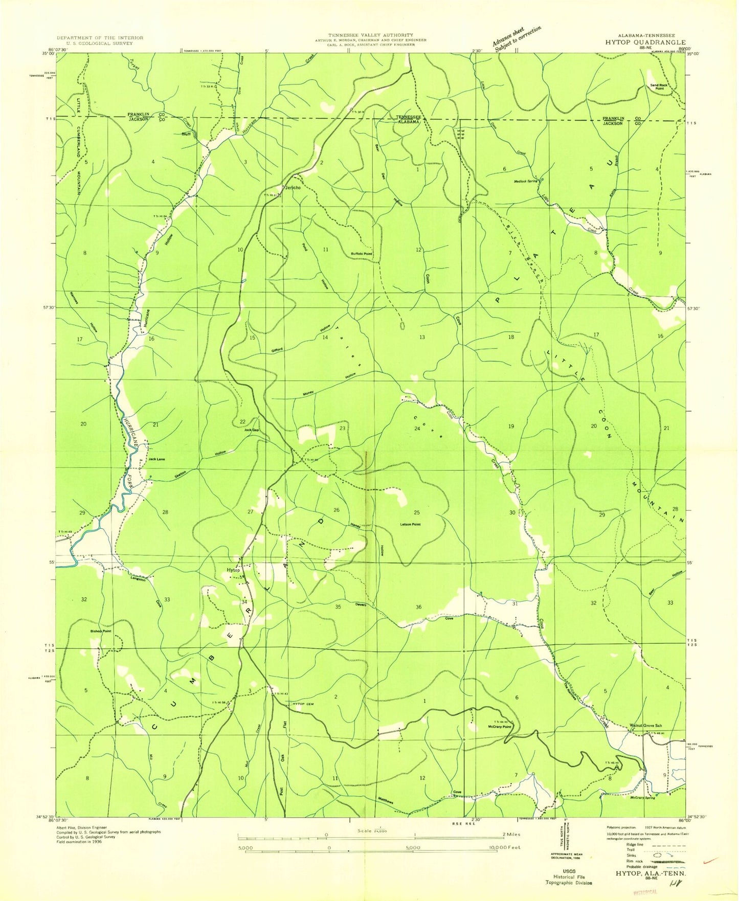
Classic USGS Hytop Alabama 7.5'x7.5' Topo Map
Couldn't load pickup availability
Historical USGS topographic quad map of Hytop in the states of Alabama, Tennessee. Typical map scale is 1:24,000, but may vary for certain years, if available. Print size: 24" x 27"
This quadrangle is in the following counties: Franklin, Jackson.
The map contains contour lines, roads, rivers, towns, and lakes. Printed on high-quality waterproof paper with UV fade-resistant inks, and shipped rolled.
Contains the following named places: Bald Point Hollow, Bear Den Hollow, Bear Den Point, Bear Hollow, Billy Cove, Bishop Point, Buffalo Point, Clark Cemetery, Culver Cemetery, Devers Cove, Evans Ridge, Gifford Hollow, Haddon Cemetery, Haddon Hollow, Haddon Spring, Haney Hollow, Hickory Hollow, High Rock Point, Hytop Cemetery, Jack Gap, John Gifford Hollow, Kettle Branch, Knight Cemetery, Langston Cove, Letson Point, Little Coon Mountain, Mancher Creek, Matthews Cemetery, Matthews Cove, McCrary Point, McCrary Spring, Medlock Spring, Middle Point, Mill Creek, Money Hollow, Narrows Hollow, Polly Anne Spring, Pond Hollow, Post Oak Flat, Prescott Hollow, Pruitt Ridge, Rich Bench, Skelton Hollow, Spring Hollow, Step Point, Tate Spring, The Narrows, Turkey Creek, Wagner Hollow, Walls of Jericho, Greerton (historical), Hurricane Hollow, Jack Lane (historical), Narrows (historical), Sandy Hook Church (historical), Skyline Wildlife Management Area, Sunset (historical), Walnut Grove School (historical), Tate Cove, Hytop Church, Hytop, Jericho, Coon Hollow, Town of Hytop, Hytop Volunteer Fire Department, Little Cumberland Mountain, Bald Point, Sand Rock Point, Bald Point Hollow, Bear Den Hollow, Bear Den Point, Bear Hollow, Billy Cove, Bishop Point, Buffalo Point, Clark Cemetery, Culver Cemetery, Devers Cove, Evans Ridge, Gifford Hollow, Haddon Cemetery, Haddon Hollow, Haddon Spring, Haney Hollow, Hickory Hollow, High Rock Point, Hytop Cemetery, Jack Gap, John Gifford Hollow, Kettle Branch, Knight Cemetery, Langston Cove, Letson Point, Little Coon Mountain, Mancher Creek, Matthews Cemetery, Matthews Cove, McCrary Point, McCrary Spring, Medlock Spring, Middle Point, Mill Creek, Money Hollow, Narrows Hollow, Polly Anne Spring, Pond Hollow, Post Oak Flat, Prescott Hollow, Pruitt Ridge, Rich Bench, Skelton Hollow, Spring Hollow, Step Point, Tate Spring, The Narrows, Turkey Creek, Wagner Hollow, Walls of Jericho, Greerton (historical), Hurricane Hollow, Jack Lane (historical), Narrows (historical), Sandy Hook Church (historical), Skyline Wildlife Management Area, Sunset (historical), Walnut Grove School (historical), Tate Cove, Hytop Church, Hytop, Jericho, Coon Hollow, Town of Hytop, Hytop Volunteer Fire Department, Little Cumberland Mountain, Bald Point, Sand Rock Point


