
MyTopo
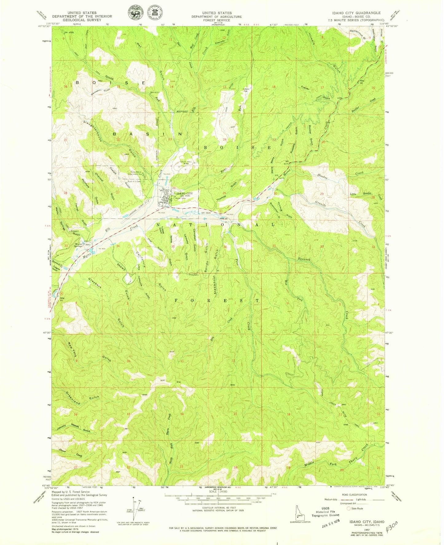
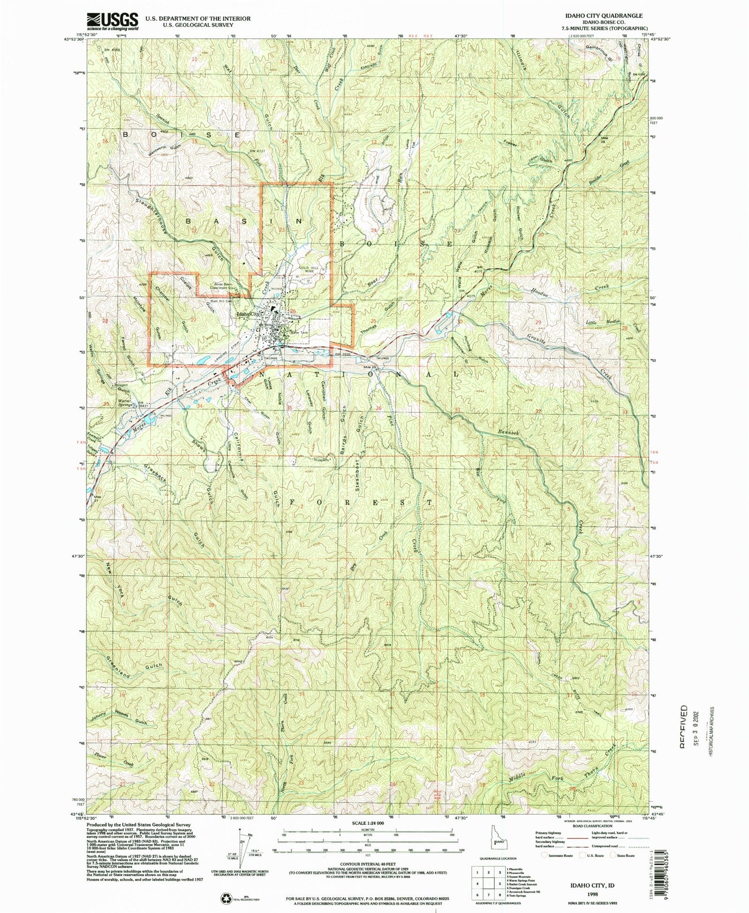
Classic USGS Idaho City Idaho 7.5'x7.5' Topo Map
Couldn't load pickup availability
Historical USGS topographic quad map of Idaho City in the state of Idaho. Typical map scale is 1:24,000, but may vary for certain years, if available. Print size: 24" x 27"
This quadrangle is in the following counties: Boise.
The map contains contour lines, roads, rivers, towns, and lakes. Printed on high-quality waterproof paper with UV fade-resistant inks, and shipped rolled.
Contains the following named places: Warm Springs Gulch, Bairds Gulch, Boise Basin Experiment Station, Old Pioneer Cemetery, Boulder Creek, Brockmiller Gulch, California Gulch, Campbell Gulch, Char Gulch, Charcoal Gulch, Chinee Gulch, Coalpit Gulch, Deer Creek, Dry Creek, Eldorado Gulch, Elk Creek, Farrell Gulch, Franer Canal, Franer Gulch, Gambrinus Gulch, Gold Hill Mine, Granite Creek, Grayback Gulch, Hoodoo Creek, Humbug Gulch, Idaho City, Illinois Gulch, Laraway Gulch, Little California Gulch, Little Hoodoo Creek, Lykow Flat, McIntyre Gulch, Mine Ditch, Noble Gulch, Rocker Gulch, Russells Gulch, Sawmill Creek, Shaws Gulch, Slaughterhouse Gulch, Spanish Fork, Steamboat Gulch, Thomas Gulch, Tollgate Gulch, Tuttles Gulch, Walla Walla Gulch, Washington Gulch, Wentworth Gulch, West Fork Bannock Creek, Wet Gulch, Wolf Creek, Grayback Gulch Campground, Granite Creek Recreation Site, Idaho City Ski Area, Ivydale Organization Camp, Idaho State Highway Maintenance Station, Idaho City Ranger Station, Bear Run Gulch, Bannock Creek, Bear Run, Pine Creek, Idaho City USFS Airport, Basin Elementary-Junior High School, Idaho City Division, Idaho City Pioneer Cemetery, City of Idaho City, Idaho City Volunteer Fire Department, East Boise County Ambulance, Boise County Sheriff's Office, Idaho City Police Department, Idaho City Post Office