MyTopo
Classic USGS Ideal NW South Dakota 7.5'x7.5' Topo Map
Regular price
$16.95
Regular price
Sale price
$16.95
Unit price
per
Couldn't load pickup availability
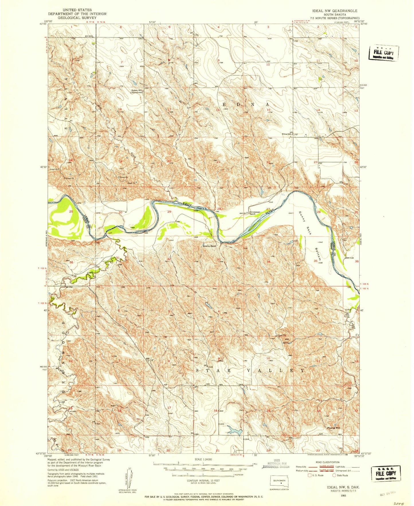
Historical USGS topographic quad map of Ideal NW in the state of South Dakota. Map scale may vary for some years, but is generally around 1:24,000. Print size is approximately 24" x 27"
This quadrangle is in the following counties: Lyman, Tripp.
The map contains contour lines, roads, rivers, towns, and lakes. Printed on high-quality waterproof paper with UV fade-resistant inks, and shipped rolled.
Contains the following named places: Bruck Herman Dam, Christensen Ranch, Dog Ear Creek, Edna, Edna School, Frantz Farms 4 Dam, Gunny Sack Bottom, Ideal Segment, Kewley Ranch, Labrecque Dam, Lee Calhoon 1 Dam, Lee Calhoon 2 Dam, Mill Iron Creek, Sylvia, Township of Edna, Township of Star Valley