MyTopo
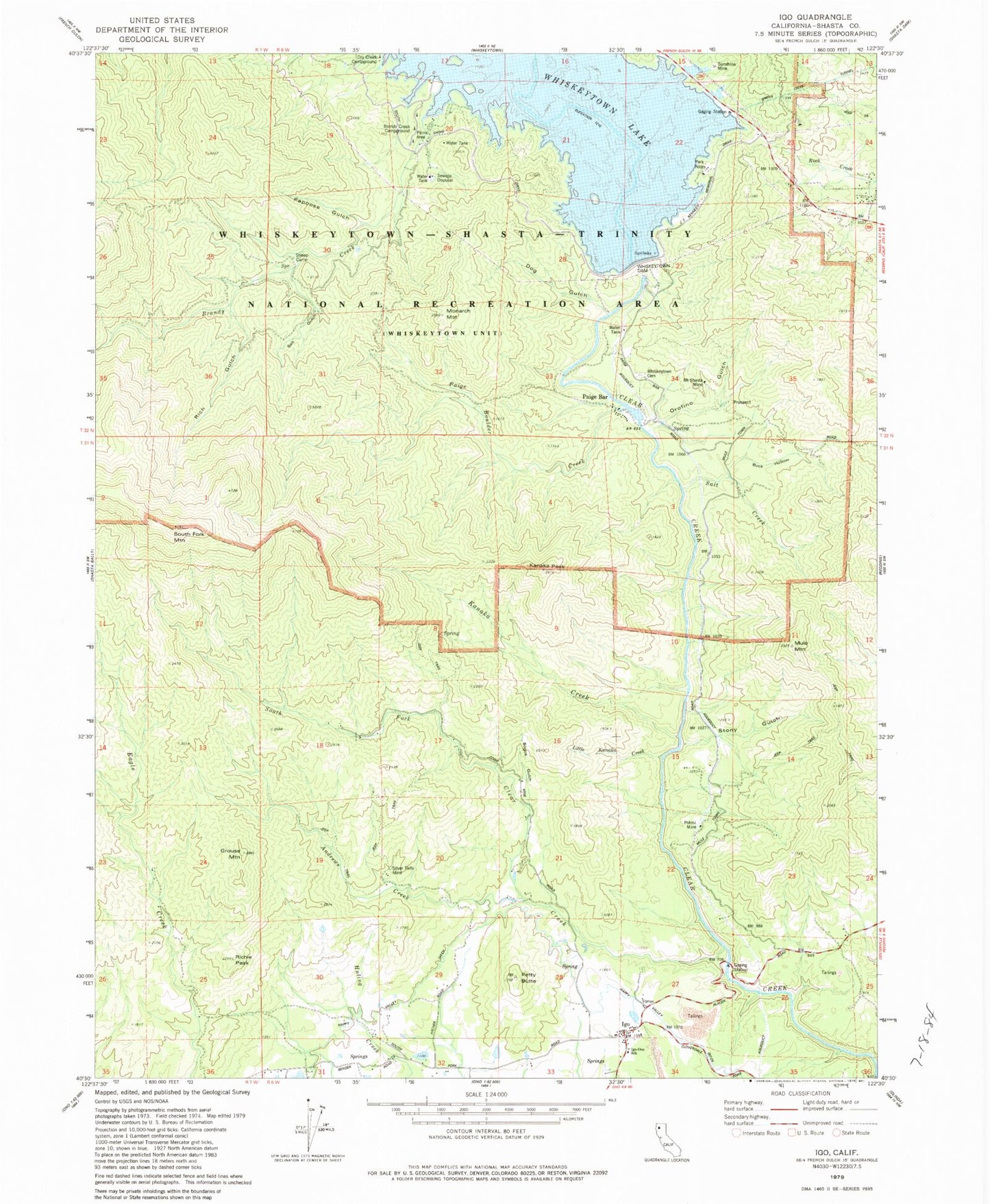
Classic USGS Igo California 7.5'x7.5' Topo Map
Couldn't load pickup availability
Historical USGS topographic quad map of Igo in the state of California. Typical map scale is 1:24,000, but may vary for certain years, if available. Print size: 24" x 27"
This quadrangle is in the following counties: Shasta.
The map contains contour lines, roads, rivers, towns, and lakes. Printed on high-quality waterproof paper with UV fade-resistant inks, and shipped rolled.
Contains the following named places: Andrews Creek, Brandy Creek, Buck Hollow, Dog Gulch, Dows Gulch, Graddock Gulch, Grouse Mountain, Igo, Kanaka Creek, Kanaka Peak, Little Kanaka Creek, Monarch Mountain, Mule Mountain, Orofino Gulch, Paige Bar, Papoose Creek, Petty Butte, Rich Gulch, Salt Creek, Salt Gulch, South Fork Clear Creek, Stony Gulch, Whiskeytown-Shasta-Trinity National Recreation Area, South Fork Mountain, Bogus Gulch, Brandy Creek Campground, Igo - Ono Elementary School, Mount Shasta Mine, Paige Bar, Paige Boulder Creek, Papoose Gulch, Potosi Mine, Richie Peak, Sheep Camp, Silver Falls Mine, South Fork School (historical), Sunshine Mine, Whiskeytown Cemetery, Clair A. Hill Whiskeytown Dam, Igo - Ono Volunteer Fire Company Station 50, Igo Post Office, Igo Cemetery