MyTopo
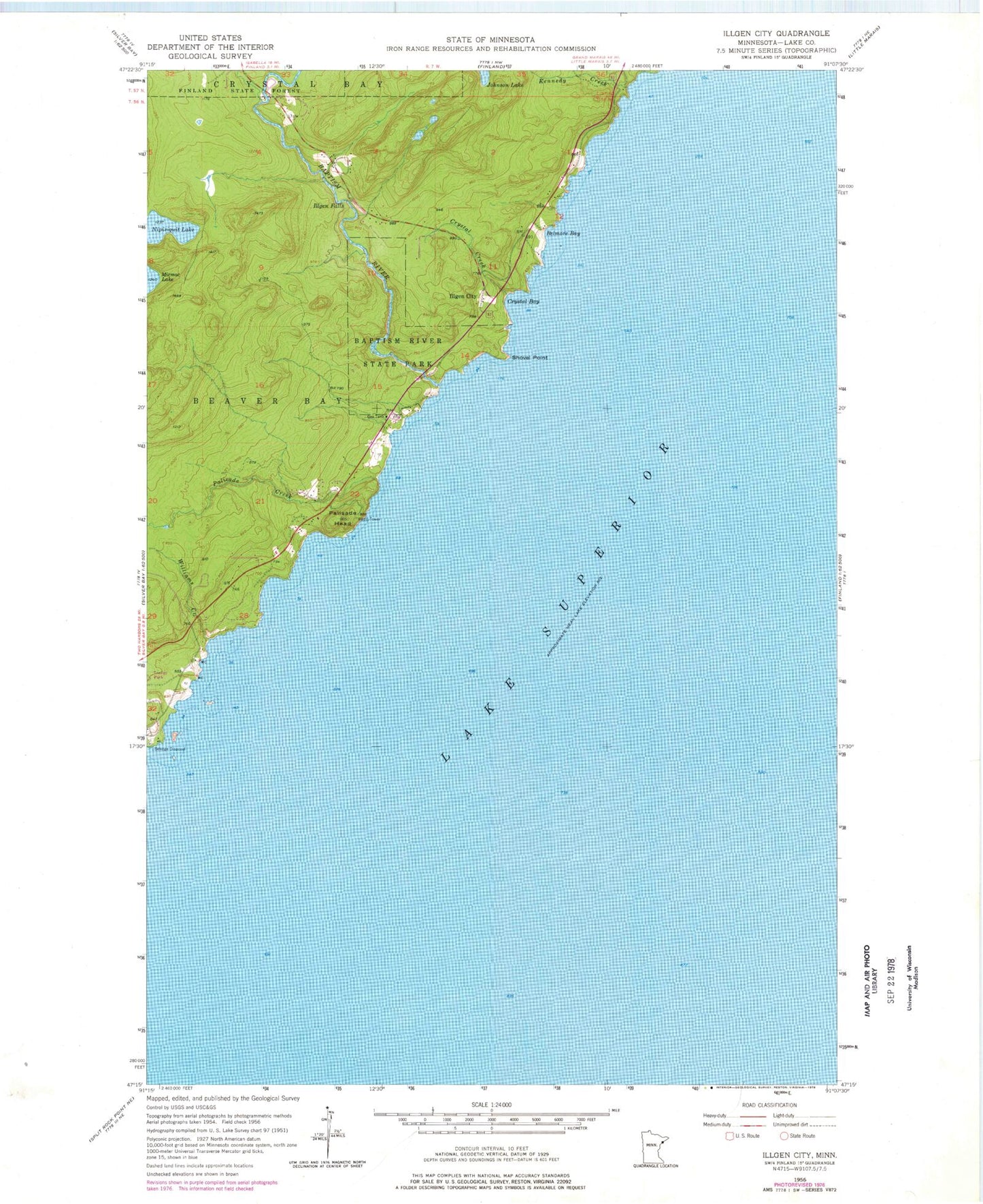
Classic USGS Illgen City Minnesota 7.5'x7.5' Topo Map
Couldn't load pickup availability
Historical USGS topographic quad map of Illgen City in the state of Minnesota. Typical map scale is 1:24,000, but may vary for certain years, if available. Print size: 24" x 27"
This quadrangle is in the following counties: Lake.
The map contains contour lines, roads, rivers, towns, and lakes. Printed on high-quality waterproof paper with UV fade-resistant inks, and shipped rolled.
Contains the following named places: Baptism River, Baptism River State Park, Belmore Bay, Crystal Bay, Crystal Creek, Illgen Falls, Kennedy Creek, Palisade Head, Shovel Point, Williams Creek, Illgen City, Nipisiquit Lake, Palisade Creek, Baptism River Rest Area, Palisade Head Historical Marker, Palisade Baptist Church, Jehovah's Witnesses Congregation, Northern Exposure Campground, Reider Silver Bay Cemetery