MyTopo
Classic USGS Illinois Hill California 7.5'x7.5' Topo Map
Couldn't load pickup availability
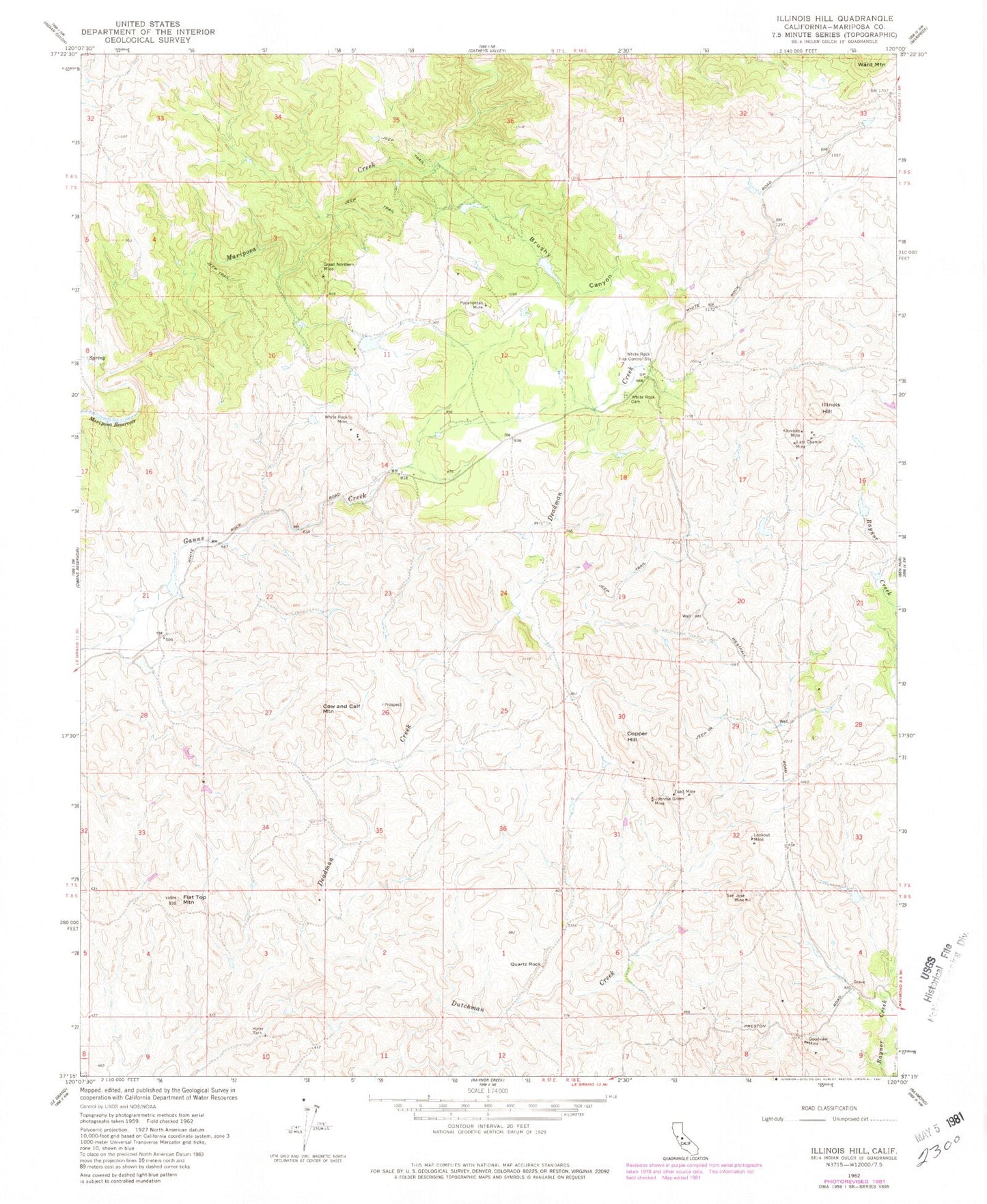
Historical USGS topographic quad map of Illinois Hill in the state of California. Map scale may vary for some years, but is generally around 1:24,000. Print size is approximately 24" x 27"
This quadrangle is in the following counties: Mariposa.
The map contains contour lines, roads, rivers, towns, and lakes. Printed on high-quality waterproof paper with UV fade-resistant inks, and shipped rolled.
Contains the following named places: Brushy Canyon, Copper Hill, Cow and Calf Mountain, Flat Top Mountain, Goodview Mine, Great Northern Mine, Illinois Hill, Johnnie Green Mine, Klondike Mine, Last Chance Mine, Lookout Mine, Pocahontas Mine, Quartz Rock, San Jose Mine, Toad Mine, White Rock Cemetery, White Rock Fire Control Station, White Rock Mine