MyTopo
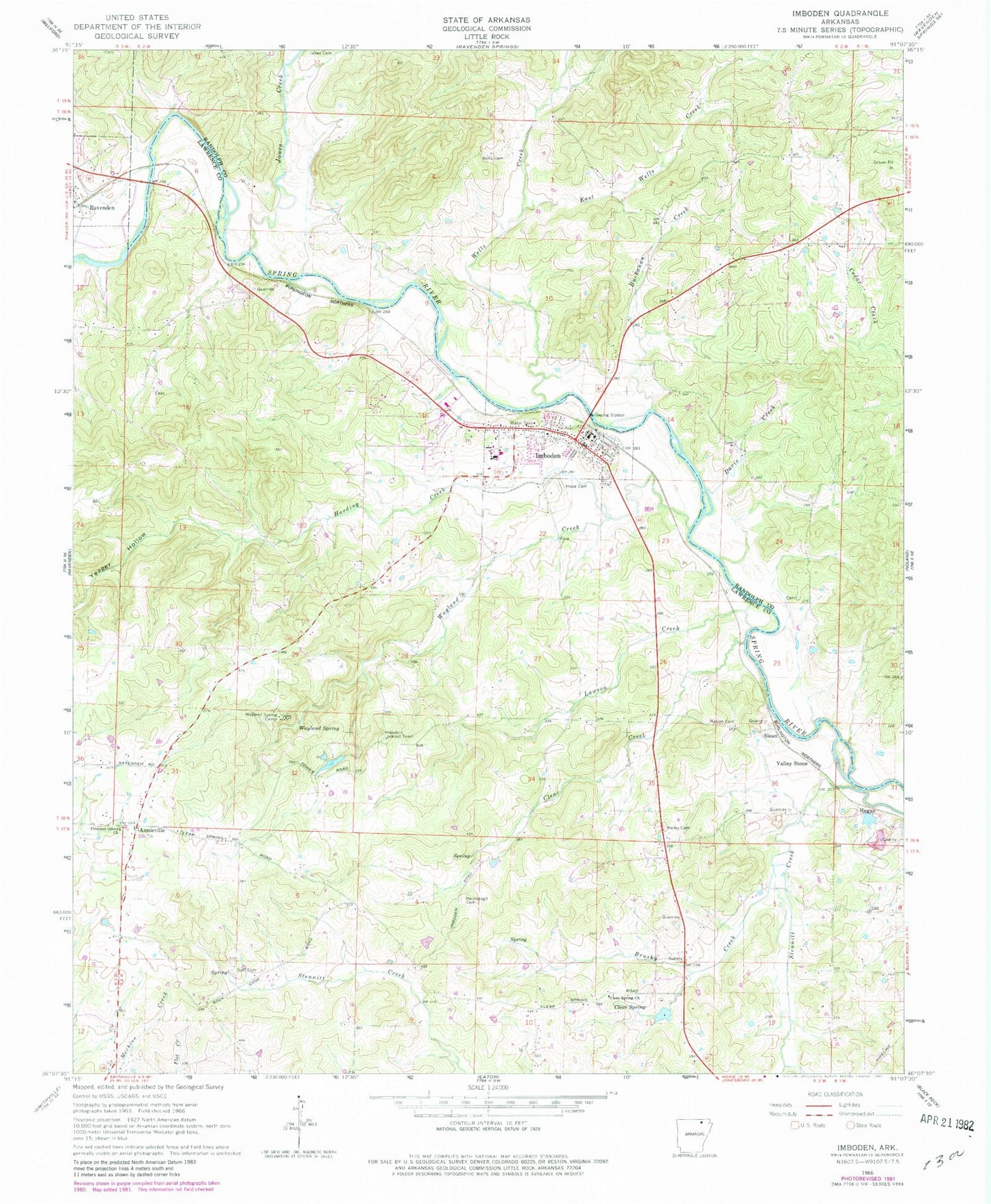
Classic USGS Imboden Arkansas 7.5'x7.5' Topo Map
Couldn't load pickup availability
Historical USGS topographic quad map of Imboden in the state of Arkansas. Map scale may vary for some years, but is generally around 1:24,000. Print size is approximately 24" x 27"
This quadrangle is in the following counties: Lawrence, Randolph.
The map contains contour lines, roads, rivers, towns, and lakes. Printed on high-quality waterproof paper with UV fade-resistant inks, and shipped rolled.
Contains the following named places: Annieville, Black Rock Quarry, Buchanan Creek, Burshy Creek, Campbell Cemetery, Clear Creek, Clear Spring, Clear Spring Church, Davis Creek, Dent Cemetery, Doctor Ralph Joseph Lake, Doctor Ralph Joseph Lake Dam, East Wells Creek, Harding Creek, Hogan, Holobaugh Cemetery, Hope Cemetery, Imboden, Imboden Area Charter School, Imboden Lookout Tower, Imboden Post Office, Imboden Volunteer Fire Station, Janes Cemetery, Janes Creek, Kelley Cemetery, Lawson Creek, Nation Cemetery, Pleasant Grove Church, Rhea Cemetery, Sloan, Sloan - Hendrix Elementary School, Sloan - Hendrix High School, Starling Creek, Stennitt Creek, Town of Imboden, Township of Annieville, Township of Dent, Township of Spring River, Valley Stone, Wayland Creek, Wayland Spring, Wayland Spring Camp, Wells Cemetery, Wells Creek, Yeager Hollow, ZIP Codes: 72415, 72434