MyTopo
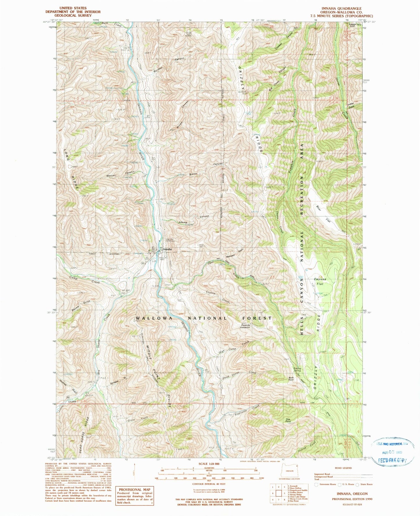
Classic USGS Imnaha Oregon 7.5'x7.5' Topo Map
Couldn't load pickup availability
Historical USGS topographic quad map of Imnaha in the state of Oregon. Map scale may vary for some years, but is generally around 1:24,000. Print size is approximately 24" x 27"
This quadrangle is in the following counties: Wallowa.
The map contains contour lines, roads, rivers, towns, and lakes. Printed on high-quality waterproof paper with UV fade-resistant inks, and shipped rolled.
Contains the following named places: Adams Canyon, Bailey Canyon, Bare Creek, Bear Flat, Bens Creek, Big Camp Canyon, Big Sheep Creek, Brown Canyon, Buck Point, Burcher Canyon, Camp Creek, Cayuse Flat, Cemetery Hill, Coyote Creek, Crooked Canyon, Curiosity Creek, Dead Horse Creek, Deer Creek, Doe Point, Findley Spring, Fivemile Viewpoint, Grave Creek, Hartshorn Butte, High Camp Creek, Imbler Gulch, Imnaha, Imnaha Cemetery, Imnaha Gulch, Imnaha Post Office, Little Sheep Creek, Maxwell Basin, Rippleton Creek, Sprague Gulch, Stickney Gulch, The Bridge School, Thorn Creek, Trail Creek, Wallowa County Branch Library Imnaha Bridge School, Weaver Canyon