MyTopo
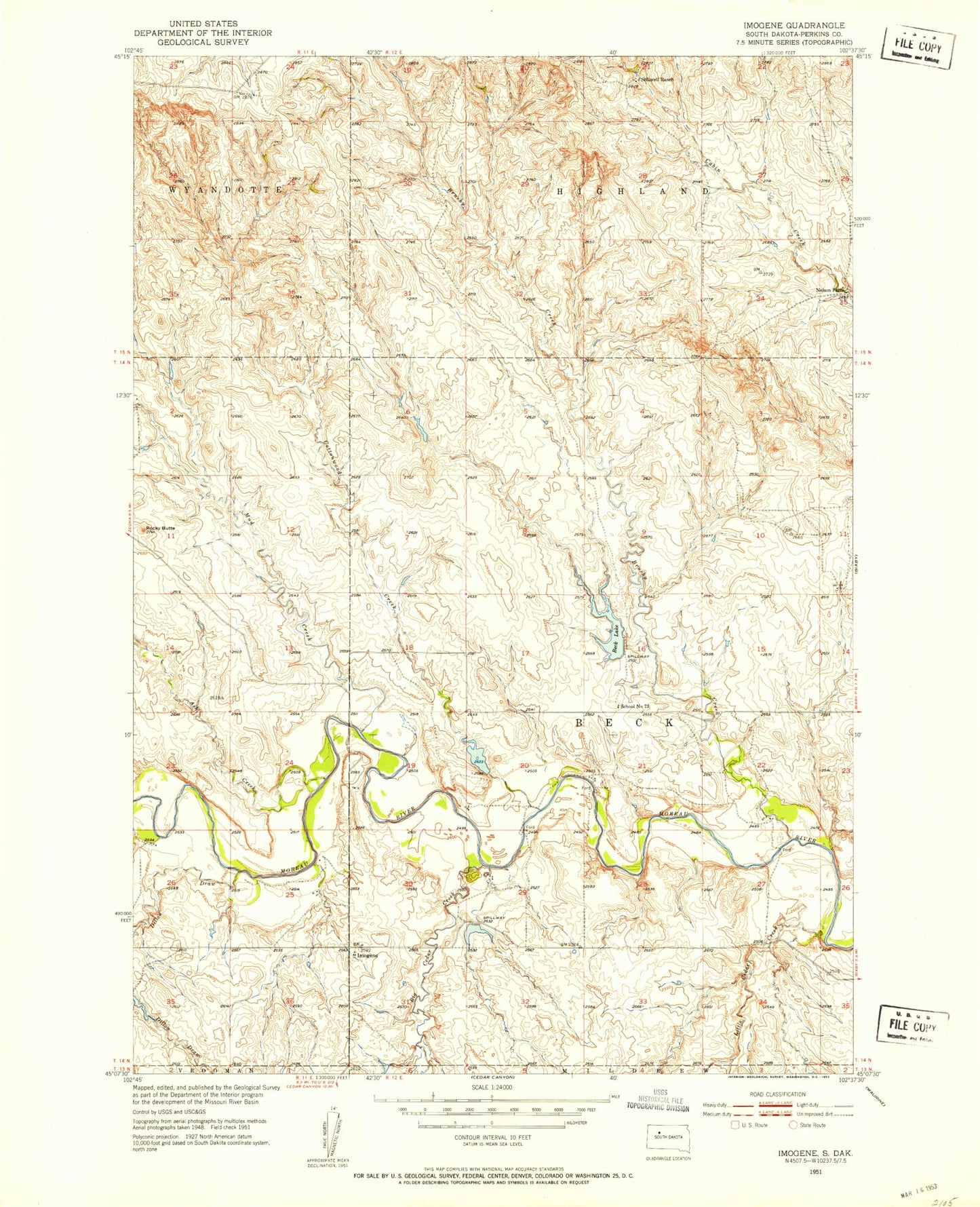
Classic USGS Imogene South Dakota 7.5'x7.5' Topo Map
Couldn't load pickup availability
Historical USGS topographic quad map of Imogene in the state of South Dakota. Map scale may vary for some years, but is generally around 1:24,000. Print size is approximately 24" x 27"
This quadrangle is in the following counties: Perkins.
The map contains contour lines, roads, rivers, towns, and lakes. Printed on high-quality waterproof paper with UV fade-resistant inks, and shipped rolled.
Contains the following named places: Ash Creek, Badlands, Beck Lake, Big Cedar Creek, Blomberg 42 Ranch Private Airport, Brushy Creek, Cottonwood Creek, Dillon Draw, Frank Gebracht Dam, Herman Kaubish Dam, Imogene, Little Cedar Creek, Mud Creek, Nelson Farm, Rocky Butte, School Number 73, Stillwell Ranch, Township of Beck, Township of Beck-Highland, Vern Anders Dam